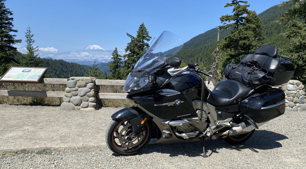
A single-post summary of the entire 2021 Snarl Par-Tay trip, with all the usual trimmings.
The Road Tales
Here are all the posts for this trip out to the Par-Tay:
- 2021 Snarl Par-Tay day 1 – Life with Crohns
- 2021 Snarl Par-Tay Day 2 – Impromptu Iron Butt
- 2021 Snarl Par-Tay Day 3 – Smokey Scenic Route
- 2021 Snarl Par-Tay Day 4 – Minor Derailment
- 2021 Snarl Par-Tay Day 5 – Where’d the Smoke Go?
- 2021 Snarl Par-Tay Day 6 – Summit to Surf
- 2021 Snarl Par-Tay Day 7 and 8 – No Joy for Covid Tests
- 2021 Snarl Par-Tay Day 9 – Race to Oroville
- 2021 Snarl Par-Tay Day 10 – Crossing on 20
- 2021 Snarl Par-Tay Day 11 – A Cool Day along the Western Hi-Line
- 2021 Snarl Par-Tay Day 12 – US2 into North Dakota
- 2021 Snarl Par-Tay Day 13 – Dodging Storms
- 2021 Snarl Par-Tay Day 14 – Riding Underwater
- 2021 Snarl Par-Tay Day 15 – Parting Shot from the Weather Gods
Map
Here’s the route I took for this trip. It is probably best to use the view larger map button (upper right corner) to open the map in a new window so you can inspect it in detail. Note that one day has a big jump directly to the end due to my iPhone overheating and shutting down.
Statistics
Here are the pertinent (and often useless) statistics for this journey.
Distance
- Total distance: 5,606mi (9,021km)
- Longest day (mileage): 1,021mi (1,643km) – Stoughton, Wisconsin to Sheridan, Wyoming
- Shortest day (mileage): 47mi (75km) – Olympia, Washington to the Par-Tay
- Average distance per day: 374mi (602km)
- Average distance per travel day: 400mi (643km)
- Miles riding solo: 5,606mi (9,021km)
- Miles riding 2-up: 0mi (0km)
- States visited: 10 – Michigan, Indiana, Illinois, Wisconsin, Minnesota, South Dakota, Wyoming, Montana, Idaho, Washington, North Dakota.
Time
- Total trip days: 15
- Travel days: 14
- Longest day (time): 14:40 – 1,021mi (1643km) – Stoughton, Wisconsin to Sheridan, Wyoming
- Shortest day (time): 4:30 – 47mi (76km) – Olympia, Washington to the Par-Tay
Altitude
- Highest altitude: 10,965ft (3,342m) – Beartooth Pass on US212 in Montana
- Lowest altitude: -0ft (0m) – Car ferry from Port Townsend, Washington to Whidbey Island, Washington
Fuel
- Average fuel efficiency: 36.9mpg (6.4L/100km)
- Best fuel efficiency: 41.99mpg (5.6L/100km) from Tonasket, Washington to Bonners Ferry, Idaho
- Worst fuel efficiency: 30.4mpg (7.7L/100km) from Harlem, Montana to Poplar, Montana
- Average fuel efficiency riding solo: 36.9mpg (6.4L/100km)
- Average fuel efficiency riding 2-up: Not applicable
- Total fuel cost: $536.13
- Total fuel used: 150 gallons (567L)
- Average fuel cost: $3.585/gallon ($0.94/L)
- Highest fuel cost: $4.299/gallon ($1.13/L) – Aberdeen, Washington
- Lowest fuel cost: $2.899/gallon ($0.76/L) – Wisconsin Dells, Wisconsin
- Longest distance between fill-ups: 254mi (409km) – Sheridan, Wyoming to Red Lodge, Montana
- Most gas pumped during a fill-up: 6.529 gallons (24.71L) – Saginaw, Minnesota to Houghton, Michigan – (Tank capacity is 7 gallons (26.5L).
Service
- Total service cost: $0 – I performed no services on this trip, though Nightowl is now 1,101mi (1,771km) overdue for a 6k-mile service (oil change).
- Things now broken on Nightowl: Nothing.
Lodging
- Days sleeping in a tent: 3
- Days getting a hotel room: 10
- Days staying at home or in friends’ homes: 2
Music
- Songs played from music stored on iPhone: 302
- Songs played from SiriusXM radio: I didn’t count.

