
I could have used this “extra” day to rest, but I decided to get in some extra riding in the Adirondacks. What could go wrong?
Pre Ride
I was awake shortly after 8am. Looking out the window, all I could see is a blue sky above me.
What to do…
You see, we’d arrived at my Banker friend’s house a day early. That meant that I had two days to get to my next friend’s house in Ontario, a ride that I’d typically do as a single all-day Slab blast.
But now I have an extra day to play with… leaving options:
- Hang around here with friends for the day, being lazy, resting, probably eating too much… you know, typical visit with friends stuff. Or…
- I could take that subsequent all-day slab blast and turn it into a nice ride in some scenic mountains followed by a shorter slab-blast of a day.
The scenic mountains would be the Adirondacks in upstate New York. Chuck and I had crossed their southern edge together on our way out to Nova Scotia (see Day 2). This extra day meant I could ride further north into the meat of the mountains, something I hadn’t done in almost a decade.
It sounded like a good plan at the time.
I got cleaned up and walked downstairs where my two other cohorts were waiting. They saw me carrying luggage and immediately started moaning about how they were apparently chopped liver. However, both of these guys ride, so as soon as I explained my logic, they understood.
I still managed to laze around a bit before I got going. I got some route guidance from our Banker friend, loaded the Bike, and was saying goodbye right around 11am.
The Ride Before the Storms
I do a lot of riding out west, so a nice day of two-lane roads usually means long stretches of back road cruising, unmolested by obstacles like towns and other drivers. Out here on the east coast, these long stretches don’t exist. Each small community is only a mile or so away from the next small community. Consequently, the speed limit may go up to 55mph for a mile or two before it slows back down to 35mph while the road runs past the general store, gift shop, and smattering of homes that constitutes a town in these parts.
The silver lining is that you’re riding this village-to-village cycle through some beautiful meandering river valleys, with tall, forested hills on either side. In other words, enjoy the view, but not too much or you’ll miss the next speed limit change, which is likely coming in another 100 yards/meters.
I saw his cautionary tale in person today.
I’d passed this little white crossover SUV between towns. I noticed that I pulled away from this vehicle between towns, but they didn’t slow down in the towns and usually caught back up to me by the time we were exiting a given town. This went on for about four towns when I noticed a local police Cruiser facing us from the shoulder in the middle of town. I’d been slowing down, but probably not fast enough. I passed the cop and, figuring I was busted, started looking for places to pull over.
Then two things happened:
- That little white crossover SUV came flying around the corner behind me, having not slowed down for the town.
- The cop’s lights immediately turned on, flashing in bright, accusatory red and blue.
I drove on, watching this play out in my rear view mirror.
The cop pulled out, whipping around in a fast U-turn behind the SUV. I fully expected the cop to be after me, so I watched as the SUV pulled out of the way to let the cop by…
…and the copy pulled in behind the SUV.
The two pennies I found in a convenience store parking lot yesterday are working overtime. Overall, I’d see another four (4) police officers handing out citations during the day’s ride. Perhaps they’re gearing up for the coming holiday weekend.
I followed US4 all the way across New Hampshire and into Vermont. There I’d ride up to the 2,000ft+ pass near the Killington ski area (Killington Peak is over 4,000ft). West of Rutland, US4 briefly becomes a four-lane divided highway until the border with New York. There, I turned north on highway 22 at Whitehall, New York.
Riding north, skirting the edge of the Adirondack mountains to the west and the coasts of Lake George and Lake Champlain to the east, it was certainly pretty riding. You’d think I would have been stopping to take photos, but I got caught up in enjoying the ride.
In a few places along Lake Champlain, I noted a fair number of downed limbs being cut up. I also noted a bunch of power service trucks restoring power to areas that were out. That torrential downpour that fell overnight while I slept was apparently a bit nastier back here at the New York/Vermont border.
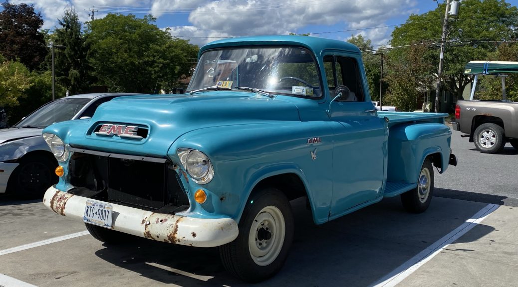
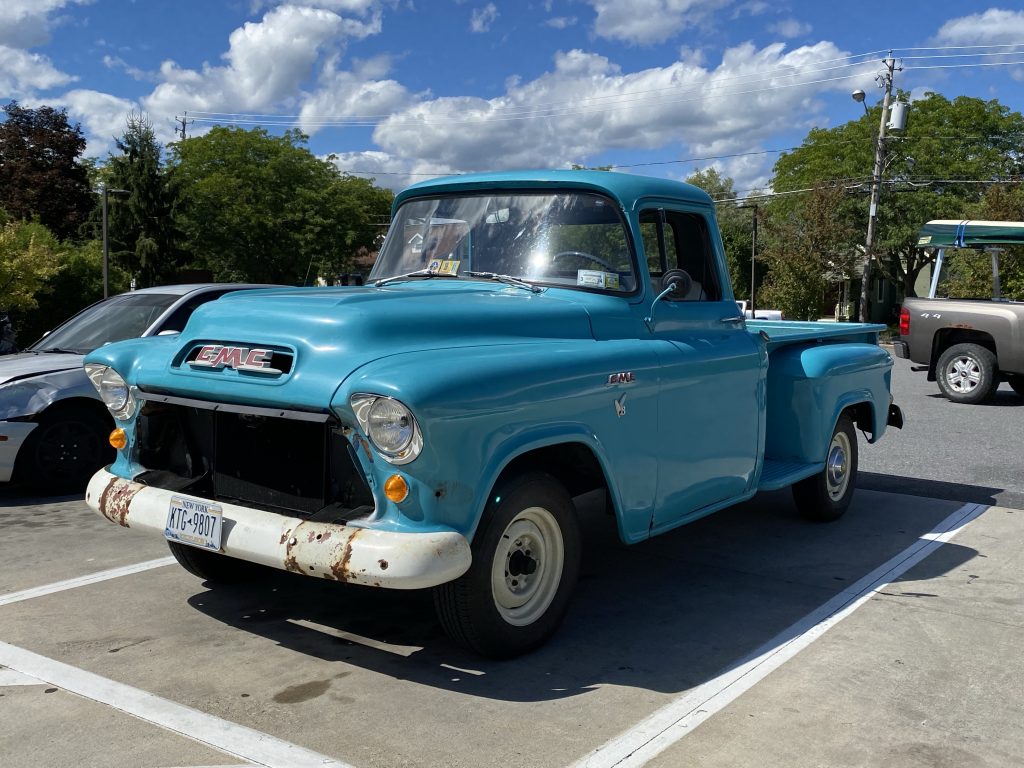
I stopped for gas and a snack in Ticonderoga, quickly snarfing down a roll of mini powdered donuts and a Vitamin Water. While I snacked, I noticed an old vehicle in the parking lot. I snapped a photo, sadly, my only photo of the day.
The day was still warm and sunny, though the cloud cover was getting a little more populous. I would eventually leave the Lake Champlain coast and head west into the Adirondacks on highway 9N. This highway starts into the mountains and follows the coast of an lake, long and thin, trapped between two ridges. I would have gotten photos of this lake, but the road was torn up in multiple one-way construction zones. They kept me busy and prevented opportunities to pull over for a photo.
The highway climbed a bit further before dropping into the plateau where Lake Placid is located. Most of the facilities for the 1980 Winter Olympics are still standing. Most noticeable are the two huge sky jumps towering over the forest on top of a steep hill. You can take an elevator to the top of the big one for photos… but there wasn’t time.
I took the local-only secret bypass that cuts the angle and saves you the stoplight-to-stoplight fun through downtown Lake Placid. With the bypass exercised, I was turning back onto the highway west towards Saranac Lake when I noticed the dark clouds now visible far off to the west. There was still areas of sunshine and broken cloud to either side of this ominous formation, but I still felt compelled to check the weather radar.
One problem with the MyRadar iOS app is that it does’t automatically move to where you are when you’ve been away from the app for a while. I hadn’t used it wince we were in southeastern Newfoundland (over 1000 miles to the east). This left me scrolling the screen with one hand while riding with the other hand. Yes! I know I’m being that guy for farting around with my phone while driving. In my defense, there was no traffic near me at the time.
With the radar finally centered on my position, the picture it painted was a nasty one, and colorful. Lots of pretty yellow and red with little bits of blue and purple here and there. All around these nice blobs of weather nastiness were nicely geometric shapes depicting he areas of the severe thunderstorm warnings that had been issued.
Given the path of the storm cells, my chosen route was going to pass right into the teeth of it.
Nice… Wonderful…
The Ride Running from the Storms
I could stop and wait it out, but then I remembered the downed limbs and power company trucks back at Lake Champlain. Downed limbs could mean dodging debris, or worse yet, downed power lines.
I could put on the rain gear and ride through it. If I’m lucky, it won’t last long (it’s moving southeast, I’m riding west).
Then common sense slapped me upside the back of my helmet. A loud inner voice stated for the record, “You’re an idiot! You’re not obligated to take this route. There’s no one waiting for you down that road.”
Yes, there was a highway (turns out, it was highway 30) that traveled south through the mountains from a point west of Saranac Lake. I just might reach that intersection before the ass-kicking from Mother Nature commences. I rolled on a little more throttle.
As I rode into the community of Tupper Lake, two things happened:
- The higher peaks off to the west disappeared in a sudden veil of gray.
- I turned south on highway 30.
After wading through the traffic in town, the Nightowl made quick work of the two cars in front of me and I did my best Valentino Rossi imitation to put some distance between myself and the oncoming storm front.
After 15 miles of riding with divine purpose, and enduring instruction from the Scenic navigation app to make a u-turn at the next intersection and get back to my chosen route, I’d emerged from under the darkest of the cloud cover. I spent a moment a the side of the road to add a waypoint or two to my route to give it a clue as to where I really wanted to go. I knew this course would take me far south of the hotel room that I’d reserved in Pulaski, NY, but I wasn’t far enough to out of the storm’s way to take the time to work that out yet.
Further south on highway 30, I took a right turn on highway 28, which would take me back towards the west, but at a southwesterly angle. I’d taken this route before, decades ago, and it was still a nice ride from one lakeside vacation community to another. I noticed that most of the vacation properties still had that cottage or camp feel. Others had been given the full upgrade, with palatial mansion homes and manicured landscaping.
Oh, to have unlimited disposable income.
About 34 miles down highway 29, in the village of Old Forge, I took a longer stop to figure out how this day would end. While the worst of the storm front was now past me to the northeast, there were still numerous smaller and less nasty thunderstorm cells blooming along my path. I’d now gone far enough south that going back to my original hotel reservation was going to be over an hour out of my way. Lucky for me, I’m a platinum member of the Wyndham Rewards program, so cancelling a reservation at the last minute is forgiven without a penalty. I then found another Wyndham property closer to my current route and reserved a room at the Super 8 in Oneida.
Unfortunately, my luck ran out in the last 39 miles of the trip.
The first shower was short and light, and so isolated that I was actually in sunlight while it was raining on me. The second shower was the huge tablespoon-sized drops of water, also while I was in direct sunlight. The third shower was the heaviest rain that I’ve had for this trip so far, but it only lasted 2-3 minutes.
By now, I was in Barneveld, New York and angling down towards Oneida on highway 365. There was one last storm cell in my path and it was moving southeast. This cell had rain to the left and right of my path. Directly over my path, there was only a pale orange veil of overcast, backlit to a pale orange by the sun low in the west sky. It turns out that this pale orange veil was rain too, it just wasn’t very hard.
When I pulled into the hotel parking lot, my helmet, boot toes, and knees were wet. The rest of me remained dry. Mother Nature relented for the moment, and I was able to unload the Nightowl for the night during a break in the showers.
Post Ride
The desk clerk at the Super 8 was very helpful. She allowed me to leave the wet Nightowl parked right in front of the front door. She also suggested a non-national chain, Pepi’s Pizza as a nearby dinner venue that was supposed to be very good.
There was more rain on the way, so I elected to leave the Nightowl where it was and walk the short distance to Pepi’s. Inside, Pepi’s looked like a cross between Chuck-e-Cheese’s and Pizza Hut. They had plenty of video games and other kid-centric diversions. Their kitchen wasn’t walled off from the rest of the restaurant, so you could see them work as they whipped out the pizzas (they also deliver).
I had only eaten the snack donuts today, so I was hungry. I ordered a medium Pepi’s Special pizza (a few meats, a few veggies), and was thinking about starting with an order of mozzarella sticks, when the fried dough appetizer caught my eye. That sounded good, so I switched to that. The waitress’ expression seemed to indicate that this was a bad idea, but I didn’t change it. When the fried dough arrived, it was piled high in a basket with half of the order covered in cinnamon sugar and the other half in powdered sugar. It was enough to give an entire table of diners a terminal sugar high.
The pizza eventually arrived and, I must admit, it was very good. Thankfully, Pepi’s pizzas tend towards a thinner crust, so I was able to eat more than two pieces before feeling stuffed.
I was in the middle of my second piece of pizza when the waitress was already bringing me a bag and a box for the leftovers; she said, “I was pretty sure you weren’t going to finish all this.” She was right.
So, after a walk back to the hotel between rain showers, I sit and write the day’s events, with sugary fried dough to munch on and three pieces of leftover pizza in the refrigerator waiting to be consumed for breakfast. (Oh, and I have a microwave in this room, too.)
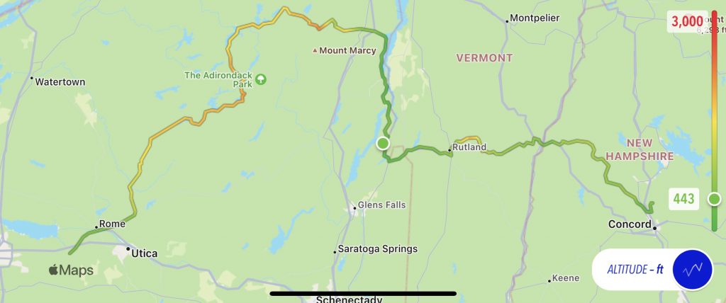
Map
Here’s today’s static map with it’s usual altitude overlay.
Today’s interactive map is broken into pieces again, but this time it’s not really the fault of the Scenic app, but a idiosyncrasy of iPhones in general. You see, recent iPhone models are pretty good at being waterproof, but actual raindrops of a certain size can be interpreted as a tap by a finger. Consequently, when I was getting pelted by some giant tablespoon sized rain drops, a few of those drops hit the phone in just the right places to:
- Activate the Route options in Scenic.
- Tap the “End Ride” button.
- Tap the “End Ride” confirmation button.
- Tap the “Save Ride” button.
So, the good news is that I have the interactive map for the first ~75% of the ride. The bad news is that I couldn’t get Scenic to find my secondary hotel in Oneida, much less navigate to it; see the GPS drama paragraphs previously in this post. Consequently, the last ~25% of the interactive map is missing.
Tomorrow
It’s across the rest of New York and back into Canada (Ontario) for a one-night visit with some friends on the way home.