
After 16 days in Canada, we finally ride back into the USA. It’s one highlight on a bit of a death march of a day.
Pre Ride
We awoke just after 8am to another blue-sky kind of day. There was some suspect cloud-cover to the west, but we figured the sun should burn that stuff off by the time we get there. (Aside: This is called foreshadowing.)
We had two possible targets for the day:
- Ride all the way to our Banker friend’s home in Canterbury, New Hampshire, or…
- Ride most of the way to our fiend’s home, leaving an easy remainder for tomorrow.
The longer target was just around 500 miles. That’s not a horribly aggressive goal, but it gets more challenging when a lot of that ride is two-lane road, includes a border crossing (where anything can happen), and you need to stop every so often to rest sore body parts.
To help us along, we’d hoped for a fairly early start. While we didn’t get out before 7am, we did head out on the highway just after 9am.
The Ride in Canada
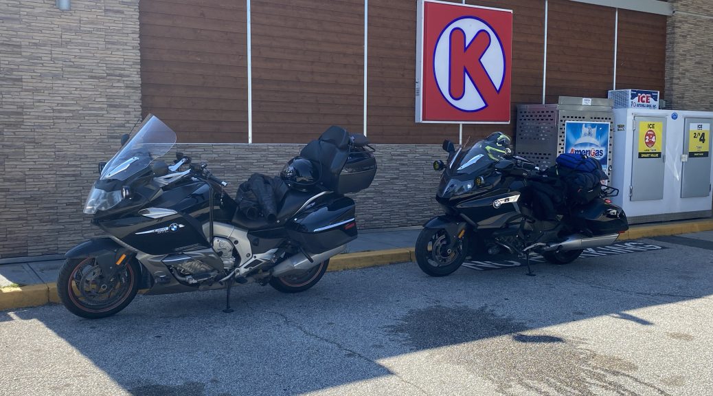
The day started great. We departed west out of Moncton on Trans Canada 2 (TC2). After 20 miles or so, we diverged towards the southwest on Highway 1 towards the border at St. Stephen’s. Both of these highways are four-lane limited-access highways; much like US Interstate highways. Consequently, these first miles were easy. The sun was out. The winds were light. The traffic level was low, allowing easy maneuvering passed slower vehicles. The temperature was still below 70ºF, so we’d both started the day with an extra layer under our jackets.
As we reached the hillier region near the coast around Hampton, I could see some lower cloud cover clinging to the hilltops. After the 11 days on Newfoundland, I grew to recognize this as coastal fog being blown on shore. I figured it may bring some mist in the upper ridge crossings, but not much else.
As we neared St. John, that coastal fog engulfed us. The mist was heavy enough that it started forming larger drops on our windshields and blowing up and off. The temperature, which had been warming up as the morning advanced, dropped down below were we’d started the day (around 64ºF). The wind, which had been light, now blew from the coast with a purpose. Those of us in the American Midwest usually associate fog with still, humid days. Here, the fog was being driven by the offshore wind. In areas where the fog was more dense, you could actually see it blowing across the road. It degraded our visibility down to a few hundred yards/meters. Thankfully, the precipitation never got worse than that driven mist.
It was in these less than ideal conditions that I was scanning for a place to stop for some fluid intake and to rest sore bones. It’s hard to find an easily accessible gas station/convenience store when you can’t see anything more than 100 ft off the highway. We’d ridden through downtown St. John’s without being able to see the surrounding town at all. The bridge over the harbor seemed like it was floating over, well, nothing.
I finally committed myself to an exit just west of downtown St. John. Unfortunately, we needed to double back on the side road a mile or so to find the advertised gas station off this exit.
After a short rest stop, we got back on the bikes and went back to the exit looking for the westbound on-ramp.
There wasn’t one. WTF?
Yes, I’d selected the only exit in the area that has no westbound on-ramp. I totally suck. We rode on side streets for five miles before the GPS managed to find a way to the next interchange that actually had on-ramps. While being back on the four lane highway 1 was a good thing, the fog/mist was at its heaviest yet.
Thankfully, the highway turned a few miles away from the coast around Musquash (what a great name for a town). I could see that our visibility had improved; up to about 0.5 mile. The heavy fog had lifted enough that it sat over the road like a low ceiling. I felt like I had to duck a little or I’d hit my helmet on it.
As we continued west, that low ceiling got higher, little by little. Similarly, the mist stopped and our windshields started to dry a bit. By the time we got to the St. George area, the higher, less dense, layer of clouds was visible through the fog layer. I spotted a patch of blue sky, pointed to it, and saw Chuck’s helmet in my rear view mirror nodding enthusiastically. Within a few more miles, the fog bank was behind us and the sun shined on our day once more.
With the sunshine came heat and humidity. Suddenly, that extra layer under our jackets became a bit of a liability. We’d be stopping for gas and wardrobe changes just after the border crossing.
We were in full sun by the time we’d reached the US border station at Calais, Maine. Being mid-day on a Tuesday, the lines were short; a couple of RVs and a tour bus in one lane and three cars in the other. We joined the cars lane and waited our turn.
The border attendant was friendly and seemed interested in our journey to Newfoundland. After the normal questions were asked (no firearms on board, thank you), we were welcomed back into our home country.
The Ride in the US
We rode a few miles into the US, looking for a gas station/convenience store that we’d seen on the way out a few weeks ago. It sat at the last intersection before the long, remote, section of Maine highway 9, which eventually led west to the city of Bangor. We both used this top to shed layer(s) in an effort to stay cool. During this stop, Chuck suddenly presented me with a piece of pizza and said, “I hope you like combo.” Apparently, the pizza here was “buy one, get half off the second”, and he couldn’t resist the bargain. While I hadn’t planned to eat at this stop, the pizza was welcome and I consumed it quickly.
The speed limit on highway 9 tops off at 55mph and around Bangor, it’s down at 35mph for a long time. Ugh. I’d bitched about this on the way out, and we lucked out with a few bird-dog candidates traveling at higher rates of speed, which we followed at a distance. I’d hoped to do the same thing here, but two miles into the highway 9 stretch, I noticed a vehicle awaiting to pull into traffic. It had “State Patrol” in the rear window and a conspicuous cornucopia of antennas on the roof.
Crap.
I’m looking to make some time and I have a State Trooper following behind, just waiting for those dumb bikers to make an ill-advised pass at 80mph.
At the first truck lane passing zone (uphill stretch), we eased around two of the cars in front of us by only traveling about 5mph over the speed limit. The State Trooper didn’t follow. At the next truck lane, we passed another car. This slow process went on until I was confident that:
- We were no longer in range to be clocked.
- The State Trooper didn’t appear to be motivated to pass slower traffic in an effort to keep up with us.
We proceeded to increase our cruising speed and make better time. For whatever reason, this stretch of highway 9 seemed shorter on the return trip. Part of that was an alternative route back that skipped the lower speed limit areas of highway 9 near Bangor. We’d cut south to pick up highway 1, which eventually dumped us out on the I395.
Just before the interstate, we made another rest stop to stretch our legs and such.
Once on I95 south out of Bangor, the speeds increased and the miles rolled quickly. There was still that southerly wind that had pushed the coastal fog across our path earlier in the day. The wind made the 80mph down the highway feel like 100mph. That much buffeting for 200 miles adds significantly to one’s fatigue level.
Shortly after we passed downtown Portland, Chuck motioned emphatically to his fuel tank and moved over to the right lane to indicate that he needed to exit for gas. This confused me since our bikes both have the same engine and I read 22 miles to empty on my metadata display. Yesterday, we’d ridden an entire tank of gas, much of it into a non-trivial headwind, and finished the tank with our distance-to-empty figures only being off by 8 miles.
Aside: this tank was very different. When Chuck signaled me, his distance-to-empty range was 6 miles.
To make matters worse, upcoming interchange that Chuck wanted to exit on was the I195 spur; another interstate highway, not a surface street. Still they signs said that there would be gas at this exit, so we exited.
On I195, the first exit was only a mile away. At the end of the exit ramp was a gas pump sign pointing right; we turned right. Unfortunately, that road ended in a T intersection 0.5 miles later and still no gas station. We hung a right, pulled to the shoulder under some shade, and I queried my Scenic app for the nearest fuel. Just ahead on this street a few blocks.
Hallelujah!
We pulled into the Shell station, and filled up the bikes. The other need at this stop was a restroom, but this gas station didn’t have one for public use.
Arrrgh!
At this point, we decide to forgo the growing evening commute combat drive out on the I95. Instead, we’ll switch to state and county highways to wind our way from the coast over to the Concord area, and our destination for the day.
I find the next nearest gas station using Scenic and we ride over there. Nope. That place is a fuel oil distributor, not a gas station. I throw up my arms and give up, heading down the road for our first turn onto our newly selected back-roads route to our destination.
A few blocks into the new route, I spot another Shell station. We stop, seeking their restroom… but they don’t have a public restroom either. The attendant refers me to the Wok n Roll store next door. So I pay it a visit. Then it’s back on the bikes and off on our new back-roads route.
But in the Scenic app, our location isn’t updating. I finally pull over when I can see that our next turn is 100 yards ahead. Scenic still says “turn right in 1.5 miles”. Nothing I can do can reset it or get it to start detecting our location or motion again. I finally throw in the towel and stop that ride and start a new one, with a very simple route that should get us to our destination via back roads.
At this point, I’m frustrated as hell and everything on earth sucks right now. Consequently, the growing rush hour traffic causing us to crawl down the road, stop and go, from stoplight to stoplight, puts me in an even better mood. Truth be told, once we were out of the town and in the country, the pace by the commuters was very good… but such moments were short lived because the don’t-care-about-speed-limits commuters would inevitably get stuck behind some little old lady making her monthly trip to the supermarket.
We did eventually find ourselves in Canterbury, New Hampshire. Similarly, the Scenic app did eventually direct us to the correct road from which I found our Banker friend’s home.
For a ride that started out so favorably, it sure trans-morphed into a death march across New England.
Aside: Yes, I’m being overly dramatic. Can you say, “poetic license”. I knew you could.
Post Ride
We arrived at our Banker friend’s house, unloaded the bikes, and were whisked away in a car to go to dinner. The haste was necessary since we’d arrived shortly after 7pm and the restaurant, Alan’s of Boscawen, closes the kitchen at 8pm.
We got to the restaurant in time to get served. We had a trainee waitress who was really trying to do well, but things didn’t go exactly right and it put her in a semi-rushed mode to cater to our needs. This was especially apparent when we, as a table of three diners, had four different requests to make of the waitress, but as soon as she heard the first one, she rushed away to get that handled. Her heart is definitely in the right place; experience will come with time.
In any case, the food was tasty and we enthusiastically filled our mostly empty stomachs.
Back at the Banker’s house, our host turned into a pumpkin and went to bed, leaving Chuck and I to furiously type away on our respective keyboards. Trip reports don’t write themselves, you know.
Breaking up the Band
My friend Chuck and I have been riding together for the last 19 days. Some Hollywood marriages don’t last this long. We covered just over 4,800 miles together on this trip and somehow managed to not wreck either of our bikes, and to not drive each other completely nuts.
Starting tomorrow, our paths diverge. I’ll be heading in the general direction of home. He’ll be hanging out with friends on the east coast for a while before continuing his journey to… well, he hasn’t decided yet.
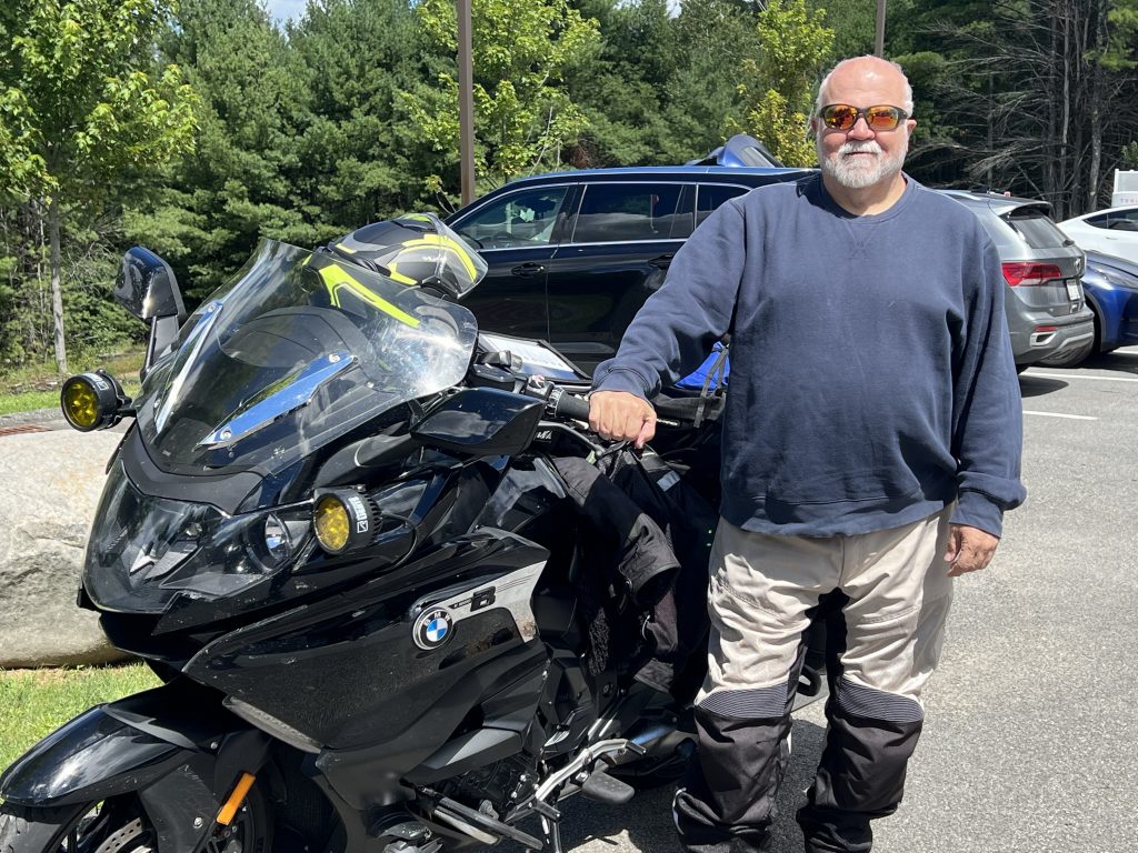
So, cheers to Chuck! I rode with him, and I’ve got no complaints.
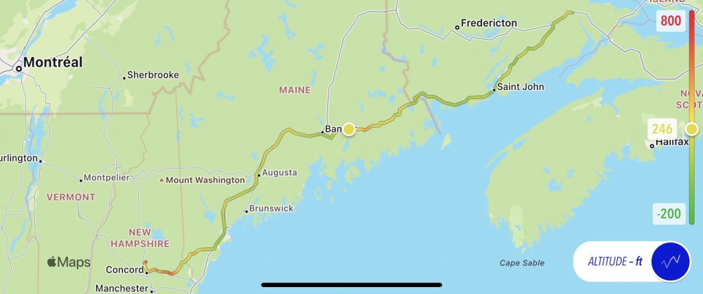
Map
Here’s today’s static map with the normal altitude overlay.
Today’s interactive map was, unfortunately, broken into two pieces. My Scenic app had a seizure mid route and totally forgot how to determine where I was. It was asking me if I wanted to resume the route when I’d already been moving down the road five minutes. My only recourse was to end that ride and then start a new ride for the rest of the trip. Very frustrating.
Anyway, now that I’ve finished my brief rant, here are the two interactive map pieces for the day:
- Part 1 – Moncton to Biddeford
- Part 2 – Biddeford to Canterbury
Aside: It’s possible that downtown Biddeford is something of a GPS black hole. It turns out that Chuck’s satellite ride tracker also failed in the same region. It must be a conspiracy.
Tomorrow
Hmm… good question. Chuck is hanging around with friends for a while before continuing his ride. I’ll either be taking the day off, or continuing the ride home, aiming for upper New York state in the general direction of friends in Ontario that I hope to visit the next day.
We’ll see…