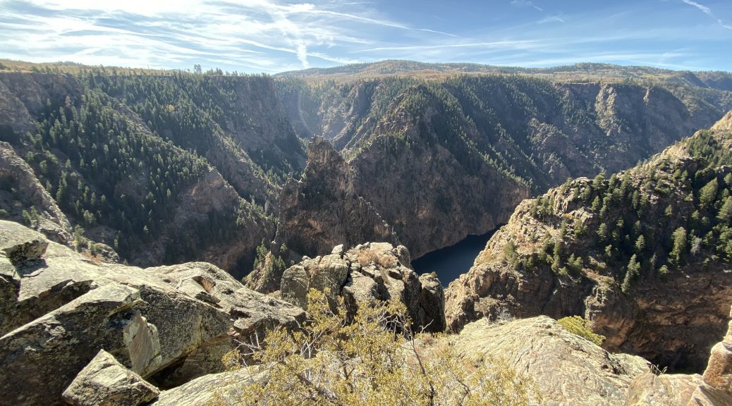
I aimlessly weave through Colorado to see several canyons, a few mountain passes, two wildfires, and lots of photo stops.
The Start
How many times have you heard this already on this trip? I woke up to sunny skies and chilly temperatures. The only difference today was some haze towards the mountains that appeared to be burning off as the day warmed up.
Today (Wednesday) was my last throwaway day before my trek home across the plains needed to start. If I was going to be home Saturday evening, I needed to be departing the Rockies on Thursday and getting at least into Nebraska. That meant today’s route didn’t need to end outside the Rockies.
Looking at the map and poking around a few hotel apps, I decided that Buena Vista, CO would be a good starting point for Thursday’s ride.
But Buena Vista was only 170 miles (273 km) away (from my current location in Delta, CO) and would only take three hours (or less) to ride that.
This will not do.
With a little more map gazing during breakfast, I discovered an alternative route that was far from direct and would (probably) eat up the day properly.
The Ride to Blue Mesa Reservoir
Pete, John, and I had ridden US50 west through central Colorado on our way to PITS, so we’d already ridden past the Blue Mesa Reservoir. What we hadn’t done, however, is ridden along the north rim of the Black Canyon of the Gunnison River. This was a less direct and more scenic route. It’s just a happy coincidence that the last third of it was twisty as hell.
After gassing up in Delta, I headed east on Colorado Highway 921 (CO92). This route heads west through range lands towards the mountains in the distant east. There was only a slight haze still in the morning sky and I could tell now that it wasn’t smoke, though I had heard that there were a few wildfires in Colorado right now.
After about 20 miles, CO92 enters the small town of Hotchkiss and turns south towards the canyon. It also starts a slow and steady climb.
For those of you who want to really experience Black Canyon, you need to take the 15 mile dirt road off of CO92 to the north rim. I didn’t take that road this time, though I have in the past and the views you get from the canyon rim do… not… suck.
The top of the climb also marks the canyon rim, so I knew I was getting close. About this time, I noticed that the shady areas near the road still had snow from last week’s one-day storm that just happened to arrive the day after we past through going west.
Anxious to get a photo or two of the canyon, I stopped at the first non-official overlook (basically a wide gravel shoulder) and took a few photos. I noticed that off in the distance, I could see the San Juan mountain range and a streak of smoke rising from a wildfire on the west side of the range. I was heading into the San Juans later today and was understandably interested in where the smoke was drifting.


A bit further down the road, after dodging a few free range cows and carving a few corners, I stopped at the Hermit’s Rest overlook and took several more photos.


Back on the Bike, carve a few more corners, and I stopped at the Pioneer Point overlook. This one was a bit more involved as it had several lookout points and I felt obligated to see them all. This overlook features two lesser canyons meeting up with the main canyon. In the middle of this confluence of canyons is the Curacanti Needle, worn narrower than the surrounding features by wind and water. The Denver & Rio Grande Western build a railroad that passed a stone’s throw from the base of the needle and it became a featured site for passengers traveling west. The D&RGW famously used a drawing of the Curacanti Needle as their logo for 20 years. Eventually, they ceased trains on this line and a few years later the canyon floor, including the railroad, was submerged behind the rising waters held back by the Morrow Point dam.


A few dozen Twisties later and I stopped at the Blue Mesa Dam overlook for a few more shots.


Back on the road I passed over the rim of the dam and up the south canyon wall to meet up with US50. Heading east, I passed the Blue Mesa reservoir, crossed the bridge to the north shore, and continued east until I turned south on Colorado Highway 149 (CO149).
The Ride to South Fork
CO149 from US50 west of Gunnison, CO south to South Fork, CO, has to be one of my two favorite roads in all of Colorado. I like the regions it passes through so much that I actively shopped for land here back in the early 2000s. You start in the arid rolling sagebrush near the Blue Mesa Reservoir and slowly climb until you reach Powderhorn. Here you crest a low pass and the south side of the pass is has a lot more forest. Down into the valley that houses the Lake Fork of the Gunnison River you’ll find green irrigated pastures for cattle and horses. Turning south, you follow this valley floor into the San Juan mountains. The canyon slowly gets narrower and the road hugs the west canyon wall well above the river itself.
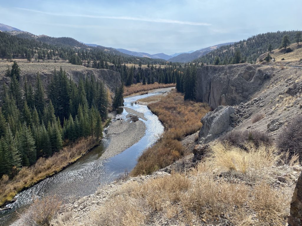
Quite suddenly, you drop down a grade and now you’re in a narrow canyon right next to the river. It was here that I noticed that the aforementioned smoke from the wildfire on the west end of the San Juans was now overhead; it wasn’t too heavy and I could only barely smell it. The canyon carving continues for several miles until you arrive in Lake City, a lovely little berg nestled between mountains with nice houses scattered around the surrounding hills. The homes on the main drag show much older architecture and have probably been around for over 100 years.
Passing through town, you immediately re-enter the river canyon and climb up the mountains. You cross over the river and now the climb begins for real, twisting and turning is way up the mountain to the southeast of Lake City, revealing a brilliant blue lake in the valley below. This is Lake San Critobal. Curious tidbit: this is the third largest natural lake in Colorado and it sits several hundred feet above Lake City while it’s only about two miles away as the crow flies. The valley floor makes a natural dam that keeps Lake San Cristobal from flooding the town.


Continuing up the mountain, I see a sign for the Windy Point overlook. I’m in a meandering, time wasting mood, so surely I have to check it out. The views were nice and gave further perspective on the smoke from the wildfire to the west.


More curves and climbing and I eventually crested Slumgullion Pass (isn’t that a great name?) at 11,530 ft (~3,500m). Usually, this is above the tree line, but this pass still had significant forests in the more protected areas. Down a bit and across a high-altitude basin and you reach the continental divide at Spring Creek Pass at 10,898 ft. From there it’s all downhill (mostly).
There’s one valley that you pass during this downhill run that contains a series of marshy lakes. The water in this valley forms the headwaters of the Rio Grande river, which forms much of the Texas/Mexico border before flowing into the Gulf of Mexico. Here endeth your useless trivia for the day.
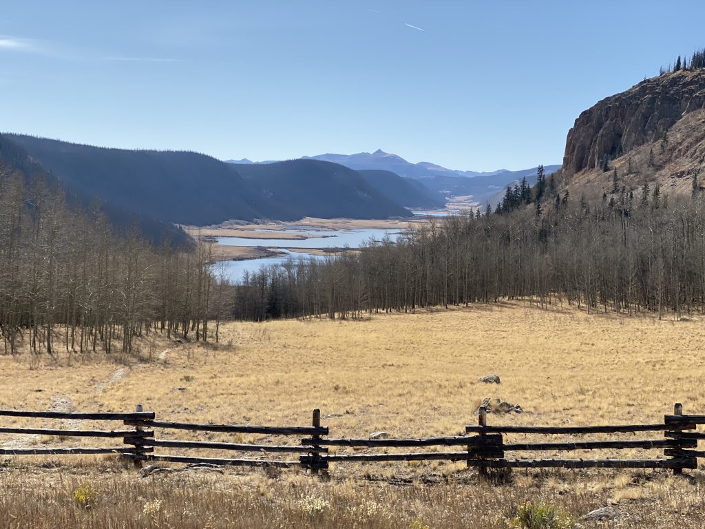
Down through another canyon, you end up entering the small box-canyon community of Creede. You approach it along the west canyon wall, turn right to pass the six blocks of downtown, and turn right again to exit town via the east canyon wall. I needed a rest stop for a bio break and to get a quick snack. I stood around watching the locals come and go. Creede is not without it’s set of colorful characters; let’s just leave it at that.
East of Creede the road rejoins the Rio Grande river and picks up an old railroad right-of-way, complete with old dilapidated bridges over the river. A few locations even had old cars rotting away on the sidings. For a railfan like me, it was pretty cool. Following a river grade can only mean one thing: more canyons!
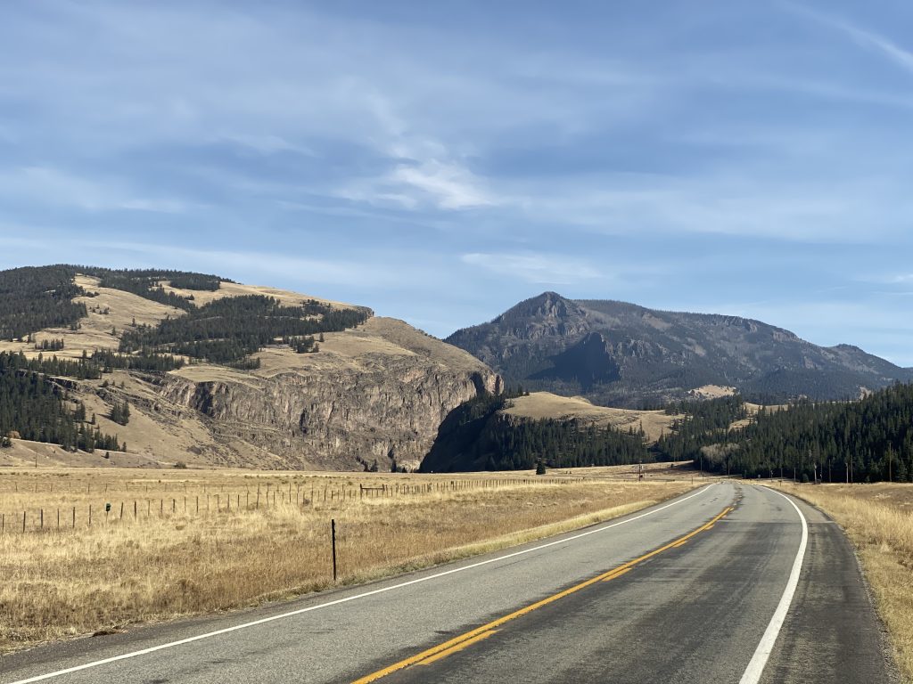
Eventually, the valley opens up and the road straightens out. Soon enough, I’m rolling into South Fork.
The Ride to Buena Vista
I still haven’t stopped for gas today, so I’m keeping an eye on my range readout and comparing it with the distance to the next town. Nope, no need to stop for gas in South Fork. Leaving South Fork, I turn northeast to take a cutoff that will save me a few miles on my way to US285.
When I reach US285, there’s a small community (didn’t see a name) around the crossroads. There’s a gas station here, but I don’t need to stop as long as the next town, Sagauche isn’t too far out. Turning north, I spy the mileage sign and it shows that I should make Sagauche with 20 miles to spare.
I fuel up in Saguache and strike up a conversation with the couple riding the only other bike at the place. As it happens, George and Kitty are from my home state, a little over an hour away from me in Grand Blanc, Michigan. We talk routes and they say they’re headed to Arizona via Durango, CO. I ask if they plan to do US550. They look puzzled. I explain the need for all lovers of motorcycle touring to someday ride US550 between Durango and Ridgeway. I even tell them how to get going back in their intended direction without doubling back. They say they’ll look at a map tonight. We say our goodbyes and I’m back headed north on US285.
Truth be told, US285 leaves Sagauche to the east, not the north, because it has to wind around a mountain range before heading over a low pass into Poncho Springs. Along this route, I note yet another long majestic mountain range showing off good shadows in the late-afternoon sun. Yet another photo opportunity.

Just before the Poncho Springs pass, I note some smoke in the mountains to the east. Most of it looks like smoldering as opposed to raging flame, but there’s still some fire equipment moving around as crews make sure it the fire doesn’t flare up again.
The last 20+ miles between Poncho Springs goes by pretty quickly. Pete, John, and I rode this stretch on the way west, with the Collegiate Peaks off to the west just about to hide the sun. I reach Buena Vista and ride through downtown as the sun falls behind the mountains to the west. The Super 8 I’m looking for is right on the main drag and I check in for the night.
Post Ride
After I unpack, I test the hotel WiFi and find that it’s pretty good. I take some time to upload the boatload of photos that I took today so I can add them to my trip post. Then I check online resources for good restaurants in the area. By the time I leave the hotel, it’s 7pm, dark, and already chilly.
I find The Lariat in downtown Buena Vista in an building that has obviously been here forever. Out in front, there’s outdoor seating with two huge blazing gas heaters, but nobody is out there.
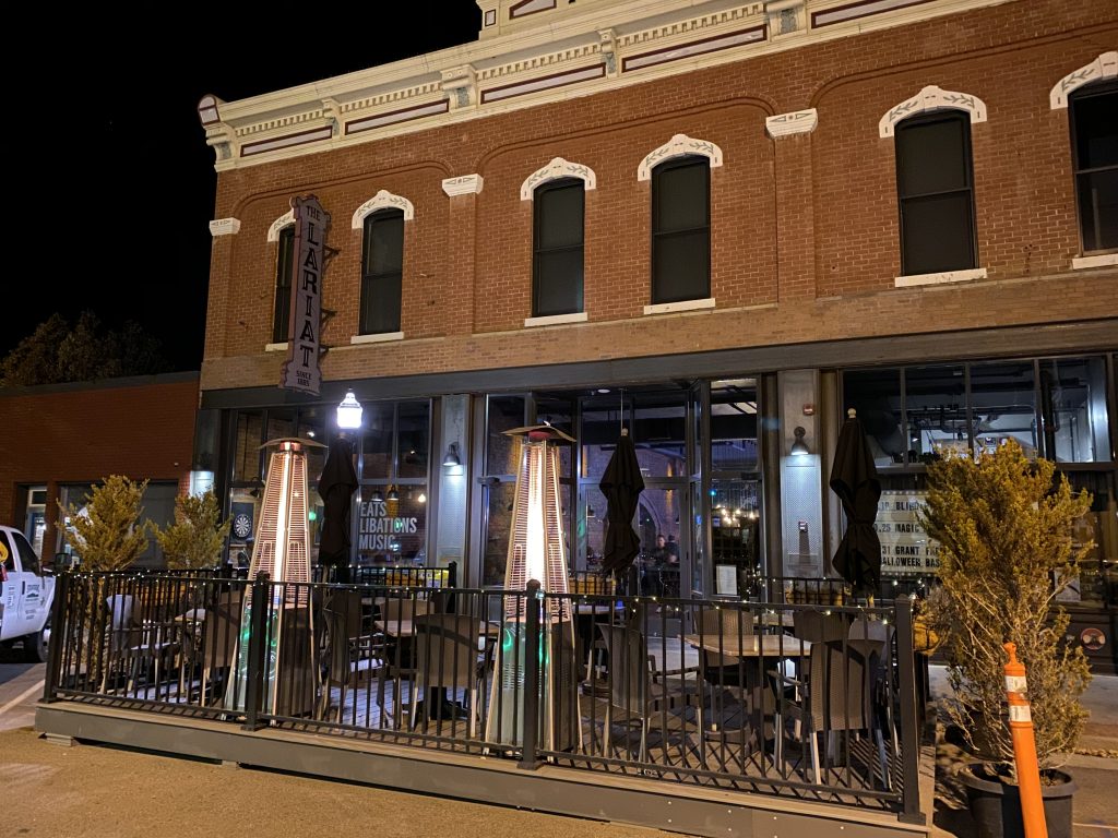
I venture inside and find the bar lively and busy. I order their customized version of an Old Fashioned (they add maple and cinnamon) and their Bison sliders for dinner. While I wait, I figure out the WiFi password and start adding descriptions to all the photos I uploaded earlier.
The food arrives and tastes pretty good. Bison isn’t gamey, but it isn’t quite as fatty as typical beef. I liked it anyway.
After dinner I rode back to the hotel and changed into my swim trunks. For the entire trip, this is the first hotel/motel with a working hot tub. I soak. I melt. I want to go to sleep… but there’s a trip report to write.
Map
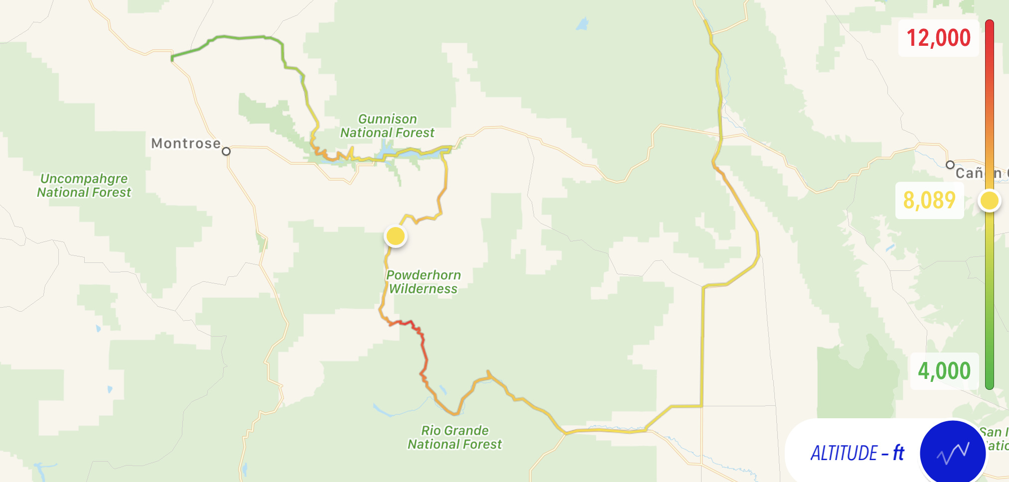
Here’s today’s map and altitude chart. Note how much of the day was spent above 7,500 feet!

Tomorrow
Say goodbye to the Rockies (bummer), cut through Denver between rush hours, and get as far east as possible.

