
By diverting into Canada for the ride home, I was able to revisit some of the roads from the old Run to the Sun rides we did in the late 1990s.
The Plan
If you’re going from Vernon, BC to Cranbrook, BC, you can go two different routes:
- Head south around most of the mountains and take Highway 3 the rest of the way; easy and direct.
- Head due east over a mountain range, take a ferry, cross two more mountain ranges, take another ferry, then (finally) ride south around the last mountain range and take Highway 3 the rest of the way; not at all direct, but much more interesting.
Guess which route I took.
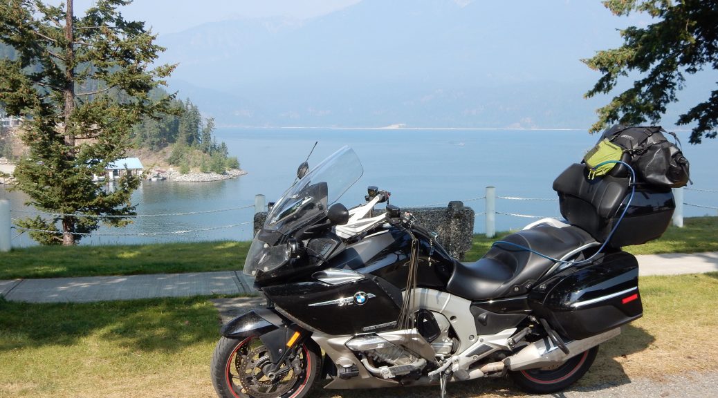
Vernon to Fauquier
I was lazy again this morning. I slept as long as I could, showered, packed, web browsed (mostly researching routes home), and finally hit the road at 10:15am. The first leg of this trip is dirt simple: Find Highway 6 east out of Vernon and ride it until the road disappears into a big lake (it’s actually best to stop short of the lake).
The big valley east of Vernon is well populated and well developed. That isn’t to say that it’s full of high-rise condominiums. Rather, it’s full of farms, vineyards, and dairy farms. That does make for a number of stop lights and a bit of congestion, but its easy to be patient when you know what comes next.
Since the highway dead-end at the Needles Ferry, which is out in the middle of absolutely nowhere, this stretch of Highway 6 gets pretty deserted. The big valley gets narrower (this means curvy), then it climbs a low mountain pass (even more curvy), then it finally descends to the shore of Arrow Lake. I’ve always enjoyed this stretch of road because you can have a long fairly spirited ride without being molested by mobs of other motorists (and hardly any slow-poke RVs). The downside is that when you do find yourself behind a slower vehicle (or worse, a logging truck), you almost have to pass on the double yellow (I know, this is forbidden), or the curviness of the road may have you waiting several miles for a spot to pass.
During this ride, I picked up a follower: a guy on a Honda Valkyrie. He’d appear in my rear view mirror, then disappear after some curves, only to appear again when I got behind another car or the road got straight.
I don’t know if the smoke, which was ever-present, had anything to do with it, but we had a surprising amount of broad-daylight deer activity on this road. I had two solo Bambi encounters and both of them were crossing the road, not just next to it. The first one was with Mr. Valkyrie behind me; luckily he was being aware and slowed down with me to let the deer pass. The second encounter was when I’d dropped Mr. Valkyrie a bit. The second Bambi, a young buck, wasn’t moving off the road fast enough and I needed to use the horn to get him to hurry up.
About 10 miles from the Needles Ferry, Mr. Valkyrie appeared behind my and blew past me. This was a straighter stretch of road, but apparently I wasn’t going fast enough.
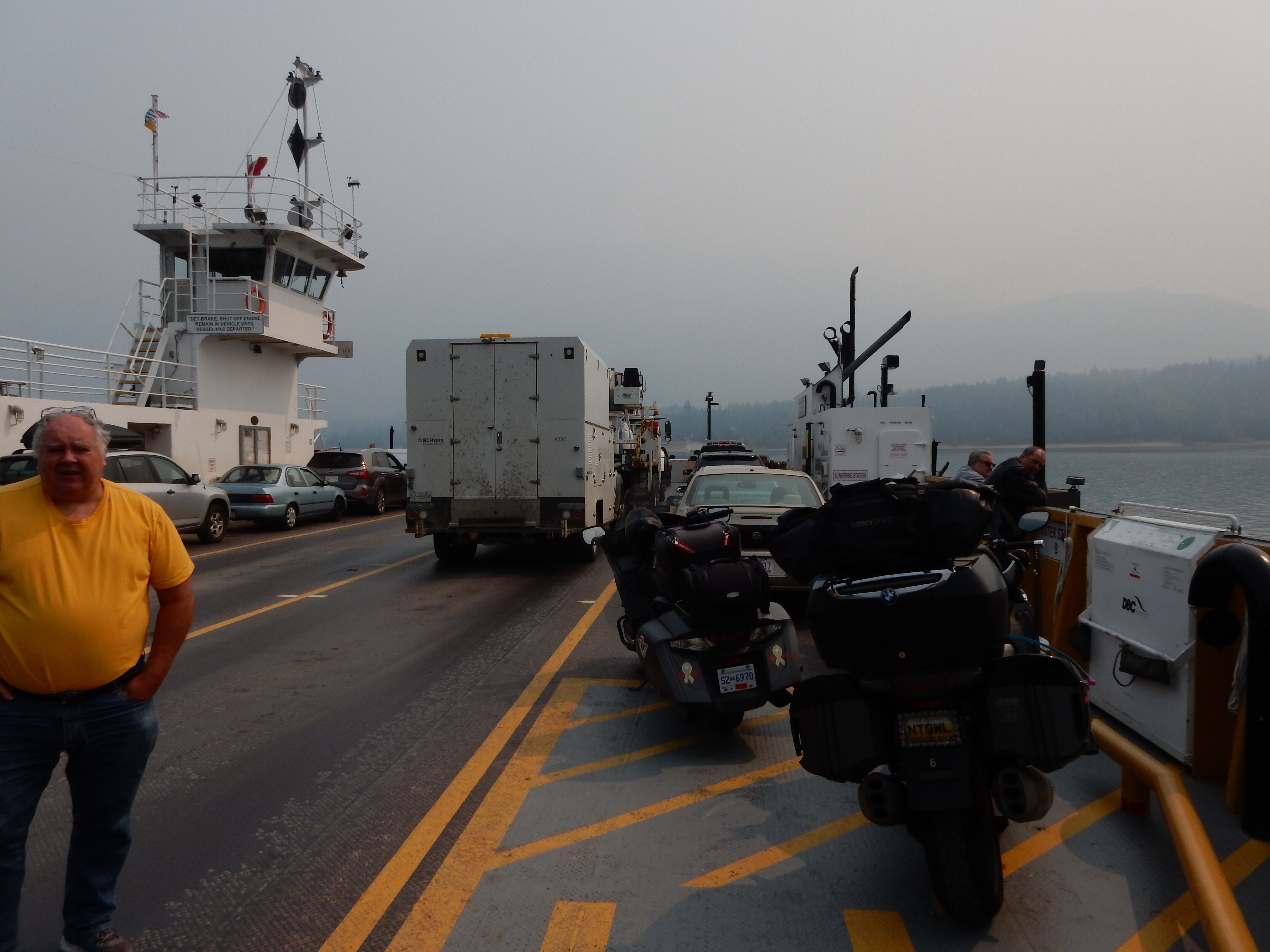
When we pulled up to the Needles ferry staging area, there was Mr. Valkyrie at the end of the line, giving me the thumbs up. I came to a stop about a minute before the line of cars started moving to load the ferry. We boarded and started across the lake. Mr. Valkyrie walked over and apologized for passing me so abruptly; he said he was worried that we’d miss the next ferry crossing. <shrug> I wasn’t in a hurry, but getting to the ferry just in time is quite alright by me.
Lunch in Nakusp
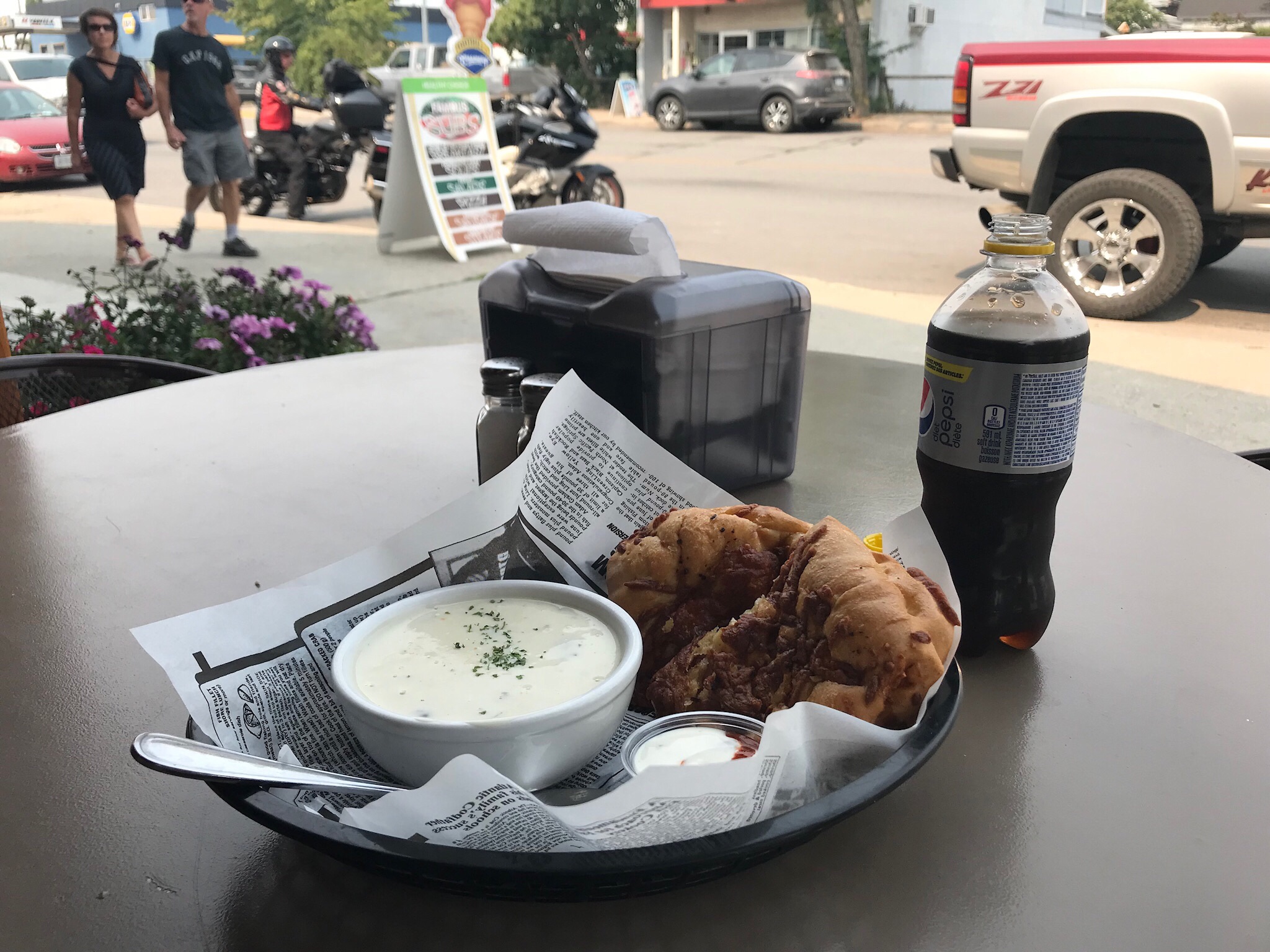
The trip from Fauquier (east side of the Needles ferry) north to Nakusp was short and uneventful. By now it was almost 1pm and I wanted to grab a bite to eat. I saw a lot of people at tables in front of a little A-frame chalet that served as a drive-in kitchen, but that wasn’t what I had in mind. A little further down the street I found Hoss ‘n’ Jess’ Bistro. They had shaded tables out front and served me a bowl of cream of mushroom soup and a chicken and cheese Stromboli with dipping sauce. I sat and ate while three different people who saw the Nightowl’s license plate came over to say that I was “far away from home”.
These conversations were pleasant, especially with a local guy out for a ride on his BMW GS. He asked where I was headed and I mentioned the planned route to New Denver, Kaslo, and down to the Kootenay ferry. I mentioned that this would allow me to take Highway 3A from the ferry down to Creston along the east shore of Lake Kootenay. Mr. GS Rider smiled at the mention of Highway 3A and interjected, “That’s a nice road”. I mentioned that I’d traveled this area previously and had picked this route on purpose. Mr. GS Rider nodded and confirmed that I was certainly hitting the highlights.
Nakusp to Kaslo
The road from Nakusp to New Denver is all about exchanges. You exchange one lake for another; you exchange the west slope of a mountain range for the eastern slope of the same range. Up and over you go and you end up looking at another nice little town on the shores of a long lake. The only difference is that the name of the town changes from Nakusp to New Denver.
One thing that was different was the smoke. Up on the mountain range, the smoke was appreciably lighter. So much so that I was compelled to take a photo.
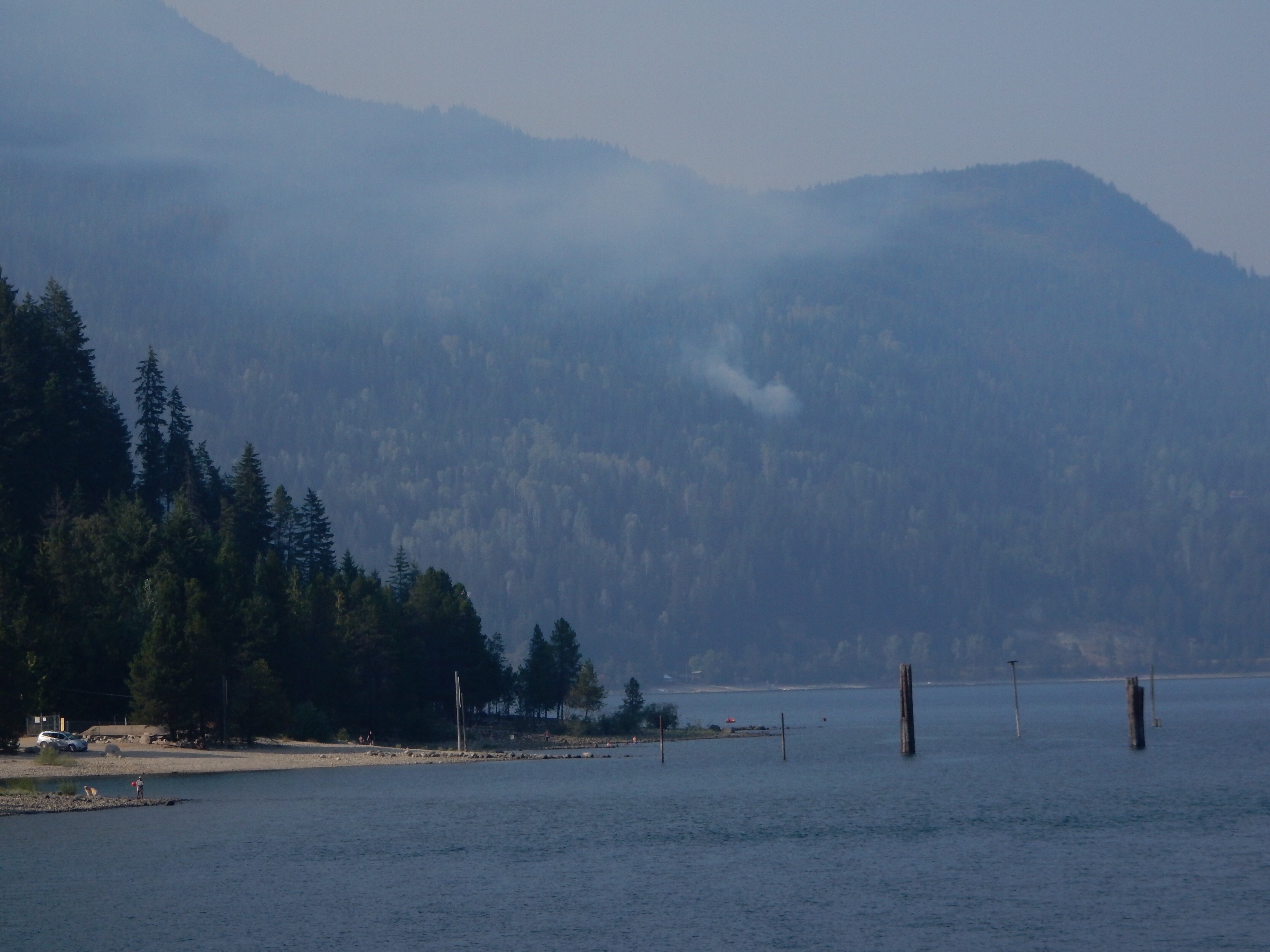
By the time I was back down the mountain and rolling through New Denver, the smoke was thick again, so thick that you couldn’t see across the lake.
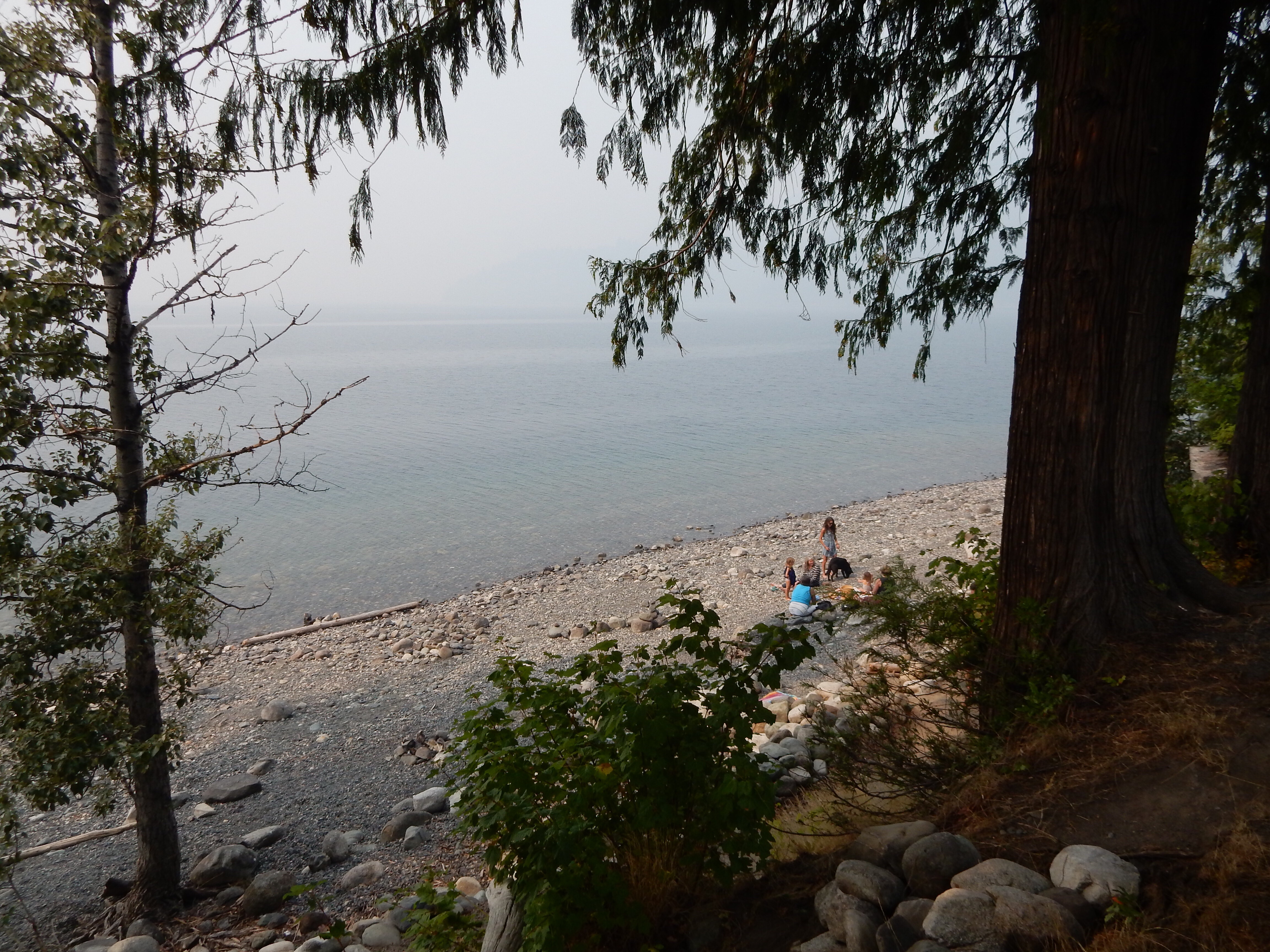
I took a couple of photos and a fellow beach-goer mentioned that the smoke wasn’t as bad over the next range along Lake Kootenay. Since this is where I was going next, I decided to move down the road.
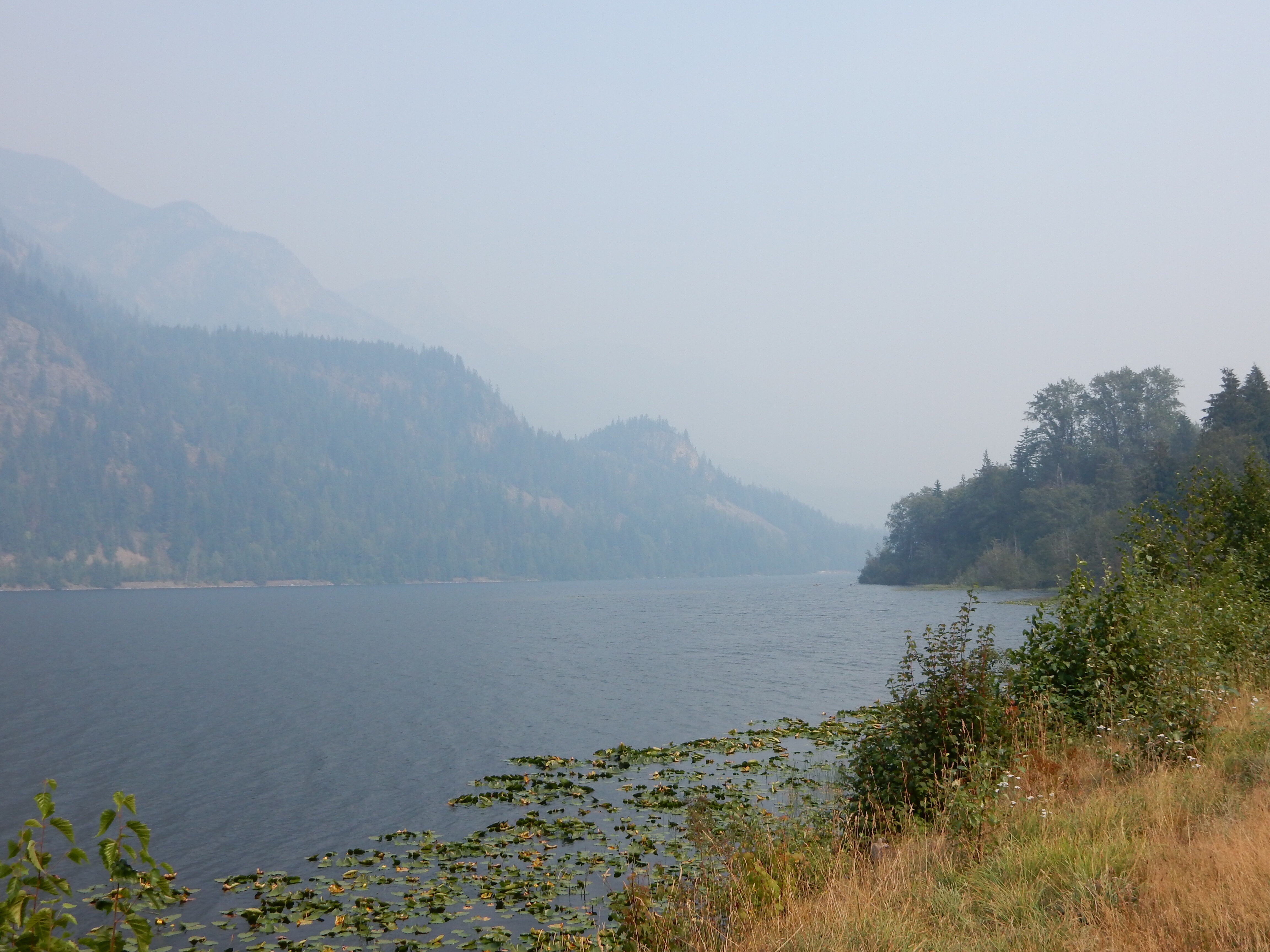
At the top of the range between New Denver and Kaslo there is a lake: Fish Lake. I’ve taken a photo from of this lake every time I’ve traveled this road. This time I was tempted to skip it. It was very smoky looking back to the west (the best vantage over Fish Lake), and I’d just passed a tractor trailer and would likely have to pass him again if I stopped for a photo. I stopped anyway.
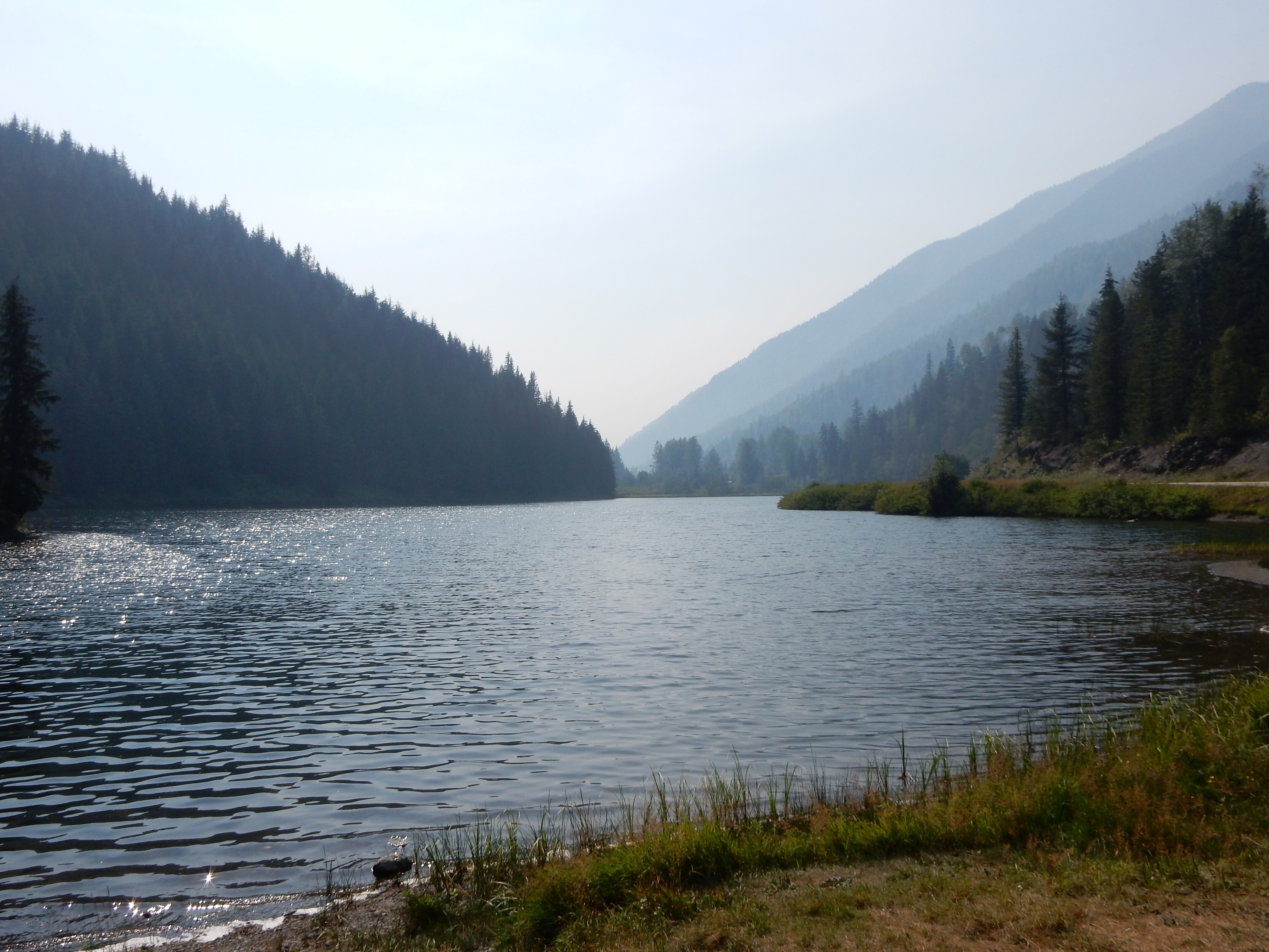
I also took a photo looking down the other side of the range. It’s pretty clear that the air is clearer in that direction.

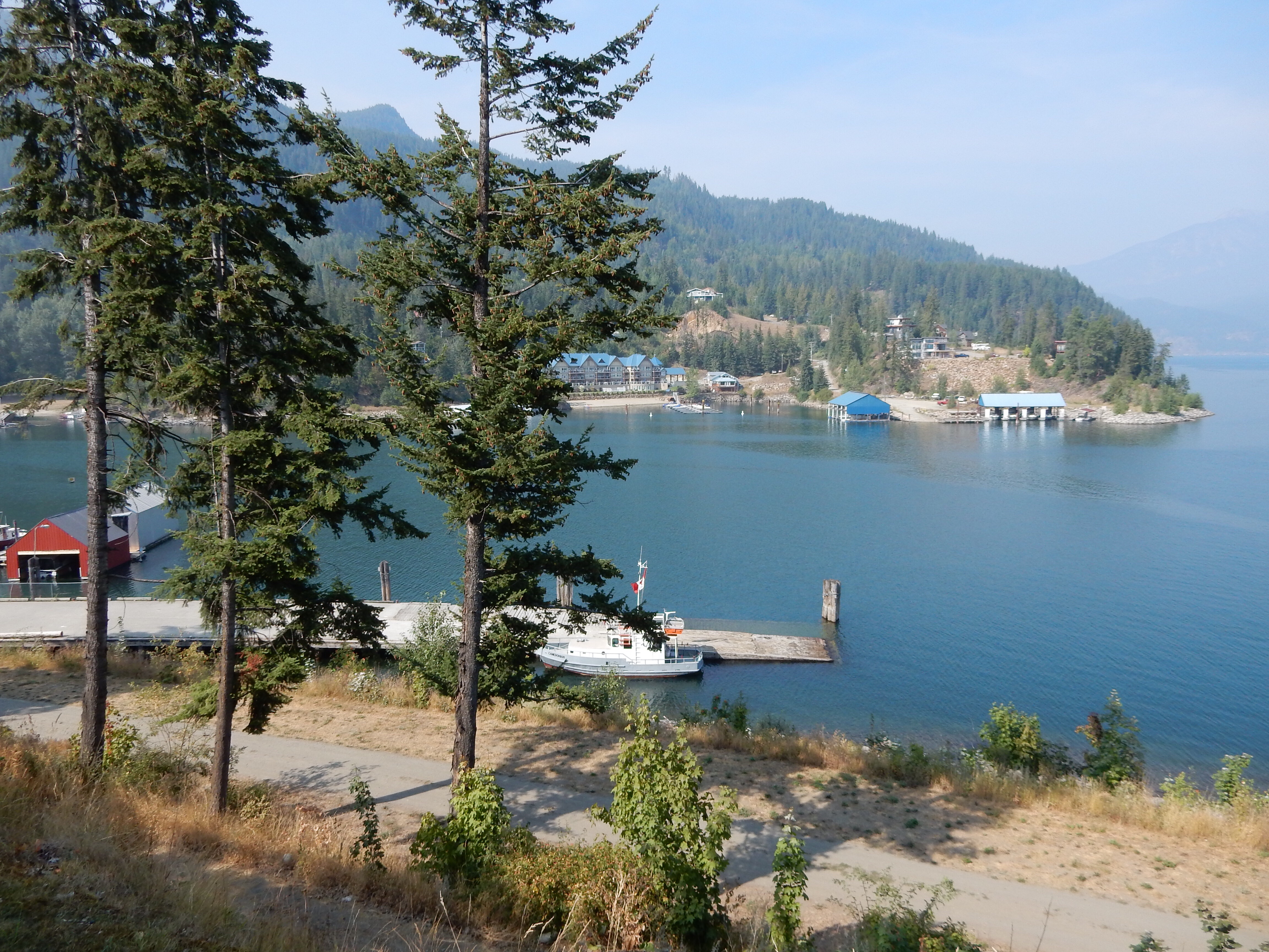
The decent into Kaslo follows a stream, tumbling along down the mountain. Plenty of fun curves later, you’re suddenly in Kaslo, a town perched on a bluff overlooking Lake Kootenay. I took a moment to get off the main drag and explore the place. I found an old hotel that looked well restored, and a nice cove with lots of docks and marinas in it.
A quick check of gas showed that I still had plenty to get to the ferry (and probably on to Creston too), so I ventured south to find the ferry.
Waiting for the Ferry
I didn’t find it in time.
That isn’t to say that I didn’t know where the ferry was, because I’d ridden it several times before and knew exactly where it was. Unfortunately, I pulled into the ferry staging area about five minutes too lake to catch the ferry. The good news, however, is that this lake has two ferries running on it and they pass each other on the lake mid-trip. Consequently, I’d be able to board another ferry in about 45 minutes. So I had some time to kill.
I used the time to check a few things on the Nightowl. Then I checked out the multitude of tourist-oriented shops that lines the ferry staging area, hoping to cash in on bored travelers waiting for the next ferry. There was an ice cream shop, a deli, a bakery, two are galleries, and a shop that specialized in tie-dyed attire.
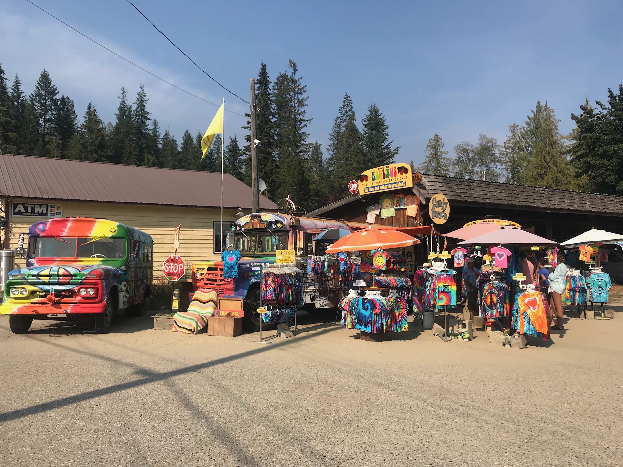
Guess where I spent my time.
Lake Kootenay Ferry
Soon enough, the 45 minutes was spent and it was time to pilot the Nightowl onto the ferry for the crossing. They placed me at the front of one of the rows, which bodes well for a clean getaway on the other side. There was another biker farther behind me that got special treatment and got detoured around other cars so he could take the space next to me. He was riding a BMW sport Bike and was on a first-name basis with the ferry crew. I figured he had to be a local that used the ferry often.
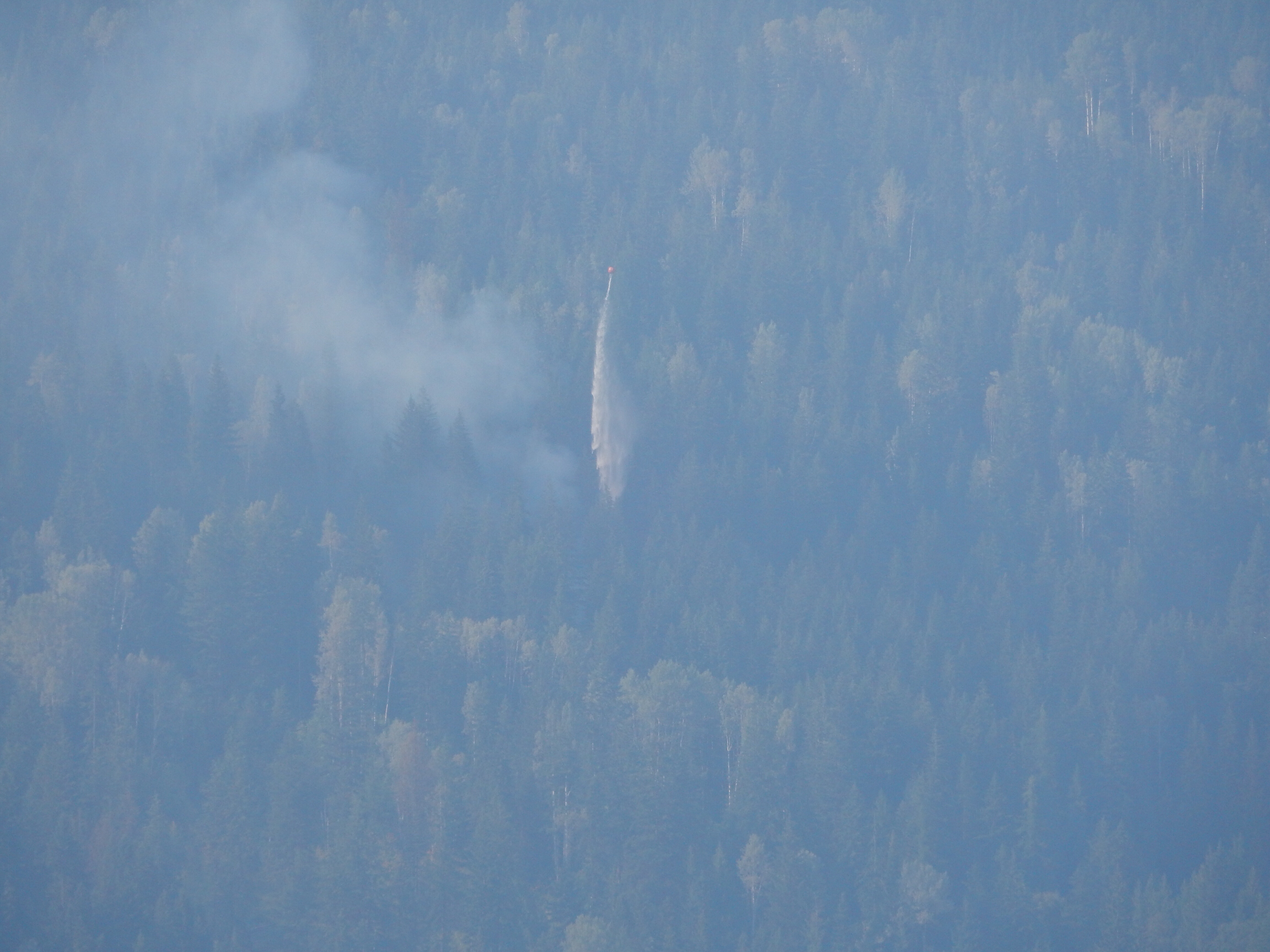
While we had been waiting, a bunch of fire trucks had taken off up the west side of the lake. As the ferry pulled out of its berth and into Lake Kootenay, we could see why. Up on the mountain north of the town of Balfour was the familiar billows of smoke from a new wildfire. If you read my last trip report, you know that another fire is the last thing British Columbia needs right now; half the damn province is already on fire.
As we pulled further out onto the lake, we could watch a helicopter tanker pick up water from Lake Kootenay and drop it on the fire. It was pretty far away, but with the help of a zoom lens, I could make out the stream of water falling on the conflagration.
After taking a boatload of photos (bad metaphor, sorry), we were docking on the east side of the lake and they let the two motorcycles off first. After the first couple of turns, the BMW sport biker took off around me. Figuring that he was a local, I decided to follow him as best as I could since he was a local and would probably know the road well.
He knew the road really well.
Using his line as a lead, I was able to venture into corners way faster that I would have if I was riding solo. To match his aggressive entrances, his exits were under hard acceleration, which I was more than happy to try and match. If a RCMP officer had happened by, we were both dead meat. It was hellaciously fun.
The BMW sport biker pulled off with a wave after about 15 miles of hard riding. I ventured on without his entry speeds, but still keeping a spirited pace.
Highway 3A north of Creston is just way too much fun. Following the lakeshore, it curves all over the place, goes up and down a lot, and gives you great views if you take the time to look at them between curves. Every time I’ve ridden 3A, I make sure to take a few photos from this one overlook. I stopped this year to take some more.
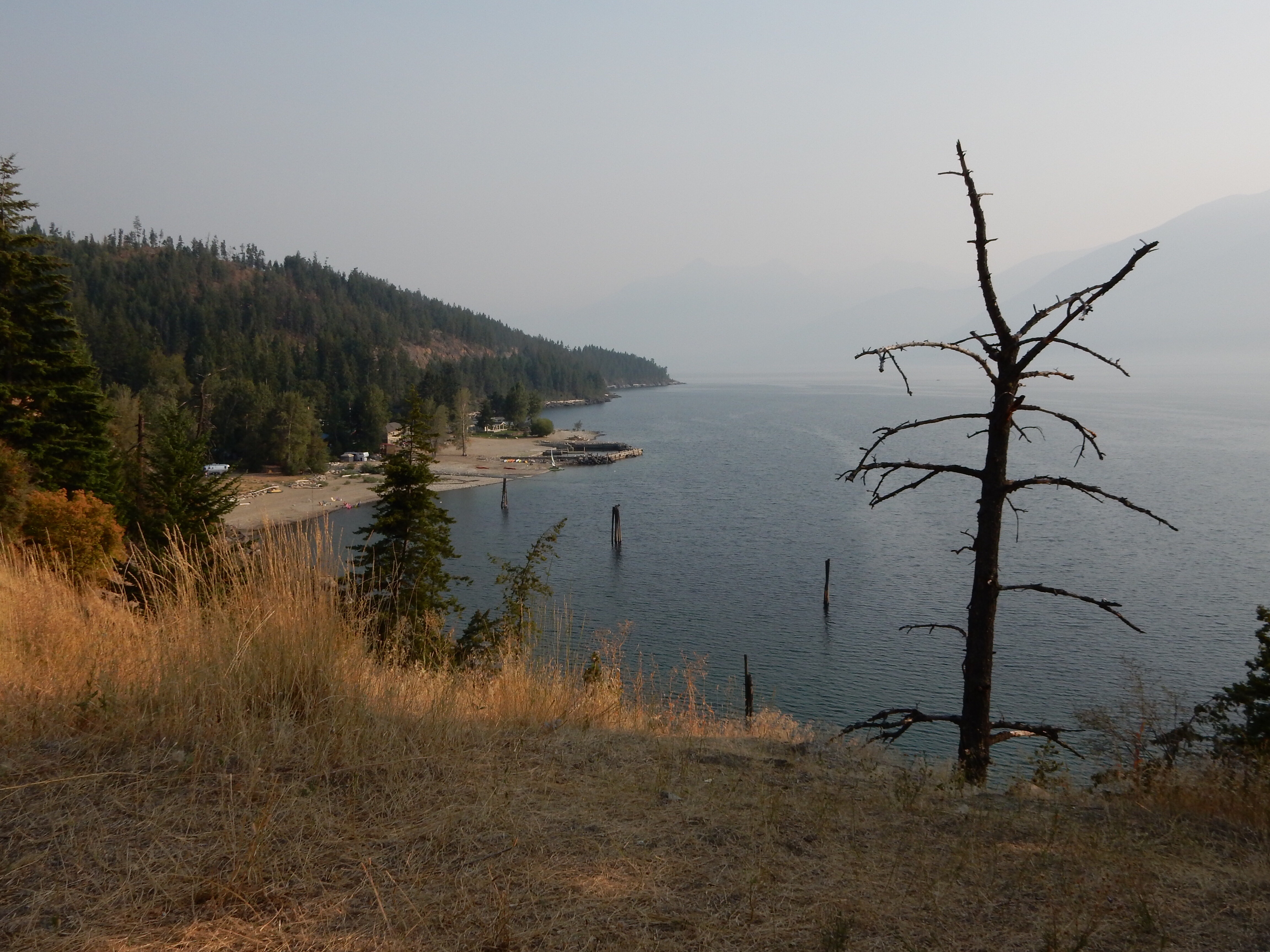
I noticed that down by the southern end of the lake the smoke was getting thick again. Bummer. Way too soon, Highway 3A straightened out a bit and wove down the mountainside into Creston.
The Last Leg
It wasn’t quite 6pm, so I decided that I had time to push on to Cranbrook. I knew that I would have mountains to the west of me on that leg and that the shade they provided would likely bring the critters out early, but it was only ~60 miles.
What I had forgotten is that the time zone boundary between Pacific time and Mountain time lies between Creston and Cranbrook. Instead of arriving in Cranbrook at 7:30pm, I would be rolling in at 8:30pm. In some of these mountain towns, they practically roll up the streets and shut down everything by 9pm. Cranbrook is a little larger, so I was hoping that I could still find a place to eat at 9pm on a weeknight.
To make matters worse, they are resurfacing the highway between Creston and Cranbrook. This, naturally, meant that I had to wait at a section of single-lane traffic for 10 minutes to further delay my progress.
This stretch of road also follows a Canadian Pacific rail line. In the comparably short distance between Creston and Cranbrook, I saw one large freight waiting in a siding and two smaller (probably higher priority) freights hauling ass south.
Once in Cranbrook, I used my phone apps to find myself a room for the night. I had entertained notions of pitching a tent, but that was before I suddenly lost an hour to the Mountain Time zone.
When asked about dinner, the hotel clerk directed me to a East Side Mario’s, an Italian eatery a few blocks down from the motel. They made me a very nice Bloody Mary (called Caesar up here in Canada), and a single-serving Hawaiian pizza.
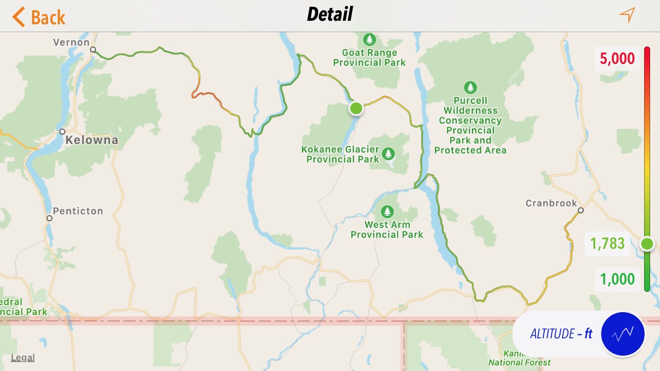
Map
Here is the map of the today’s route.
Tomorrow’s Plan?
I’m going to try and run around the north side of Lake Superior (I know, that’s three provinces away) on my way home. That means staying in Canada for a few more days. It also means increasing the length of my days a bit, which will likely happen naturally as I leave the mountains and enter the Great Plains.
Gallery of Today’s Photos


