
Today I ride the target stretch of US191 in Arizona, and finish the day with a whirlwind tour of Canyon De Chelly.
Before the Ride
I had set an 8am alarm so I could get a decently early start. The day wasn’t going to be horribly long, but it traversed some twisty roads so I didn’t expect to make great time.
I showered, packed up, and went downstairs for the motel breakfast. My reasoning was that I’d likely be in the middle of the desolate mountain portion of US191 at about lunch time, so I’d better eat something now. The offerings were pretty good: I had a strawberry waffle and a single biscuit covered in sausage gravy. Not bad for a motel breakfast.
The Ride
I stopped for gas on my way out of town and headed north on US180. The weather was sunny, but the temperatures were just below 80ºF, so I was riding with the vents closed on my jacket.
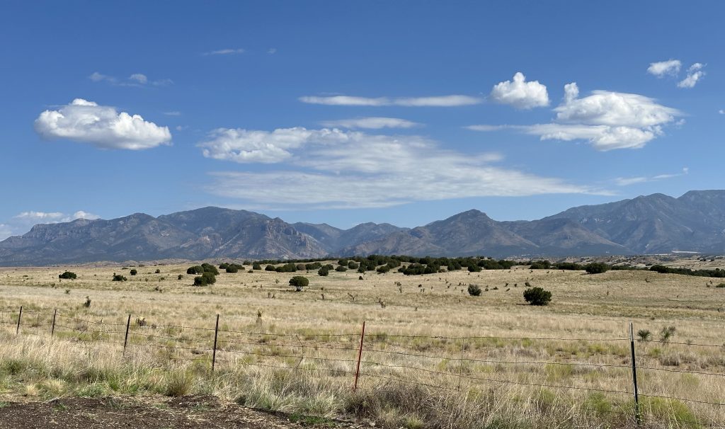
The next ~45 miles took me up a wide mountain valley. Lots of cattle range in the valley and plenty of distant mountains to either side. Soon enough, it was time to turn southwest on NM78.
NM78 turned out to be a rather fun road. Almost immediately, the terrain become a lot more rolling. I noticed that the elevation was getting consistently higher, even with the roller coaster ups and downs. Eventually, the range gave way to scrubby pine forest, and that eventually changed into tall lodge pole pines.
At that point, NM78 got a lot curvier and the road started to climb the first mountain pass of the day. This was a fun ride, especially after I realized that the abundant tar snakes on the road were very well worn and didn’t upset the Nightowl’s handling at all.
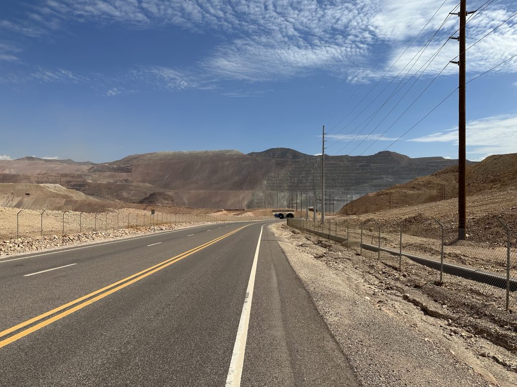
Down the west side of the first pass, I turned north onto US191, which led me down into a deep mountain valley and the town of Clifton. Clifton was obviously a mining community and there were railroad tracks all over the place to different regions of the valley; some abandoned and others still in active use by the Arizona Eastern Railway.
I chose to get gas in Clifton since I had no idea if there was any gas along US191 between here and Alpine (spoiler: there wasn’t). There was one other Bike at the gas station. It was a Heritage Softail of undetermined vintage. It’s rider was a woman in a riding jacket, capri shorts, and what looked like lace-up deck shoes. When she donned her helmet, it revealed long white and pink braids of hair attached to the helmet in two long tails. It looked like she had an Arizona license plate. She headed off just before I parked the Nightowl to use the restroom (don’t know if I’ll see one of these until Alpine either).
During the gas stop, I noticed that I’d somehow lost another hour. I know Arizona isn’t on Pacific time, but I seem to remember that the state is notorious for doing unusual things with their time and daylight savings, so I just accepted the fact that the iPhone and the GPS were correct; I updated the time on the Nightowl too.
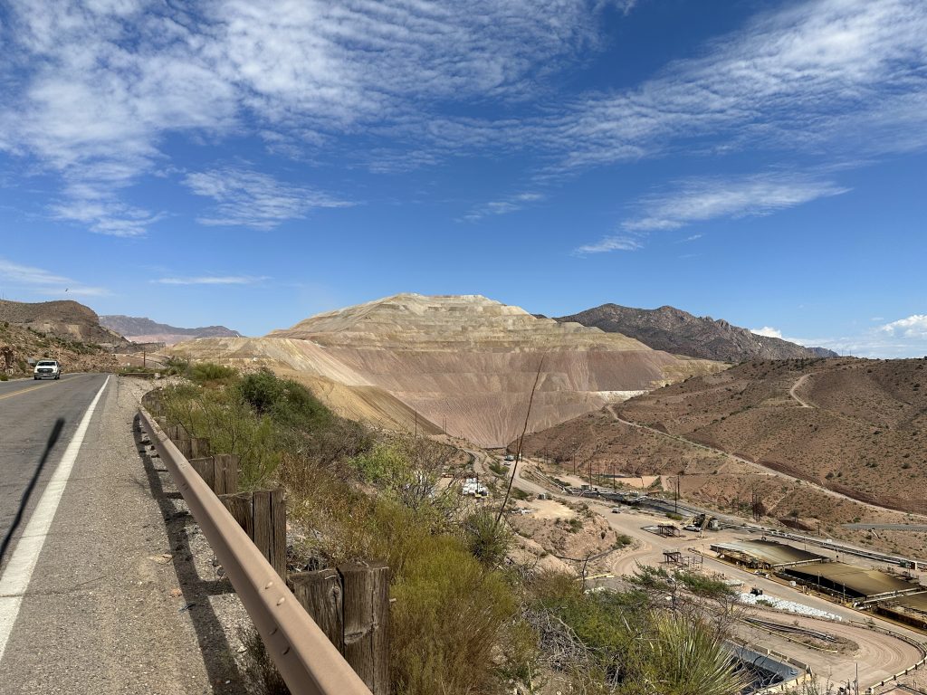
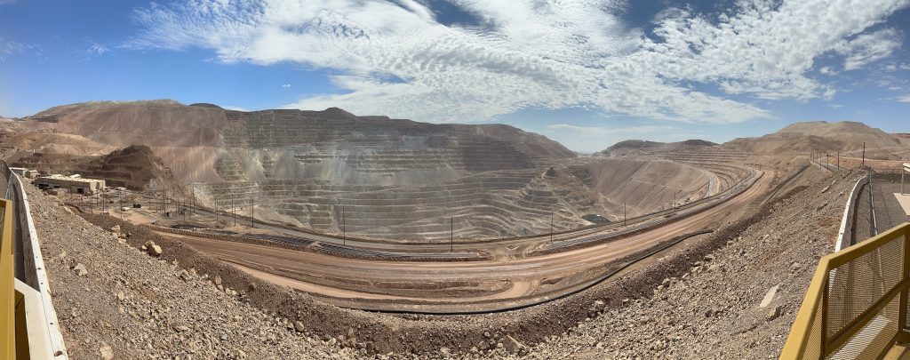
Heading north on US191, I started the long and circuitous climb up, into, through, and around, the Morenci copper mine. This is a gargantuan site with dozens of huge ore haulers driving on makeshift roads and along terraced cut into the mountain. It was impressive, but not much fun to ride through. All that heavy gear tore up the road.
Finally escaping the upper reaches of the mine, the road continued to climb and provide lots of Twisties to ride around. Unfortunately, I wasn’t having quite as much fun as I wanted because the road was in horrible condition. Several layers of chip seal had worn off in some areas, making the surface a bit like late-winter potholes back in Michigan. Not the best surface for railing around tight corners.
To add to the challenge level, I had to ride through a one-lane construction zone where they’d just laid new asphalt on the road. The lane they directed me onto had yet to be fully compacted by the steam roller, it was like riding through sticky sand. I fully expected my tires to be coated with the tarballs, but somehow that didn’t happen.
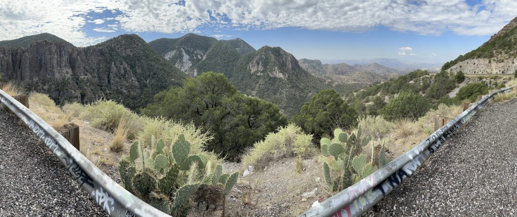
As expected, the road was tight enough that the overall pace was slow. The speed limit alternated between 25 and 35mph due to all the tight corners. Slowly but surely, the road conditions improved and I was able to increase the spirited nature of the ride a bit. Even at an increased pace, the miles rolled very slowly. Luckily, I had this portion of the road nearly to myself; I didn’t see more than a handful of cars over the first 20 miles. I needed a break and spotted a trailhead parking lot that offered a good overlook.
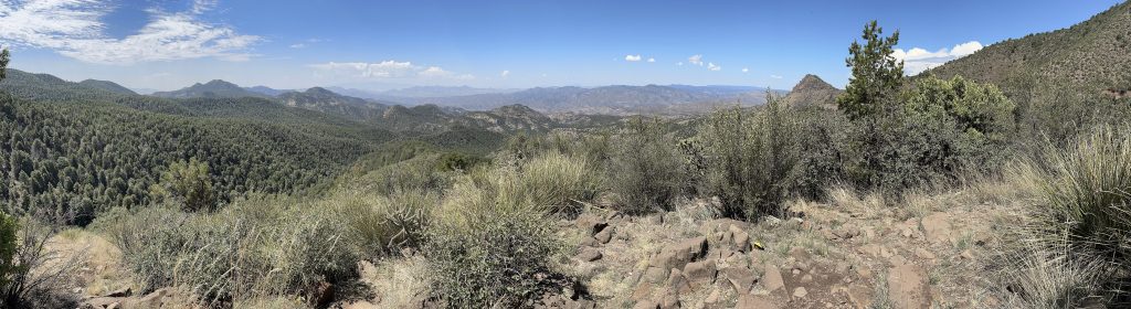
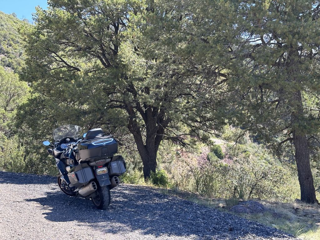
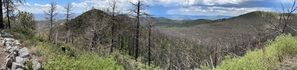
A bit further on, I entered a region that was victim to a recent wildfire. The road conditions changed for the better again. Much like NM78, the multitudes of tar snakes proved to be well worn and harmless. I stopped at another parking area for more photos.
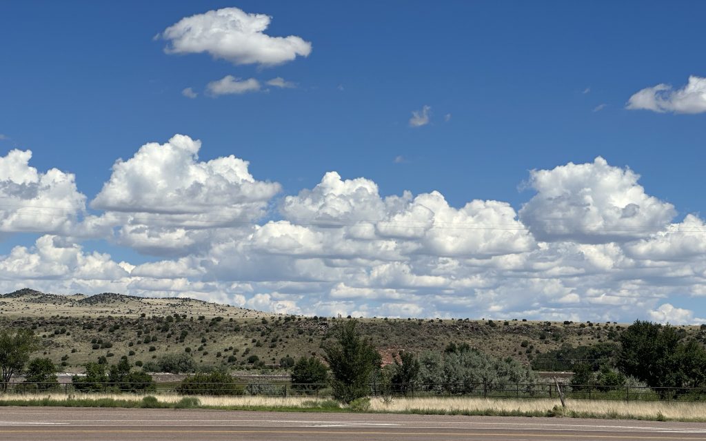
In the few moments when the road didn’t demand my complete focus, I’d noticed that there were dark clouds advancing on the mountains from the northwest. The eastern portion closest to me looked like just a shower, but the darker clouds to the west were full of lightning.
Unfortunately, US191 wove its way all over creation to get around these mountains, so it was hard for me to determine if I was going to get wet or not.
I did end up getting wet, but just a shower and not a cats-and-dogs downpour. Of course, the rain was falling as the weather climbed over the summit, so I was just emerging from the showers when I hit the pass at ~9,200 feet. The combination of rain and altitude meant a precipitous drop in temperature. I felt the chill and checked the bike’s temp readout: 60ºF; that’s almost 40º colder than back in Clifton.
Heading down from the pass, the twisties gave way to sweepers and the road conditions improved yet again. Naturally, my pace increased to match.
I eventually caught up with a bike riding in the same direction. I didn’t recognize the rider at first, but it was the helmet braids woman. She was wearing a rain suit now and was tearing down the mountain at an impressive rate, especially considering that she was riding a Softail. I caught up to her and she waved me by.
By the time I reached Alpine, the sun was back out, the roads were dry, and the chill from the showers was gone. I turned north towards Springerville.
I lost the helmet braids woman at Springerville; she turned off on US60 west. I turned off as well, but at a gas station for gas, fluids, and a snack. I found some Vitamin Water and a Strawberry Shortcake ice cream bar. I found some shade and consumed my snack and watched the traffic go by.
Back on the Nightowl, I’m heading north again. The terrain here is wide open and the speed limits allow for a good pace, unless the road conditions are crappy. North of St. John’s, the road conditions were crappy. The blacktop looked new, but it was wavy as hell, like some asshole kept changing the depth of the layer of road they were installing. At 75mph, those abrupt waves sent you all over the place. Not very relaxing at all.
At Sanders, I merged onto the I40 west Slab for a grand total of five miles before exiting to continue north on US191. I was now on the large Navajo Reservation that covers most of northeastern Arizona. Coincidently, the road conditions got much better. Go figure. I could set the cruise at 75mph, but one foot on a highway peg, one hand in my lap and simply cruise along. Very nice indeed.
Glancing at my iPhone, I notice that that mysterious hour of time is now back. I guess the Navajo nation doesn’t keep the same time as the rest of Arizona. Whatever, I adjust the clock again.
After another westerly jog at Ganado, I was in the home stretch. Off in the distance, I could see some mountains on the horizon. Could these be the San Juan range in southwestern Colorado? I may be too far away for those; I’m not sure.
Descending down off a mesa, I pull into Chinle and locate my motel for the night. It’s a large Best Western with an on-site restaurant in the middle of the compound. I check in and discover that the restaurant is open until 8pm. That presents some opportunities.
Extending the Ride
If I don’t have to rush over to the restaurant for dinner, I may have time to tour Canyon De Chelly today instead of tomorrow morning. Besides, the sun is higher in the sky now than it will be tomorrow morning if I get an early start, so photos taken today will look better.
I put my gear back on, grab some on-board water for the ride, and go.
There are two ways to see Canyon De Chelly:
- Take the north or south rim roads maintained by the National Park Service. The rim roads offer views down into the canyon.
- Take a tour offered by the naive Navajo residents. They’ll take you along the canyon floor in a Jeep or other off-road vehicle.
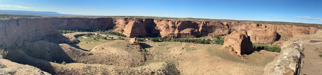
Given my rushed schedule, I had planned to view the Canyon from the South Rim road.
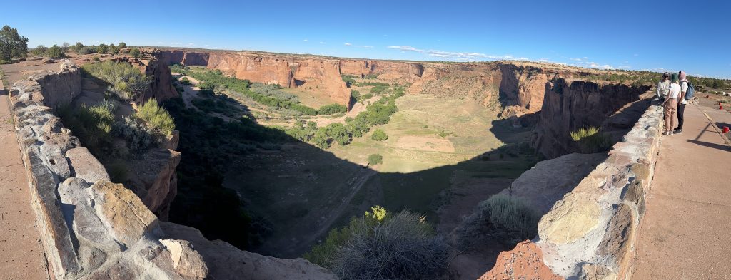
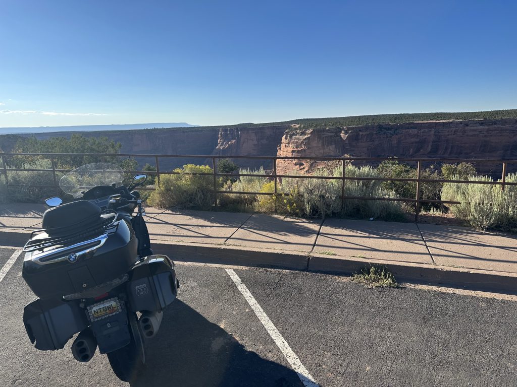
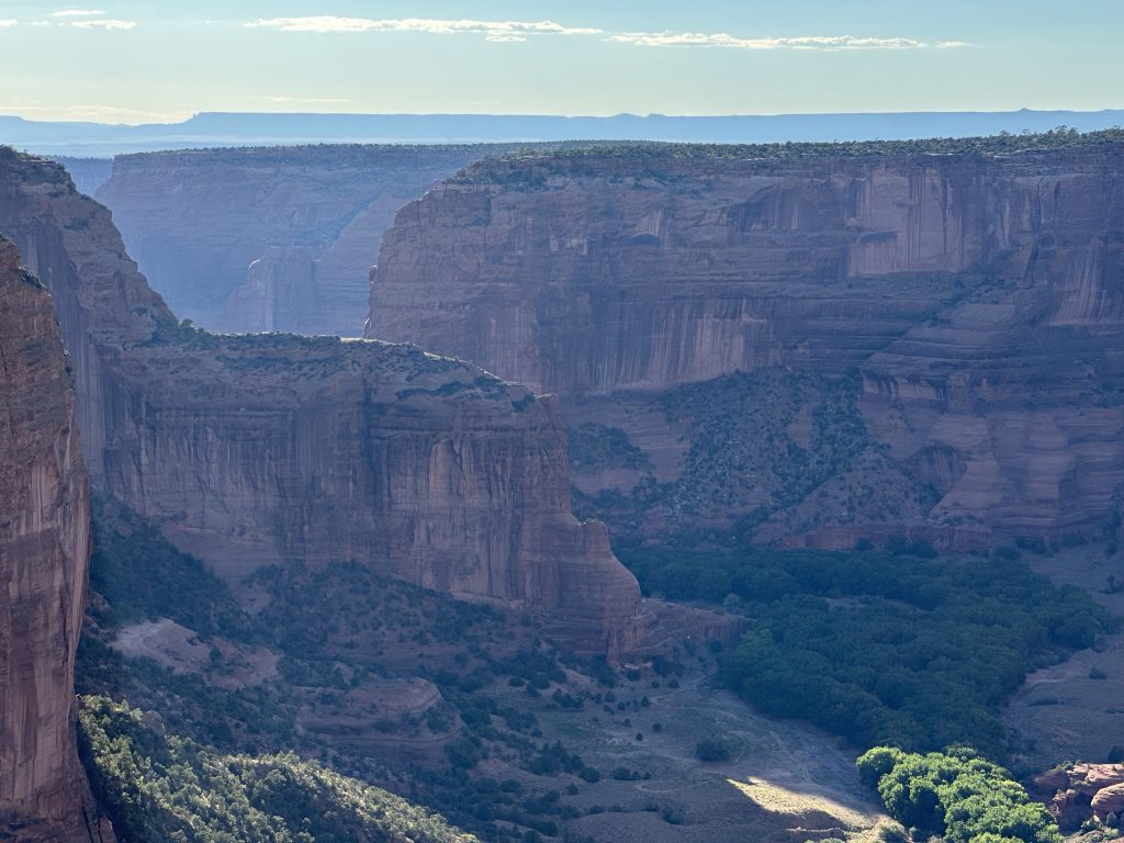
First I stopped at Tunnel overlook.
The I stopped at the Tsegi overlook.
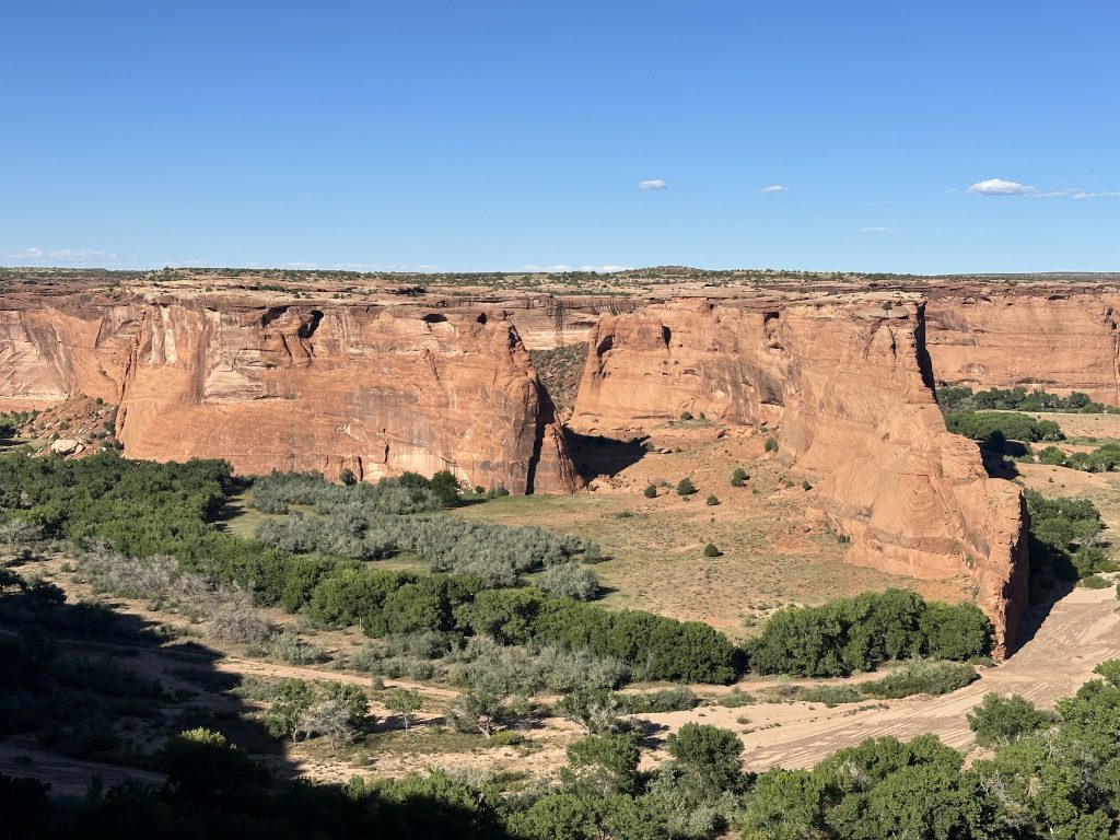
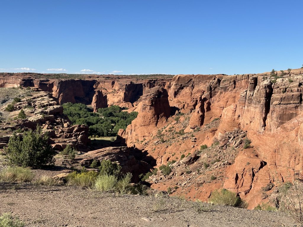
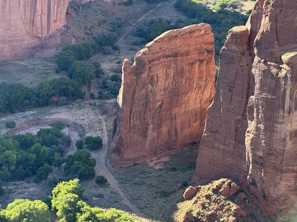
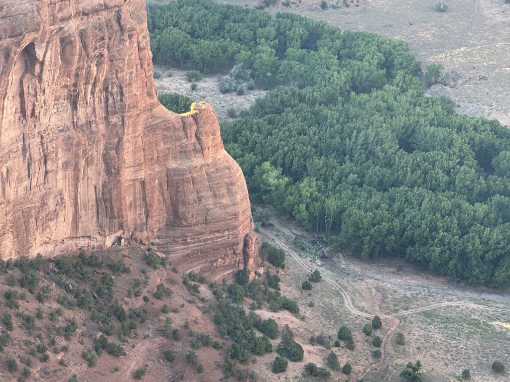
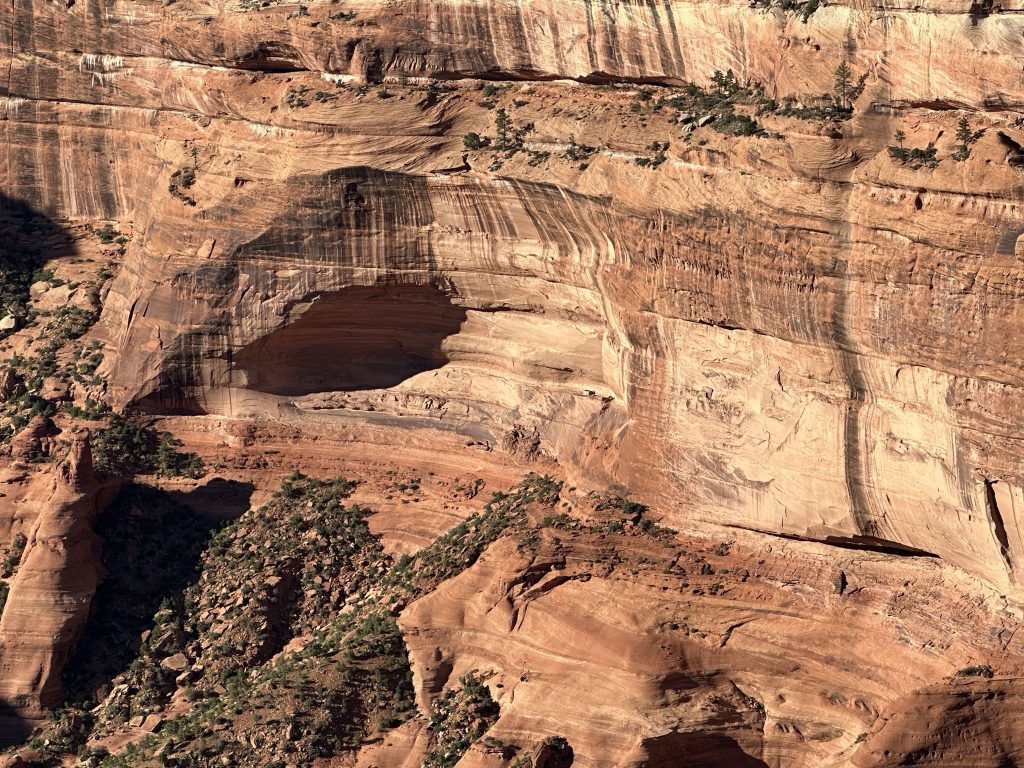
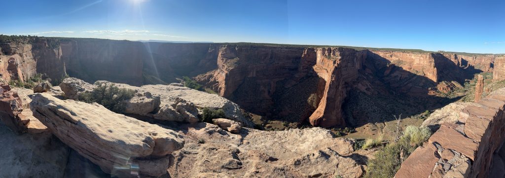
The stop at Junction overlook required a little hiking to get to the canyon rim, but the views were worth it.
The White House overlook was closed for some reason. So I continued down to the Sliding House overlook.
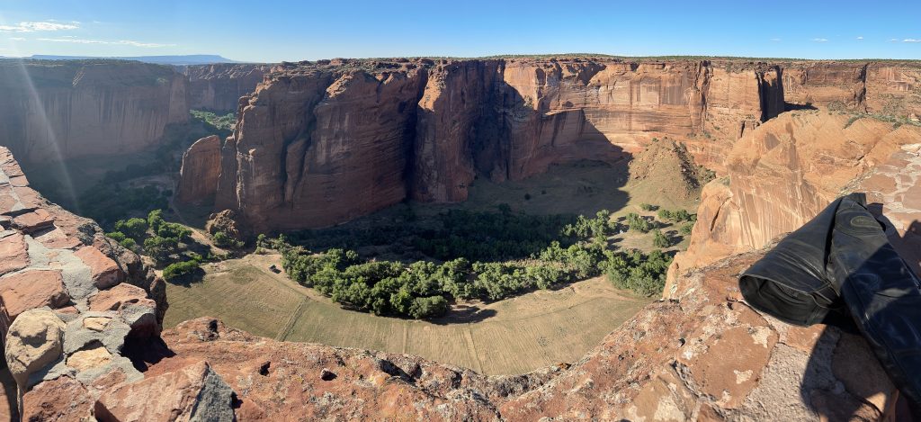
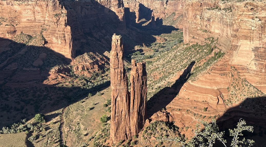
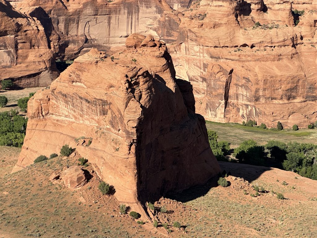
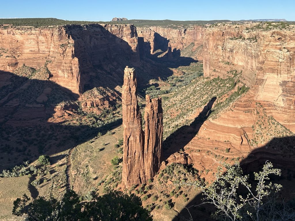
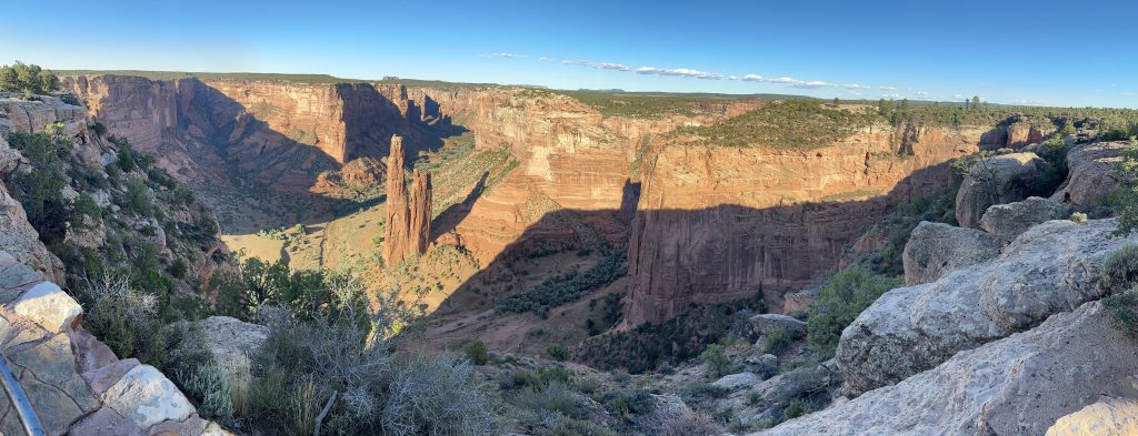
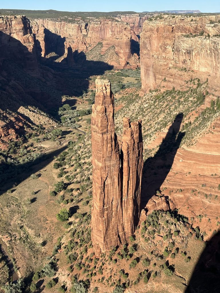
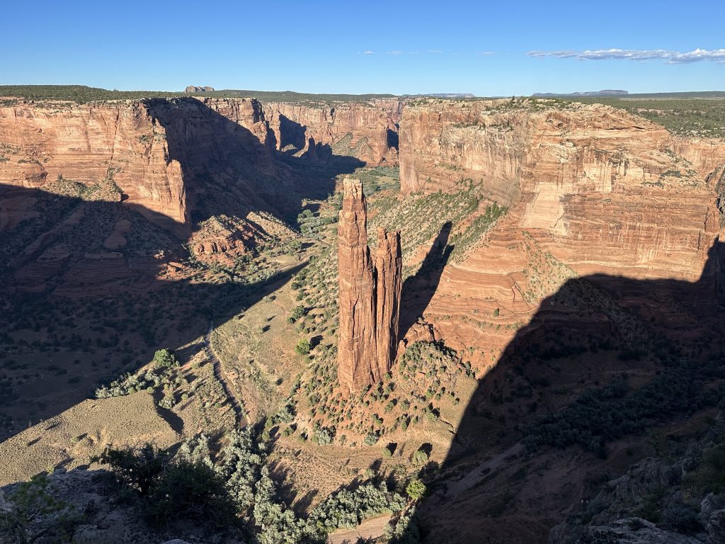
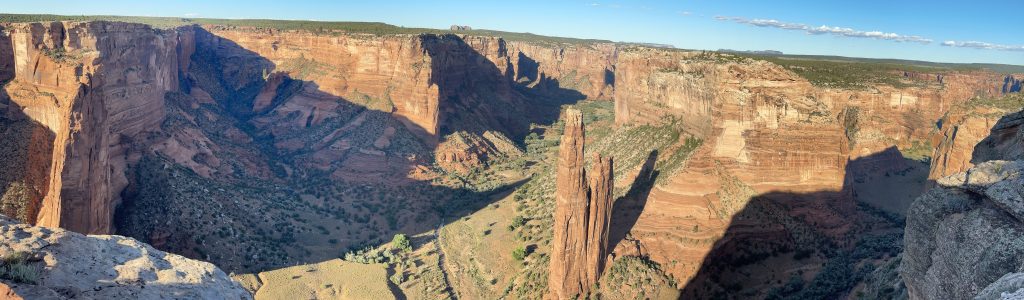
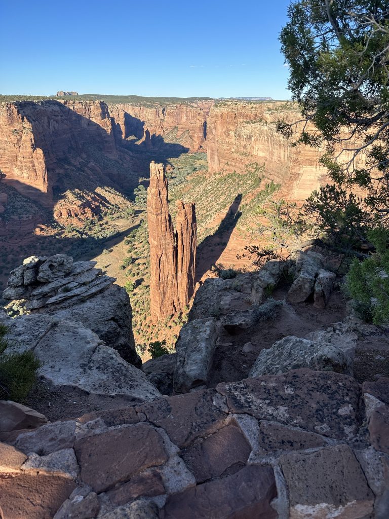
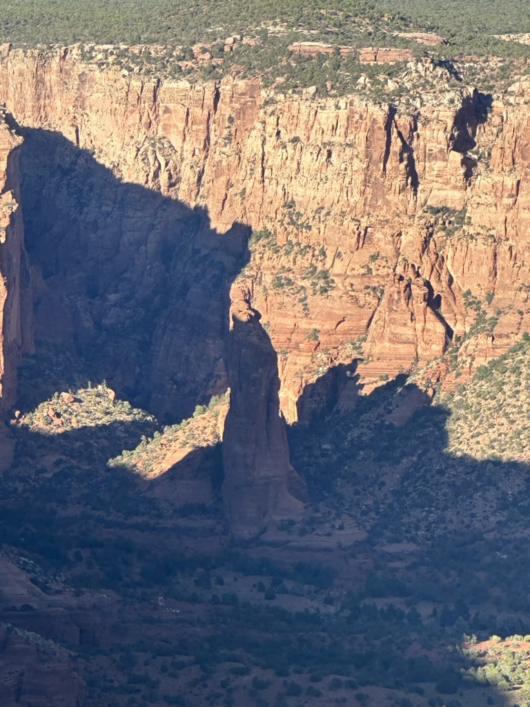
The last overlook is the Spider Rock overlook. It’s several more miles down the road, and you have to watch out for cattle because much of this land is privately owned and open range.
Just before the Spider Rock overlook is the Face Rock overlook; I stopped for a few photos.
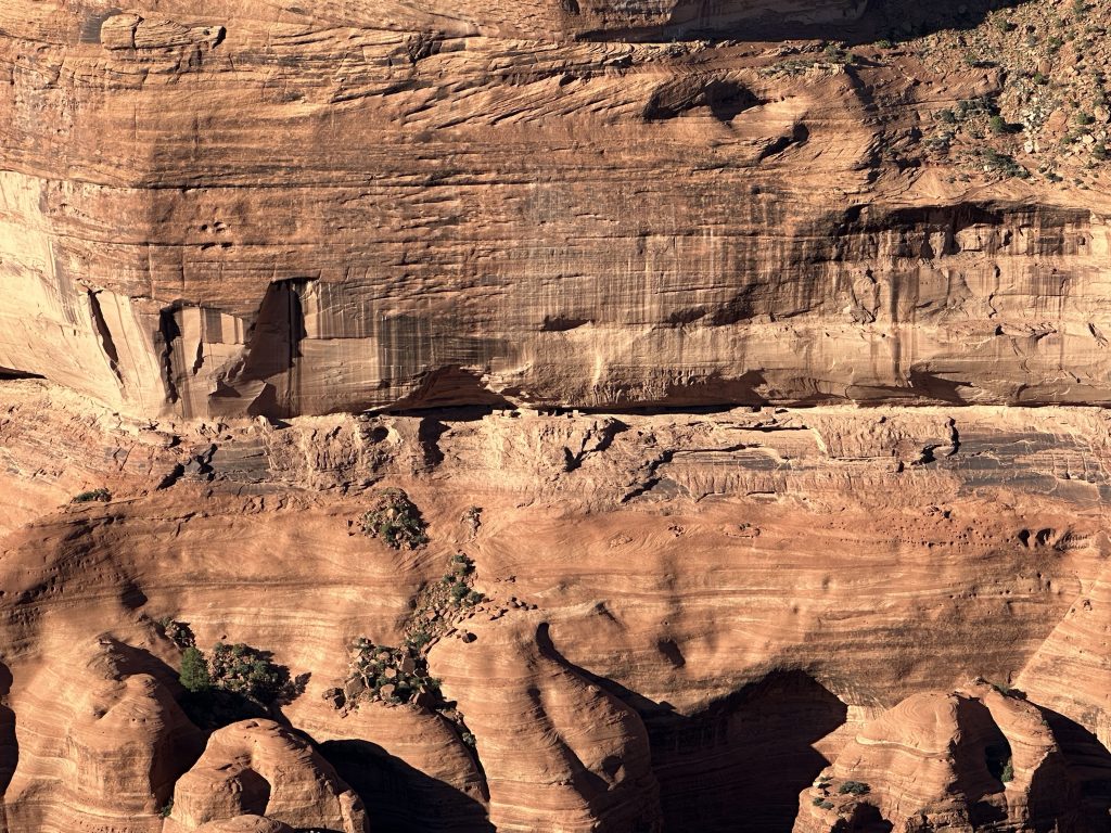
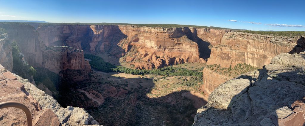
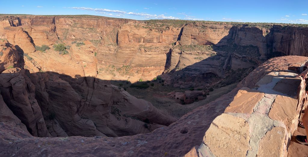
Finally, I reached the Spider Rock overlook. Luckily, the sun was still high enough in the sky to shine all the way to the bottom of Spider Rock.
It’s a 200 yard hike to the overlook areas.
With photos captured, I relaxed and rode back to the hotel into the setting sun. Back in Chinle, I stopped for gas so I wouldn’t have to top off in the morning.
After the Ride
After putting away my gear in my room, I walked across the parking lot to the on-site restaurant. I ordered water (no pop/soda tonight; it’s all about hydration). For dinner, I ordered something they called the sheepherder. It’s like a gyro sandwich, but with roast beef instead of lamp and served on Navajo fry bread instead of pita bread. It was tasty and extremely filling.
I noticed that the hotel WiFi was available in the on-site restaurant; I managed to upload all the photos from the iPhone to my site during dinner.
Verdict on US191 in Arizona
So, was my ride up US191 worth the effort?
Yes. The scenery was fantastic, the road is technically challenging, and the traffic was nearly non-existent.
Does this mean that I’ll be finding reasons to wander out this way so I can ride it again and again?
No. While it was worth doing, the southern third of the mountainous stretch is made less fun because of the crappy road conditions. Combine that with the slog through the mine at the southern end and you have a road that, while worthy of a ride, is not something that I intend to repeat.
Map
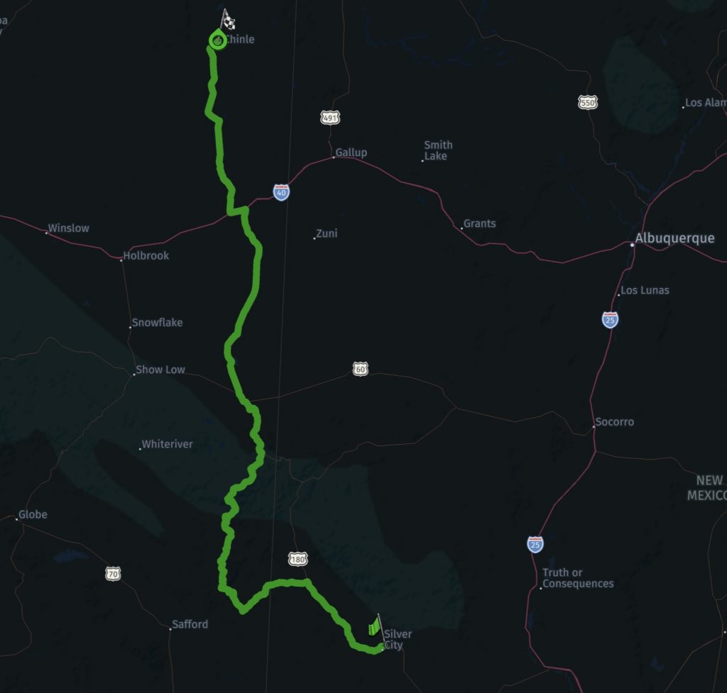
Here’s the map for today’s main ride. Click on the image to open a interactive map for this route.
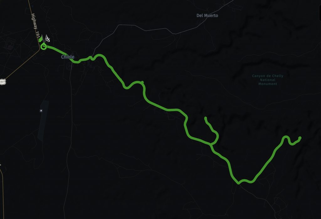
Here’s the map for the tour of Canyon De Chelly that followed today’s ride. Again, click on the image to open a interactive map for this route.
Tomorrow
Ride up to the Four Corners area, take a spin along the Million Dollar Highway, and (probably) finish the day in Gunnison, Colorado. We’ll see.