
With the backdrop effort kaput, I was just riding for myself. So, why not revisit two of the best motorcycle riding roads in America?
Pre Ride
The plan for the day was easy:
- Jump on the Slab (I90 east) and blast over to Columbus, Montana.
- Head south on a nice, sparsely traveled, road to Red Lodge, Montana.
- Ride through Bear Tooth Pass.
- Ride the Chief Joseph Scenic Byway.
- Take another less-traveled route from Cody over to Worland.
- Get a room, dine, post trip report, sleep.
What could possible go wrong? (Sorry to kill the suspense, but nothing went wrong.)
After last night’s healthy dose of Cajun pasta, I skipped breakfast and got another half hour of sleep instead. I showered, packed, and was on the road precisely at 10am. (Fins, I hear you moaning at such a late start, but I only had about 360 miles (579 km) to travel; no need to start at the butt-crack of dawn.)
The Ride to Worland
I immediately hit my first minor snag of the day; the gas station I visited was, literally, out of gas. All of the pumps had bright orange Out of Service baggies over the pump handles. Sure, there was another station right across the street, but this street is a boulevard with a center median, so you can’t just bop across the street.
Naturally, I figured it out, but it wasn’t an encouraging start to the day.
The traffic on I90 east was fairly light, and the pace was brisk. I was making good time. Once again, the highway was paralleling a BNSF railroad main line, so I was able to spot four different trains either fighting their way up a grade or waiting patiently on a siding for other traffic to pass. One train was an absolute monster grain train, all covered hoppers with two engines on the front, three (3) in the middle, and another one (1) on the back. The only reason for that much power was if all of those covered hoppers are loaded with grain. That’s a lot of bread and donuts.
When I travel this time of the year, it’s often grain harvest time. This year’s trip is a few weeks later than usual, so I was catching a few of the grain fields that chose to be harvested later. Most of the grain fields I saw were already cut low. There was also a lot of hay in the different stages of harvest:
- Cut but not yet piled into rows.
- Cut and piled into rows.
- Being baled.
- Already baled, but the bales are still in the field.
- Bales being picked up and stacked.
One farm I rode by today was in the middle of gathering the piled hay into square bales. Square bales aren’t the normal rectangular bales that you can pick up yourself. These were probably 6 foot squares. On one corner of the farm, I saw the baler gobbling up a row of cut and piled hay and spitting out these huge square bales onto a flatbed. On the other side of the farm, near the cluster of barns, I saw a huge line of these big square bales piles two high, two wide, and at least 20 bales long. I don’t know what animals he has, but he has a lot of them to need that much hay. It was an impressive operation.
As I approached the Livingston exit, which can take travelers south into Yellowstone National Park, I noticed that the distant high mountains in that direction weren’t as hazy as they were two days ago. I hope that meant my ride through Bear Tooth wouldn’t be molested by smoke.
Now in the valley with the Yellowstone River, the light traffic allowed me to kick back a bit. Right foot on the highway peg, left hand in my lap, rising only to activate the turn signal control to pass someone. I think I was able to travel almost a full hour without needing to turn off the cruise control.
Eventually, the exit to Columbus arrived and it was time to exit the slab. Montana highway 78 south out of Columbus is a nice back-road way to get to/from Red Lodge, Montana. The main highway through Red Lodge (US212) travels southwest to northeast. Consequently, if you’re coming from the east, exiting I90 to US212 and taking the diagonal to Red Lodge makes perfect sense. If, however, you’re coming from the west, like I was today, taking the same route means backtracking along that same diagonal. MT78 solves that problem. As a bonus, most people don’t know about it.
Aside: Having said that, I saw more bikes on it today than I ever have. I think the navigation programs that people use know about this route.
As usual, the ride down MT78 was a pleasant trip past farms and ranches. Some of the ranches were really nice, and indicated some serious (albeit isolated) wealth in the region.
I rode into Red Lodge about 12:30pm. The next leg of the ride, through Bear Tooth Pass and down the Chief Joseph Scenic Byway, would not offer many opportunities to refuel, so I topped off the Nightowl now. Then I thought about lunch. I hadn’t eaten a proper lunch since I left on this trip, and I really didn’t need lunch (not like I don’t have the fat reserves to survive on), but Red Lodge is a nice little all-year resort town and has plenty of cool restaurants in it’s restored downtown. I spotted Bogart’s, a bar/pizza joint, and found a parking space on the street right in front of it.
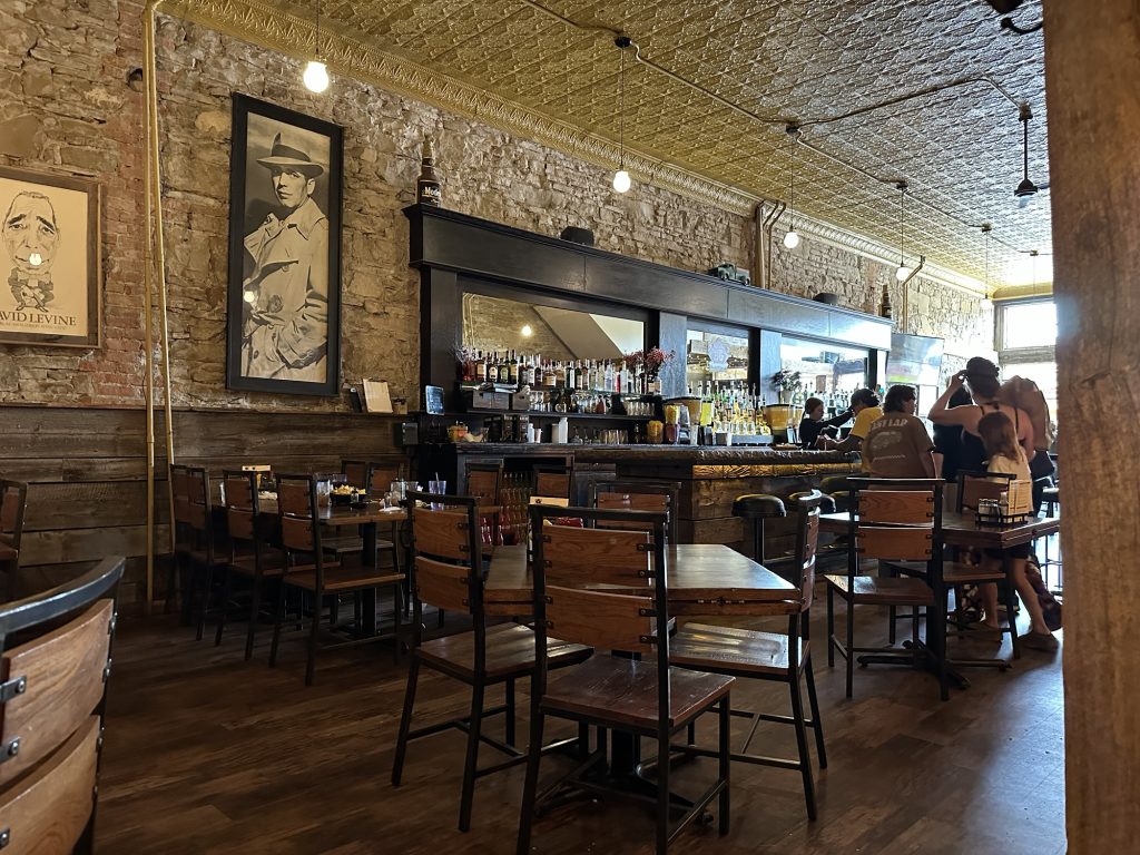
I ordered a nice little 10” pizza with Italian sausage and other stuff. It was still too much for me to eat at one sitting, but I did my best. With any vestiges of hunger properly sated, I hopped back on the Nightowl and headed south to the mountains.
Aside: Somebody tell Banker Bob that the Blue Ribbon Bar is still alive and well in Red Lodge.
Heading south into Bear Tooth Pass, you start by riding up a long valley with steepening mountains on both sides. Eventually, it becomes evident that this canyon will end in a box, so the road starts a series of switch backs up the eastern valley wall. These switchbacks are a great place to practice your second-gear switchback technique. While I had to pass a few vehicles to keep up a spirited pace, it was still fun.
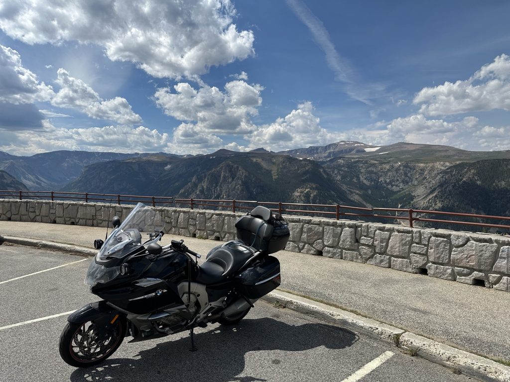
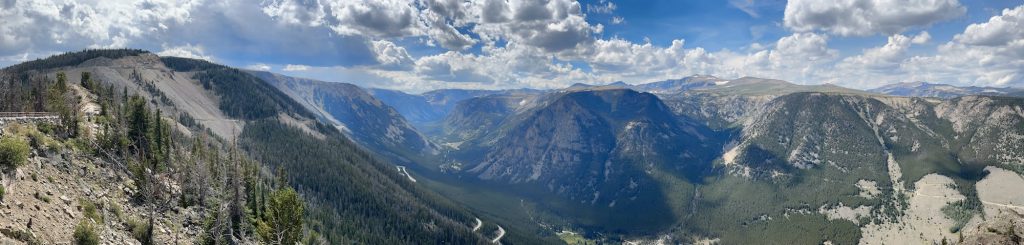
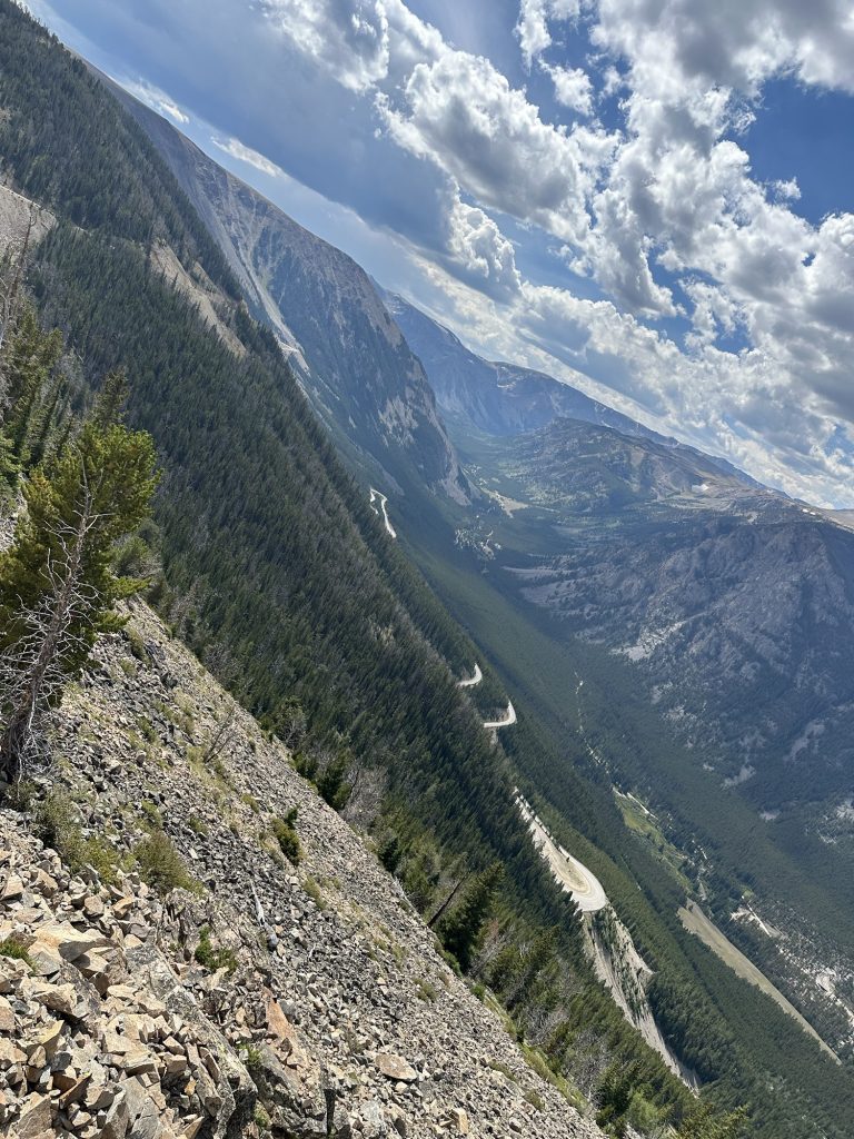
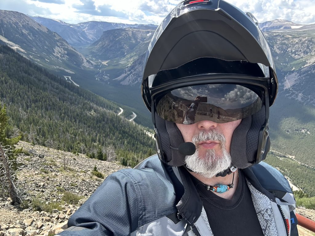
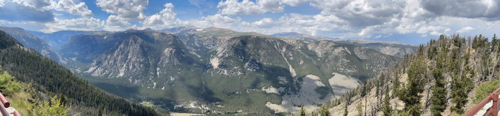
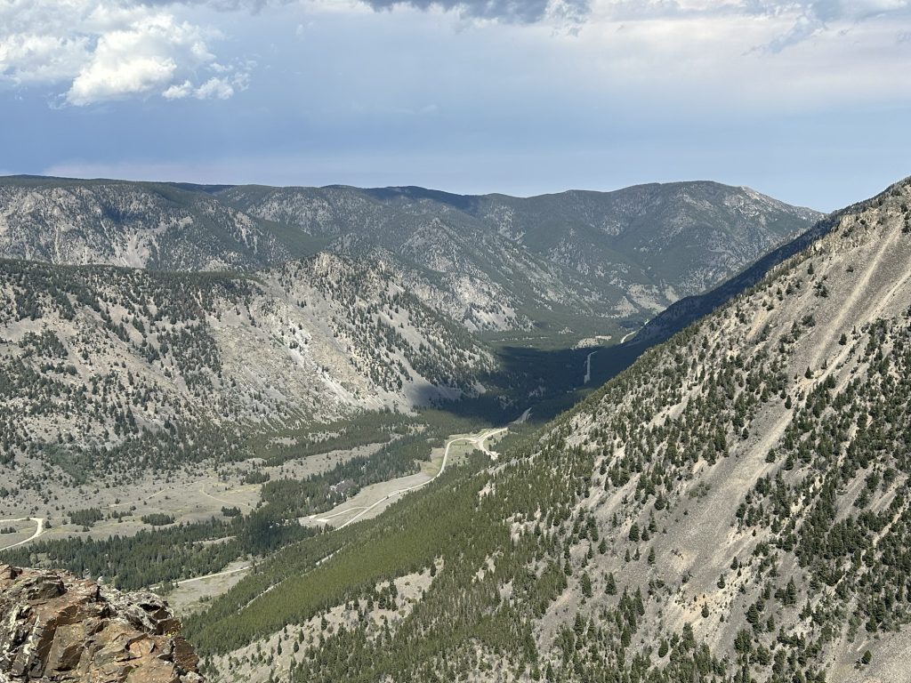
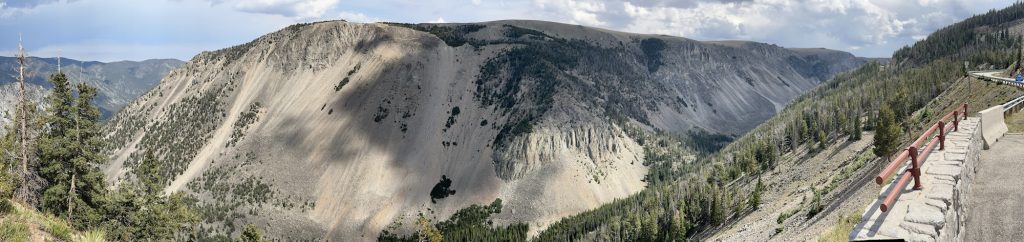
Near the top of those first set of switchbacks is an overlook, complete with a parking lot and restroom, all crammed onto the end of a ridge, such that you can look down either side of the ride just by walking across the parking lot. There’s also a walking path that takes you to the end of the ridge, where you can view a full ~270º of panoramic mountain righteousness. If you ride Bear Tooth Pass and don’t stop here, you’re a moron. Here’s some photographic evidence:
Continuing up Bear Tooth Pass from the switchback viewpoint, you soon pass above the tree line and into the open alpine landscape with wide open views in all directions. After traversing several ridges and climbing ever higher, you finally reach the summit of Bear Tooth Pass at 10,947 feet (3,336 m). Naturally, there is an overlook here, and that demands more photos.
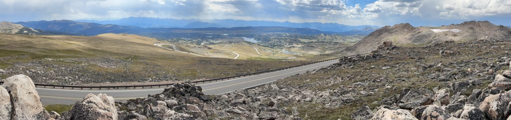
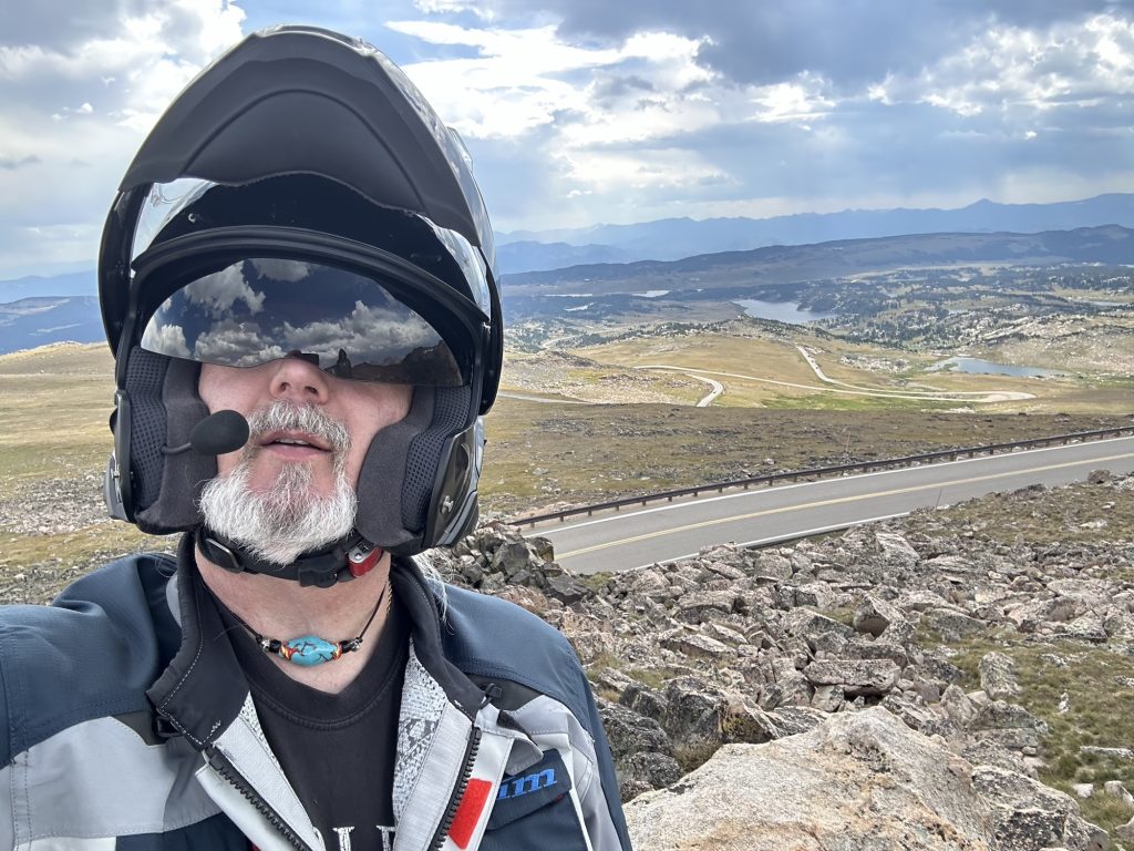
Continuing on, you start to descend, starting with a series of switchbacks (you can see some of them in the photos above), and then winding down below the tree line again.
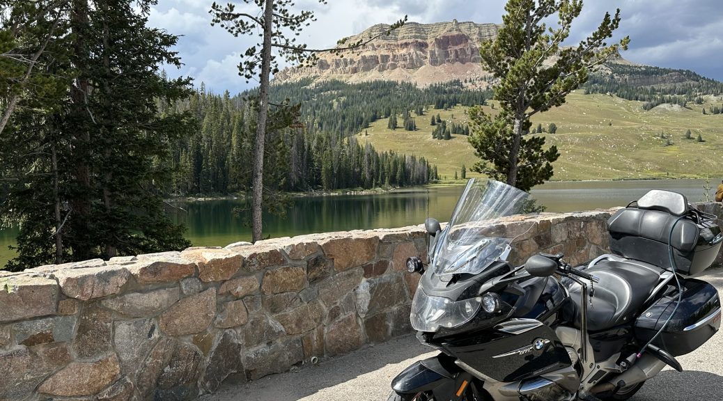
A few miles down from the summit is a don’t blink or you’ll miss it parking area west of the road that allows a view of a nice alpine lake and the mountain behind it. I’ve been stopping here for an obligatory photo of whatever Bike I happened to be riding that trip. Naturally, tradition is tradition, so I stopped for today’s photo.
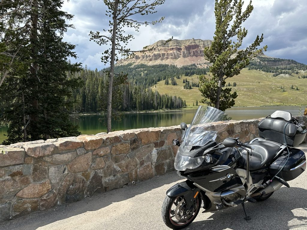
You may notice in the above photo that the cloud cover is a little darker and a little more dense. Back at the summit, I could see some rain falling on the next valley to the south, where the Chief Joseph Scenic Byway runs. I was hoping to get to that valley before the nastier skies to the west arrived.
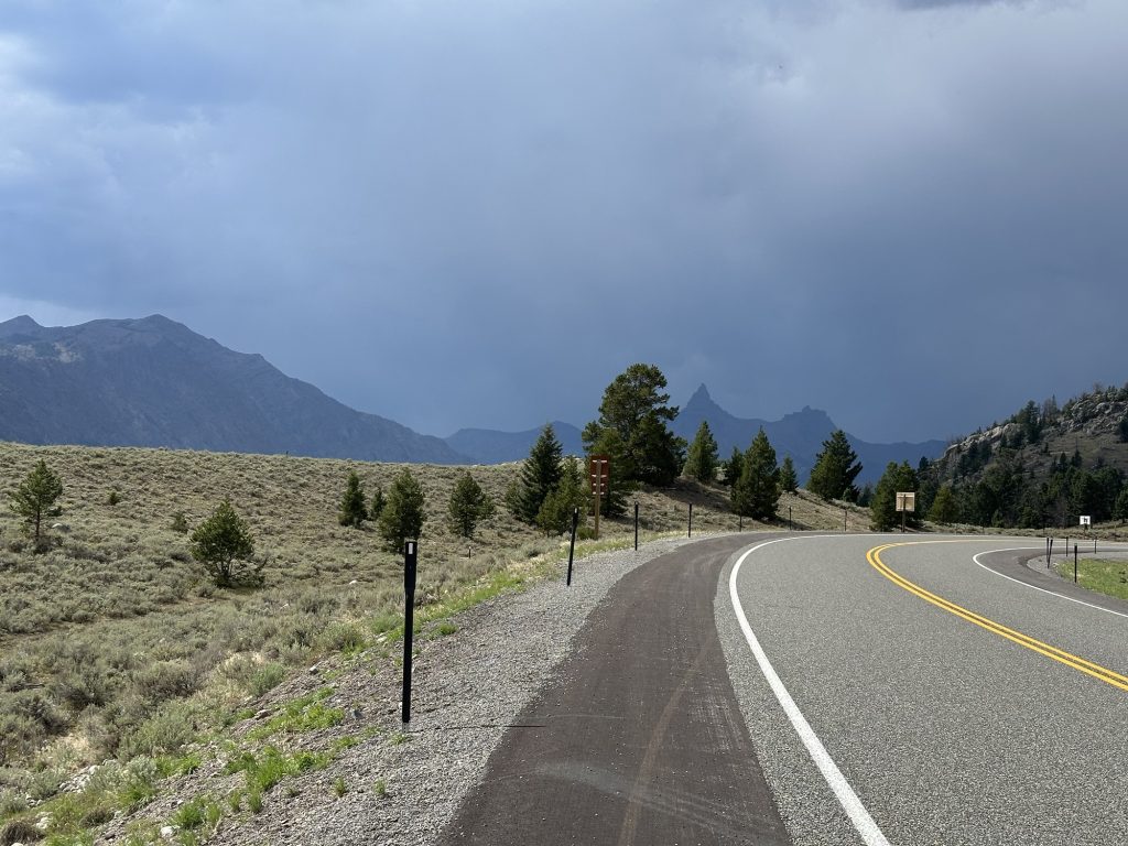
The good news is that the turn to the Chief Joseph is only a few miles west of Beartooth Lake (in the Nightowl vanity shot above). As I approached that turnoff, and looked west, the skies were seriously dark. Not like damaging thunderstorm dark, but rather like torrential shower dark.
Lucky me, I reach the turn, and the Chief Joseph Scenic Byway conveniently directed me southeast, away from the ugliness brewing to the west. Think I’m lying? I took this shot looking back over my shoulder after the turn.
I’ve made this point several times, but for those who haven’t ridden these roads, I’ll make it again. Bear Tooth Pass and the Chief Joseph are two very different rides and demand different things from a motorcycle rider, from a technical perspective.
Bear Tooth Pass is all about tight switchbacks and winding paths across alpine landscapes above the tree line, with endless mountain vistas in every direction. The turns require a little more discipline; your switchback technique will get a proper workout.
The Chief Joseph does have the ride up and over Dead Indian Pass, where you get some of the same switchback practice, but the rest of the ride is mostly forested with curves that are less tight and more sweeping. Instead of alpine openness, you get never ending sweepers through a valley and around mesas.
For this trip down the Chief Joseph, I had a nice spirited ride mostly unmolested by wayward travelers. Those few travelers who damaged my Zen on this ride was a bagger and two trikes that insisted on enjoying the views as a staid 45 mph (72 kph). Ugh. I was eventually able to get around them, but those never ending sweepers I mentioned do tend to inhibit passing. Luckily, I was able to get by them early enough that when I reached the top of Dead Indian Pass, I was able to stop at the overlook, leisurely take a few photos, and get back on the Nightowl before then caught up to me.
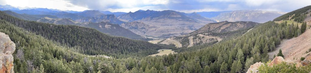
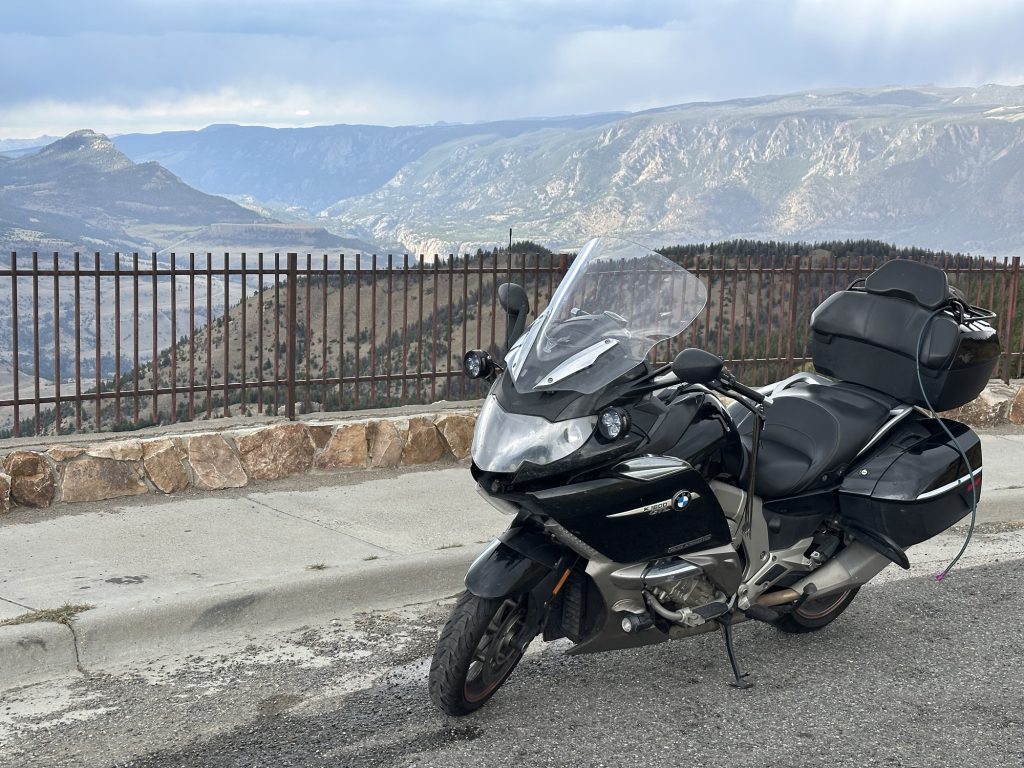
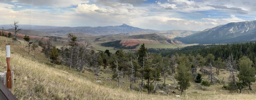
A few miles down the other east side of Dead Indian Pass, I spotted a geological formation that I always forget to take a photo of. Today, I remembered. The thing that strikes me is that this uplift of bright orange strata continues on, broken into pieces, well into the distance and several small ridges into the background. I had to stop in on the shoulder in the middle of a switchback to get this angle, but for the geologically inclined, here you go.
After descending the remaining elevation to the end of the Chief Joseph, I turned south on WY120 towards Cody. I’ve always liked Cody. It has held on to its cowboy work ethic, seemingly like a throwback to the Wild West, but not out of nostalgia. You see, a lot of the people out here have herds of livestock and they still get on horses and tend their herds or mend their fences, just like they did 150 years ago. When you ride into/out of Cody and you see people in cowboy hats, on horseback, out in the fields, they aren’t a tourist or a group ride — they’re doing work. This appeals to me on some level.
While most travelers ride east from Cody on US14 before cutting south to Worland on US16/US20, I prefer to continue south on WY120 through Meeteetse and then cut east towards Worland on WY431. I like this route because it’s more rolling and less flat, and also because it’s less travelled. WY431, especially, tends to have little to no traffic on it.
The ride down through Meeteetse was without drama, but there was a rain shower to the west that looked like it might give me a light shower, but it was moving too slowly and I passed it unwatered. Turning east at WY431, I always stop at a little roadside viewpoint that looks over a strangely eroded landscape, that looks like a cross between the Badlands of South Dakota and a huge sandcastle city that has partially washed away. Most travelers that visit Wyoming don’t even know that this minor little feature even exists. Here it is:
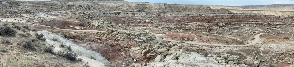
There’s a walking path through this formation, but I’ve never taken the time to walk it. I’ll need to do that someday.
During this visit, the only other person here was a lone woman, of some East Asian descent, with a small dog that she carried in a backpack. It looked like she just finished the path through the formations. Her car had a New Jersey plate, and it looked like she had been camping in her car. I got the distinct impression that she’s taking her own sweet time to smell all the roses on this journey.
Just west of the badlands view, I spotted a state trooper Cruiser heading westbound with light flashing. I marked this down as strange because I never see much traffic on this road. A mile later, another law enforcement vehicle, a county sheriff’s SUV, also heading west like a bat out of hell. It made me wonder what was going on. Perhaps a bad traffic accident.
I arrived in Worland at about 5:45pm. There was still plenty of daylight, but the direct sunlight was partially obscured by the growing cloud cover. As I looked for a gas station, I contemplated my options:
- Book a room, find a light dinner, and call it a day.
- Use the two remaining hours of sunlight to continue the 85 miles (136 km) east to Buffalo, thus shortening my trip to my friends’ home tomorrow.
While the day hadn’t been that long, parts of it were technically challenging. Still, I had plenty of energy to ride another 90 minutes. The only thing that gave me pause was the knowledge the the Bighorn Mountains would need to be crossed in those 90 miles, and that region is fairly wild and vehicular accidents with animals (deer, elk, etc.) were all too common. Early evening was their witching hour, so there was an added risk.
While I was mulling this over, my friends that I will visit tomorrow texted me to ask if I was staying the night in Buffalo. I answered that I was sitting in Worland weighing that exact possibility. My friend knows that stretch of road all too well and said I was probably safer spending the night where I was. Naturally, this sage advice came a few minutes after I’d booked a non-refundable room in Buffalo for the night.
So, over the mountains I would go.
The Ride to Buffalo
The first 26 miles (41 km) east out of Worland is rolling desert. Not much foliage, much less wildlife. Consequently, I kept a good pace in this stretch to get myself a little ahead of schedule. Tensleep is a little more developed than the last time I’d been there, but the beloved Flagstaff Cafe is long gone, replaced by a nice little motel. Tensleep has two (count them, two) RV parks that cater to people hauling horse trailers. Get your campsite and adjacent pasture for one low price.
East of Tensleep, the mountains finally begin. You start by climbing to a canyon, with the road in the base of the canyon. Slowly, the sides of the canyon rise higher and higher, and the road starts to climb the north wall of the canyon. It’s impressive, and if I wasn’t anxious to get over the mountains before the sun set, I would have stopped for photos.
Eventually, you emerge from the canyon and start to ride through a mountain forest. Here is where your Bambi radar needs to be on full alert. Since I was still on the western slope of the pass, I still had plenty of sunshine to light my way, but that forest still places you in shade much of the time.
As you near the summit of Powder Pass, you briefly flirt with the tree line, and the forest growth becomes more scattered. It was in this area where I spotted an elk herd, probably a half mile (~1 km) off the road. Cresting Powder Pass, I curled around the backside of the peak ridgeline and lost most of my direct sunlight. I’d still see it occasionally during my descent, but only a small portion of the time.
I reduced speed by about 10 mph to lower the risk a bit.
Over the next 30 miles down the eastern slope of Powder Pass, I saw three different groups of deer:
- A group of two (2), on the left shoulder of the highway. I slowed down, but they didn’t even raise their heads; they just kept eating. Fine with me.
- A group of five (5), with a youngster out in the road. I saw them early enough to honk the Nightowl’s horn at them, sending the youngster scurrying back to the adjust, all of which raised their heads but stood still. No worries.
- Another group of five, at least 50 yards/meters off the road. No problem.
Experience reminds me that there’s probably another 20 deer that I didn’t see, but I’m happy that the ride didn’t become an obstacle course challenge… until the construction zone.
The construction was a re-paving off several stretches of the highway, where each stretch had been stripped all the way down to bare gravel. Each stretch was between 1/2 mile to 1 mile long and separated by similar lengths of the old pavement. Now, the Nightowl is surprisingly nimble for a large touring bike, but it’s not a GS or a Panamerica. One of those five gravel stretches had fresh gravel on it; it was like riding on marbles. Fun, fun, fun.
Just when the construction zone was near its end, there was one last torment: a stretch of one-lane road with a pilot car and flagmen on either end to manage the direction of travel. The good news was that I was first in line, and could sit there and chat with the flagman while we waited. The expected four minutes stretched to 10, but we eventually got through.
From there, it was down the final slopes of the mountains and into Buffalo. I was able to find my chosen motel easily, and set me up with a room and suggestions on where to get a light bite to eat.
Post Ride
After a quick visit to my motel room to drop off my bag and start the air conditioner, I made my way to the Dash-In diner. It wasn’t exactly a five-star sit-down establishment with full bar, but it offered a-la-cart selections. Not needing much after my pizza lunch back in Red Lodge, I opted for two soft tacos. It was the cheapest meal I’ve had on this trip.
Knowing that I’ll need an early start (read the Tomorrow’s Plan section below), I filled up with gas and cleaned the bug guts off my windshield tonight.
Then it was back to the room to write up this report, which as you can see, took longer than I intended.
Map
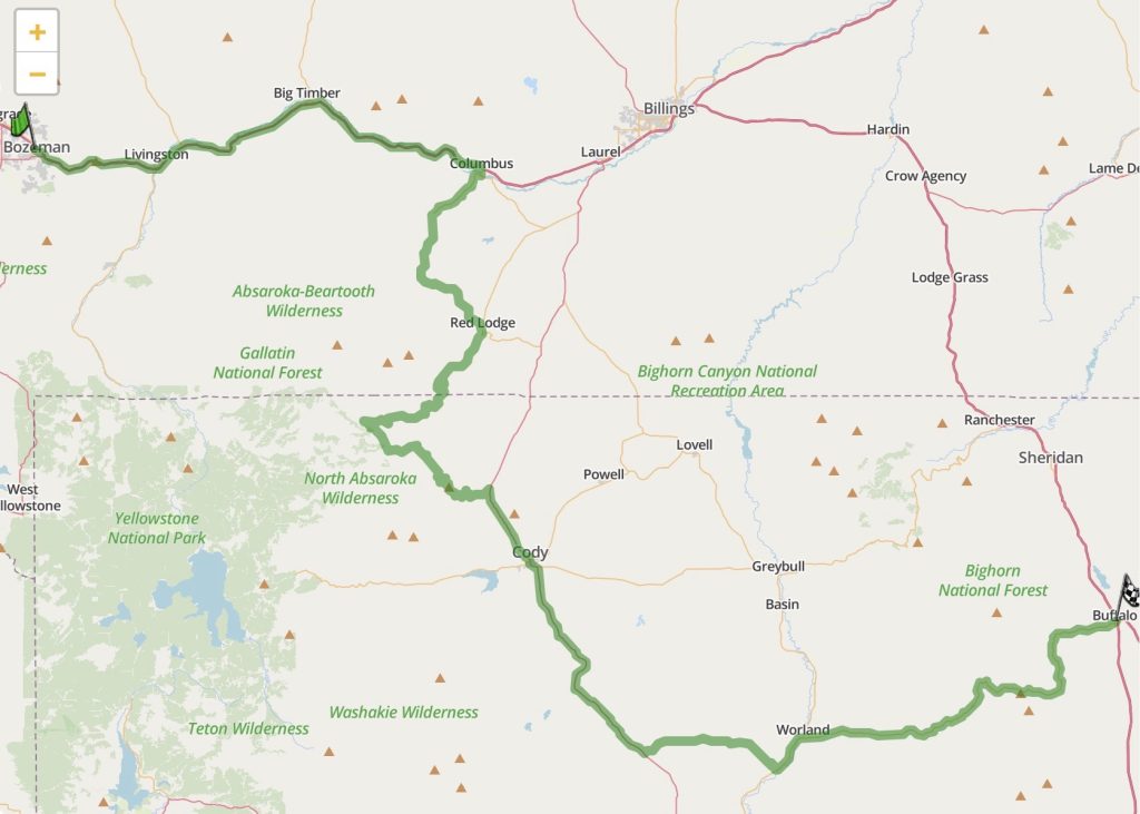
Here’s a map of the day’s travels, which you can click on for an interactive version.
Tomorrow’s Plan
This evening my friends, who will host me for the next couple of days, informed me that tomorrows agenda includes some cool stuff mid-day… assuming that I can be at their place (200 miles away, 321 km) by 11:30am.
Mmmm, a challenge; especially given that the only time I see a sunrise is when I’ve been up all night.
All set the required alarm, and we’ll see what happens. Stay tuned…