
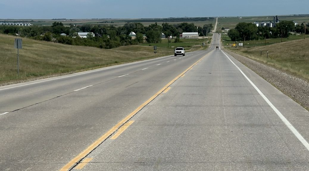
I ride hard to get to my friends in time for lunch, and after a few days of hanging out, head back east towards home.
Pre Ride on Day 6
As you may recall, was in Buffalo, WY. My friends were about 200 miles away in the area of Rapid City, South Dakota. The goal was to get on the road early and get to my friends’ home before lunch.
Ride on Day 6
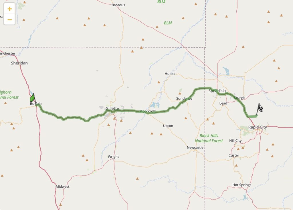
The route was easy: get on I90 east and take it all the way to the exit to my friends’ home. It would be a 2-3 hour ride, so I wanted to allow for the conservative estimate of three hours of riding time.
I was on the road precisely at 8am. (Are you reading this, Fins?)
Starting east on I90 from Buffalo is a bit wistful for me since it marks the end of the mountains. The Bighorn Mountains are just west of Buffalo, and as you start east, they begin to fade into the horizon. No more mountains for the rest of my ride home except for the Black Hills in South Dakota, and they’re just not the same.
Further along, near Gillette, Wyoming, I90 parallels the BNSF railroad main line and passes a few coal mines. This is a throwback to my youth when big-time western US railroading meant long Burlington Northern (BN) coal trains. That’s one of the big reasons that the BN in Montana is what I’m modeling.
I noted two (!) loaded coal trains heading west. Most coal loads in this region head east. The only westbound coal loads that I’ll be modeling (albeit in the late 1990s timeframe) goes to Centralia, Washington. I found myself wondering where these westbound coal loads were headed.
Along about mile marker 164 on I90 in Wyoming, if you look to the northern horizon, you can see Devil’s Tower. You need a clear day with low haze, but you can see it from the interstate. Obviously, it’s more impressive up close; if you’re interested in it, set aside the same to head north and give it a proper visit.
After crossing the Wyoming / South Dakota border, and passing Spearfish, I reached Sturgis, which is the location of the famous annual biker Rally that had just finished a few weeks ago. There were still a bunch of bikes on the road, but these were travelers who purposely scheduled this arrival time to avoid rally week. With all the bikes on the road, all the bikers were still in rally mode, which means they weren’t Waving to other bikers.
The Nightowl was doing pretty well on gas, so I didn’t need to stop for fuel before exiting north of Rapid City, South Dakota. After crawling through some heavy, bare-gravel, construction (they’re putting in a replacement overpass), I rode the last few miles and arrived at my friends’ home. I was 45 minutes early.
Mission accomplished.
Day 6 Map
Here’s the map for Day 6; click it for an interactive version.
Ride on Day 7
After a few days of hanging out with friends, it was time to point the Nightowl back towards home. I had three travel days to get there, and anywhere from 1,200 to 1,600 miles to go, depending on route. I opted to take a more leisurely route that avoided the interstate highways, in favor of good old-fashioned two lane roads. While this yielded the shortest distance to home, it involved roads with lower speed limits. You have to pick your poison; I chose novelty over speed.
For the first day, my plan was to get most of the way across the wide state of South Dakota. The route would take me through 388 miles (624 km) of the Great Plains, with only a few river valleys to break up the never ending farm land.
After breakfast and long farewells with friends, I finally got on the road at 10:19am. As mentioned, today’s route wasn’t that long, so the late start probably wouldn’t hurt me much.
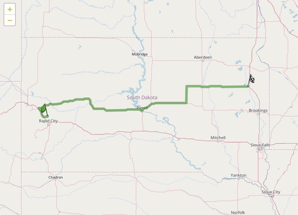
I doubled back northwest to Sturgis to pick up SD34, which would take me most of the way east across the state. I topped up with gas in Sturgis, and started east, passing several of the larger venues that were packed full of bikers just a few weeks ago for the rally. Now they were nearly empty, or closed entirely; waiting for next year’s rally.
I passed Bear Butte (off to the north) and started across the endless plain. It was almost 80 miles before I reached Bridger and started down into a broad river valleys at the Cheyenne River. Up on the plain, the only greenery was in the farmer’s fields, unless it was wheat, which had already been cut low. Down in the river valley, there was a lot more natural greenery. The Cheyenne River itself was low on the banks and muddy, barely moving at all. Then it was up the south slope of the valley and back out to the plain.
Another 80+ miles to the east, I started down into a much larger river valleys at the South Dakota capital of Pierre. This valley is for the Missouri River, one of the larger river systems in the continental United States. It was deeper, much wider, and the river was wide and blue (not muddy). I should have stopped for a photo, but I didn’t.
I stopped for gas in Pierre, and would have purchased something cold to drink if it wouldn’t have been for a system failure in the cash register at the gas station. I could fill up for gas by paying at the pump, but the poor clerk inside couldn’t sell us any of the drinks or snacks in the convenience store; the poor bastard looked absolutely stricken.
The remainder of the day’s miles were plains, plains, and more plains. I jogged north 25 miles (40 km) from US14 to US212, which was necessary since I was slowly following an east-north-east diagonal, ultimately towards the Upper Peninsula of Michigan, still some 600 miles (965 km) to the east.
It had been a hot day (~93ºF or 34ºC), so I was inclined to stop at the planned ending of Watertown, South Dakota instead of venturing further, even though it was only 6pm. Unfortunately, it was another 100 miles (160 km) before I would reach a down large enough to have motel rooms and a place to eat.
I booked a room from a gas station, crossed town to the motel, checked in, and unpacked. I cooled off in the room for a while and then ventured out for a dinner at a Mexican restaurant. I had shrimp fajitas; they were quite tasty.
Map for Day 7
Here’s the map for day 7; click on it for an interactive version.
The Ride for Day 8
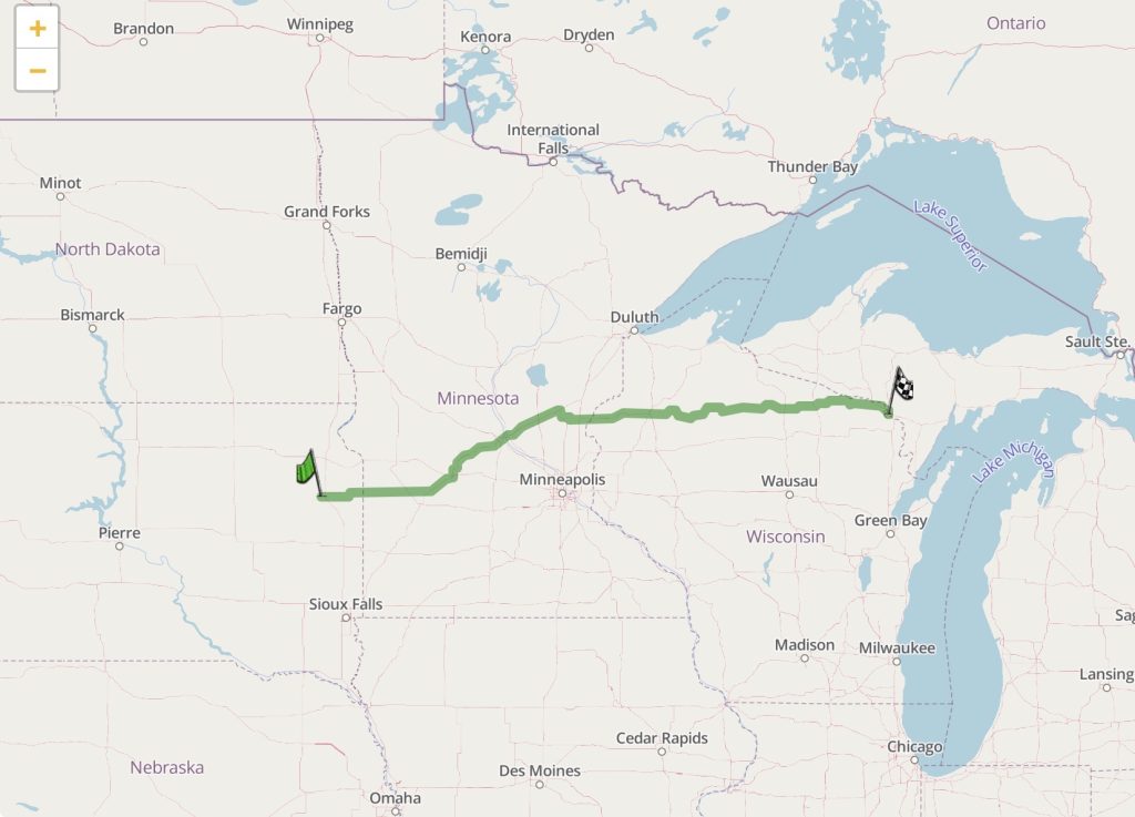
Of the three days for the ride home, this would be the longest. Starting from extreme eastern South Dakota, I wanted to cross both Minnesota and Wisconsin and stop for the night in the Upper Peninsula of Michigan. A ride of over 500 miles (804 km) isn’t that hard, especially on Interstate highways, but this was going to be nearly all two-lane roads.
The good news is that the dicey weather that was north and south of yesterday’s destination, had all passed well to the east. It didn’t look like I would catch those storm fronts, and I was perfectly fine with that. It was also much cooler than it was yesterday; I was starting with mild temperatures in the low 70ºs F (~22ºC).
I crossed the border into Minnesota within the first 30 minutes. Overall, the scenery in Minnesota was still Great Plains, but it was a bit greener and not as desolate with respect to the number of towns. The sun was out, the clouds were light, and I had my rotating playlist of curated music playing in my headset. With the exception of the need to pass the occasional vehicle that was traveling at a slower pace, which was really easy when the roads are straight and mostly level, it was an easy and nearly uninterrupted ride.
At St. Cloud, Minnesota, I encountered the only stretch of interstate highway for the day: a two-mile long (3.2 km) jog east to bypass downtown. This would be the largest town I’d see the entire day.
As I continued northeast, the scenery slowly changed from mostly farmland to mostly forest. By the time I reached Rock Creek, Minnesota, I was almost at the Wisconsin border and I was ready for a few minutes off the saddle. I filled up the Nightowl and got a Vitamin Water and an ice cream bar for me.
My route across Wisconsin was through some fairly remote regions. Yes, there is a major cottage culture around Lac du Flambeau, but it’s still out in the middle of wilderness. I found myself thinking about some of the flat tires that I’ve suffered through on other trips, wondering how long it would take to get assistance out here if I wasn’t able to plug the flat myself.
While the weather today has been sunny and not too hot, I must have caught up with the remnants of the rain the storm fronts had left the previous evening. The roads weren’t wet, but the air was sticky with high humidity; weather that my grandmother used to call muggy. It felt like my perforated leather gloves were wet, when they weren’t.
By the time I’d travelled as far as Eagle River, Wisconsin, my ass was ready to be off the saddle again. (In retrospect, I probably wasn’t using my highway Pegs enough these last two days, moving my pressure points around during the ride.) I probably could have made it to Iron Mountain (the day’s target destination) without more gas, but it would have been close; better safe than sorry. I also could tell that I was in northern lake country because I had three times the number of dead bugs on my windshield; it took me a while to get it clean again (and that lasted for all of five minutes).
A little over another hour and I was crossing the border into Michigan. My target destination of Iron Mountain was only another 15 minutes down the road, and I was able to locate my motel for the evening.
Usually, I try and eat dinner at local establishments instead of chain restaurants. Tonight, however, I’d noted a Pizza Hut franchise directly across the street from my motel. A small pizza sounded good this evening, so I allowed myself to break my rule. As a bonus, it was easy walking distance.
Map for Day 8
Here’s the map for day 8; click on it for an interactive version.
Plan for Tomorrow
Ride home, but take the scenic route along the coast of Lake Michigan.