
After starting the trip late, I have to make some time, heading west with divine purpose. The weather actually cooperated… until the end of the day.
Pre-ride
I woke up just before 8am, and started to rouse myself before I remembered that I was going to allow myself to sleep until 9am to get a full 8 hours.
Oh well, I’m up.
The morning temperature in Duluth was 60ºF (15.5ºC), so I donned a long-sleeve t-shirt, my flannel, and sweatpants to go under the riding suit. I purposely packed lighter alternatives at the top of the top-case bag, figuring that I’d eventually reach the heat and need a wardrobe adjustment.
The motel’s breakfast offerings were pretty weak. Anything hot was pre-packaged, in the fridge, and would require heating in the microwave. I toasted myself an English muffin and filled a bowl with Frosted Flakes. Breakfast of biker champions everywhere (ok, not really).
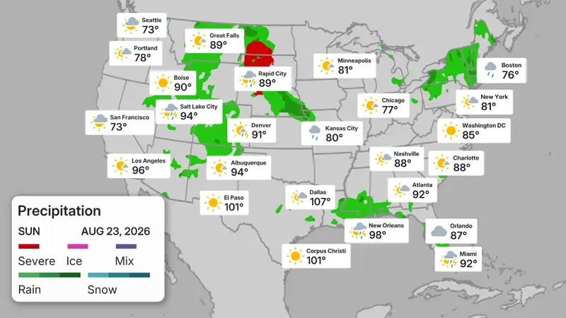
The good news was that the chilly morning included a near-cloudless sky, and nothing on the radar until the west side of North Dakota, where an ominous red blob was forecast to be waiting for me.
The Ride
The overall route I was following had the goal of getting to Butte, Montana as soon as possible. That meant cutting across Minnesota, entering North Dakota at Fargo, and then taking I94 and subsequently I90 across North Dakota and Montana.
As fate would have it, the route across Minnesota was one I’d taken before, but only once before, on my way west to join the first Run to the Sun ride back in 1997. I’d taken US2 across Minnesota several times, but this was my first time to retrace that 1997 route.
Northern Minnesota is mostly flat and mostly wooded, with non-wooded areas hosting farmer fields, wetlands, or lakes. Minnesota boasts about its number of lakes (though my home state of Michigan has even more), and this route finds hundreds of them. Some are rather small, but interestingly named (Shovel Lake, Big Twin Lake), and others are huge and host all manner of resorts and vacation cottages/palaces (Leech Lake). It was a gorgeous day, and there were plenty of boats and toys out on the lake, even on a Sunday morning.
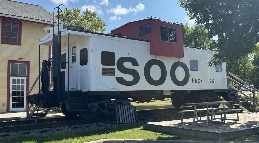
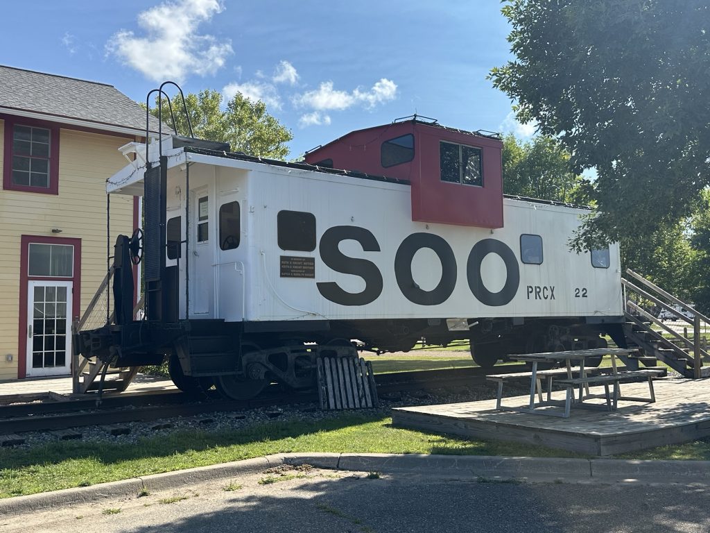
When I traveled through Remer, I spotted the old Soo Line right of way, now a walking/biking trail (sometimes called a rail trail). In the middle of town, this trail passed right by the old freight house, where a former Soo Line caboose is on display.
I hadn’t topped off the Nightowl’s gas tank before starting the day, so I was nearing empty when I reached Walker, Minnesota, the main town along the south side of the ever-popular Leech Lake.
Aside: You’d think that Leech Lake is full of leeches (yuck!). But it’s quite swimmable and is a very popular destination.
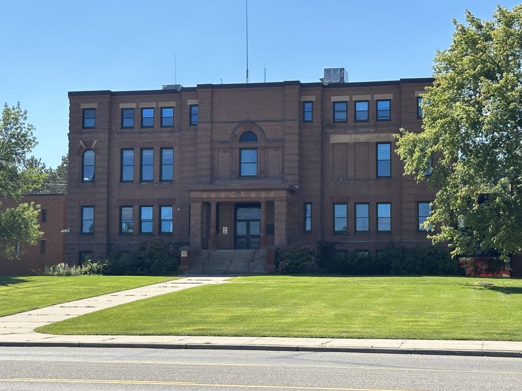
I stopped in Walker for gas and noticed the large official-looking building across the way. Sure enough, this was the Cass County courthouse, where I paid a visit back on that 1997 trip to make use of their fax line to get online and upload a trip report. (For a full explanation of the evolution of my former guerrilla computing tactics, see the article: Road Blogging Before the Internet was Ubiquitous.)
Weaving westward through Minnesota, I was able to make fairly good time in spite of the roads (especially around Leech Lake) being busy. I lost track of the number of cars I passed; the Nightowl make these two-lane passes ridiculously easy. I eventually emerged on US10 at Detroit Lakes, where the road changes to a four lane and the pace quickens.
By the time I reached Fargo, North Dakota, it was over 80ºF (26ºC), and I was beginning to cook in my gear. Right about then, I got stuck in a construction zone and the temperature on the Nightowl started to rise. This is a common syndrome when it’s been a long time since the last 18k-mile service, which is to check the valve lash. The general school of thought is that after the first two valve lash checks, it’s unlikely that these components are going to move significantly (unless you absolutely cook your engine). Consequently, I tend to perform the valve lash checks at longer intervals… unless the Bike starts to habitually overheat. You see, the valve lash checks is the only scheduled maintenance where you remove the engine’s radiator and can properly clean it. Whether the motor needs a valve lash checks or not, you’ll eventually need to clean that radiator. I fear that this winter or next spring has this task in my future.
Luckily, the Nightowl’s coolant temperature hit the highest mark just when the traffic started moving faster. The extra airflow cooled the engine in just a few moments. Still, I’ve made a note that it’s radiator cleaning time.
I waited until I was west of Fargo before I stopped for the wardrobe change. Off came the flannel shirt and long-sleeved t-shirt, replaced by a short-sleeved t-shirt. I was tempted to swap the sweatsuit bottoms for a pair of shorts (one of the advantages to wearing a riding suit), but the swap is a bit of a hassle:
- Remove your boots.
- Remove the riding pants.
- Drop your drawers.
- Replace with shorts.
- Put the riding pants back on.
- Put the boots back on.
This is not the kind of operation you should attempt in a gas station parking lot. I never know how nasty the floors are in restrooms, so I elected to keep the sweatsuit bottoms on. I proceeded to open all the vents on the riding suit, lash the collar in the open position, and head back down the road.
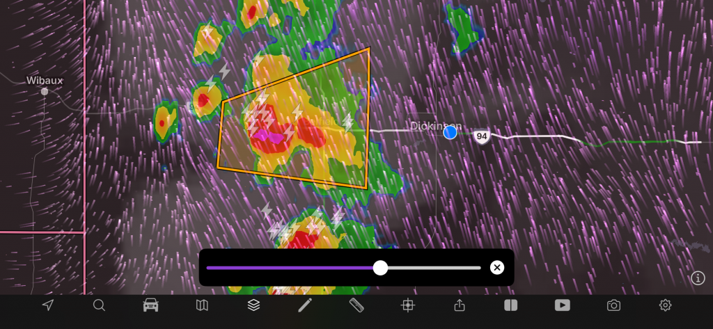
Slowly, but surely, the cities and towns along I94 dropped behind me. Valley City, Jamestown, Bismarck. As I traveled west, the cloud cover became less sparse. As I approached Dickinson, I could see the tops of distant thunderheads looming in the distance. I needed gas anyway, so I stopped to fill up and assess my weather situation.
Sure enough, there was a line of thunderstorms to the west of me, crossing the landscape from northwest to southeast. Where I was, in Dickinson, there was already a severe thunderstorm watch. In a smaller area directly to my west, and straddling I94, was a section marked as severe thunderstorm warning, the full explanation of which included hail stones the size of golf balls.
This did not sound like fun.
Studying the radar image and it’s history, I could see that there was a break forming in the line of storms, and that break would eventually be sitting directly over I94, but somewhere to the west of me. I bided my time, chatted with a few other customers at the gas station, and kept an eye on the storm, about 20 miles to the west of me.
Eventually, the updated radar showed the region of less carnage about five miles north of I94. I figured that if I leave now, I might meet it while it’s over my highway.
Sometimes, you’ve just got to say, “What the fuck.”
Closed up all my vents on my riding suit, turned off my phone (raindrops hitting it act like button presses), and headed west.
The light rain started within the first five minutes. From there, the rain got heavier, but not in the realm of a torrential downpour. For example, the road spray from other vehicles never got bad enough that I couldn’t see around the vehicles.
In the meat of the storm, I couldn’t see that the heaviest rain, and most of the lightning, was already south of I94. If course, this is western North Dakota, which is hilly, so the road doesn’t conveniently run due west. It winds around the land features, which makes the path in front of me look better/worse, changing minute to minute.
About the time the heaviest of the rain was beginning to slacken, I couldn’t see lighter sky to the west. In hindsight, I probably should have waited another five minutes or so to hit the break in the line of storms at exactly the opportune moment, but this was still a minor victory.
Emerging from the storm, the wet roads and rain-soaked landscape dropped the prevailing temperature drastically; a 20ºF (~7ºC) drop. Now I was wondering if I needed to get my original gear out for yet another wardrobe change. However, as I continued west and distanced myself from the cold front, the heat and humidity returned, peaking at 100ºF (38ºC) just west of the North Dakota/Montana border.
My original goal of Glendive, Montana was only 30 miles west of the border, so I was there fairly quickly, and before 6pm, which prompted another decision.
Between Glendive and Billings, there is only one town that will have a variety of lodging and eating establishments: Miles City, which is about an hour further down the road. If I was willing to ride until almost 10pm, I could reach Billings, which would be great, but I was already over 600 miles (965 km) for the day and another 250 miles in this heat felt ugly. Still, stopping in Glendive, with a couple of hours of daylight left, felt like a cop-out.
I had time, so I refreshed with some water in my face, some Vitamin Water for my body, and an ice cream bar for fun. While I drank/ate, I reserved a room in Miles City. With that self-refuel achieved, I ventured back out on the hot highway.
The last hour passed without major incident. Another thunderhead loomed to the northwest, but it was probably 50 miles away and posed no threat along my path.
Post Ride
My motel room is nothing to write home about. It’s small, but it’s clean, has a working air conditioner, and it at the far corner of the hotel away from everybody else. It will be fine for the night.
I walked across the street to the Black Iron Grill for dinner. My waitress was cheerful, but spread way too thin across so many tables. I ordered some jambalaya soup, a half rack of ribs, and some mashed potatoes. The soup was decent, but potatoes were fantastic (especially when slathered with butter and sour cream, duh), but the ribs themselves were underwhelming. I reminded myself to put a few racks on our smoker when I get back home.
Map
Here’s the map for today’s ride. The Scenic app recently changed their map implementation and I’m not in love with it. Here’s the satellite image with the route shown with an elevation change overlay.
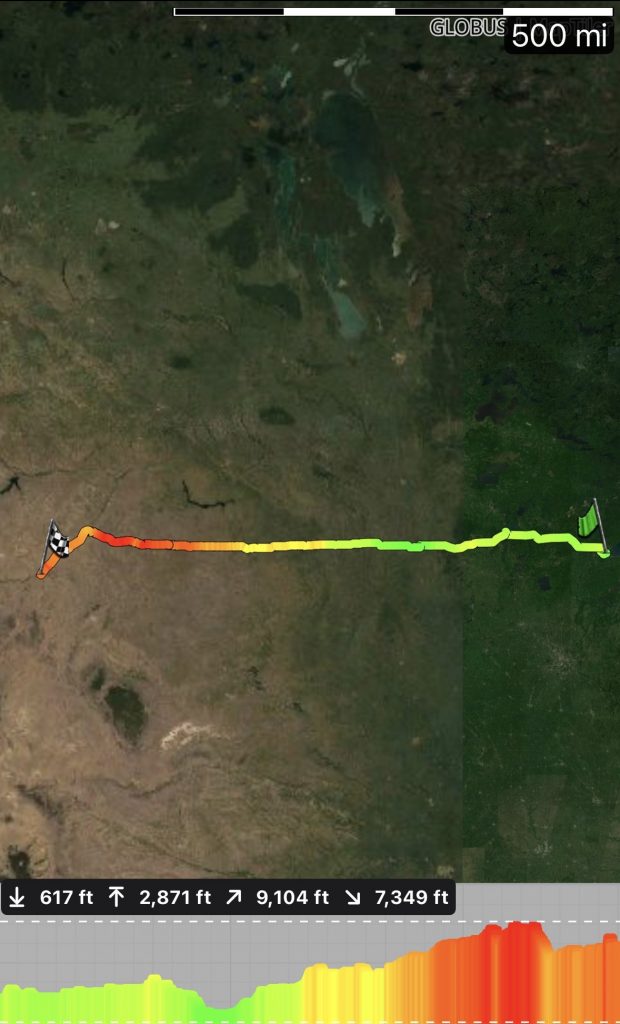
You might get a better experience using the map link.
Tomorrow’s Plan
Ride to Butte, and start taking photos.