<--Previous Up Next-->
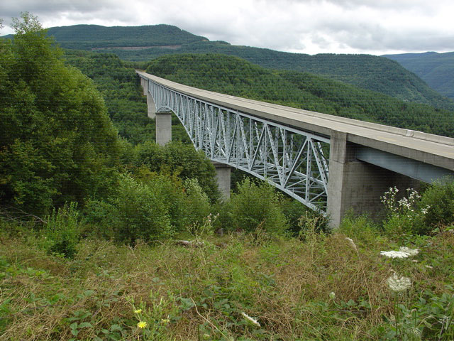
HoffstadtCreekBridge
On Washington route 504 you cross the Hoffstadt Creek bridge on your way to the viewing areas in the Mount St. Helens National Volcanic Monument. When Mount St. Helens erupted back in 1980, the Hoffstadt Creek valley marked the western boundary of blast zone where nothing was left standing. For example, on the next ridge visible in the background, only the strongest trees on the visible side of the ridge survived. Everything on the far sides of the next two ridges was leveled. If you notice horizontal lines in this photo, it is because my camera was slowly losing its mind.