
Today’s route was mostly interstate, but would start with one of the best two-lane tandems in the entire country.
The Plan
- Get up at a reasonable hour.
- Quick shower.
- Ride the Chief Joseph Scenic Byway, and when that ends, hang a right to…
- Ride through Beartooth Pass.
- Lunch in Red Lodge.
- Back roads to I90
- Try to stretch the day to Missoula, so I could squeeze in a run through Lolo Pass on Wednesday and still reach Spokane in time to pick up Karen at the airport.
The Reality
I awoke at 6:30am to the sound of raindrops hitting my tent’s rainfly. This was not part of the plan. Because I was down in the ravine in the back of the Ponderosa Campground in Cody, I had no cell signal, so checking the weather wasn’t an option. I decided that there wasn’t anything I could do about it, so I went back to sleep.
Fast-forward to 8:30am. I’m awake and packing up inside the tent. It’s still raining but it seems lighter than what I heard earlier. Even a light rain soaks everything if it last long enough, and it had been lightly raining for several hours. Consequently, the Nightowl and tent were both wet. Standing out in the rain wasn’t too bad, so I didn’t have to don the raingear top just to pack up the campsite. I transferred the my bags from the tent to the cases on the Nightowl, and proceeded to take down my tent.
Packing a wet tent generally means the following:
- The wet fly will be everything else inside the tent bag wet by the end of the day.
- Anything wrapped around the tent bag will also get damp over the course of the day’s ride.
- I need to set it up again as soon as possible, ideally tonight and in dry conditions, to let it dry out.
My normal packing strategy for my camp bag, which rides on the rack over the top case, is to wrap the Thermarest pads (I have two for this trip since Karen is along for part of it–husbands don’t last long if they make their wife sleep on the tent floor, and I didn’t want to sleep on the tent floor either) around the tent bag for a more compact pack size. If I did that today, the inner Thermarest pad would be wet from the tent bag. So I changed my strategy and rolled the Thermarest pads individually at the bottom of the bag and put the tent bag on top of them. This made the bag a little more bulky, but not so much that I couldn’t get the tie down straps over it and anchor it to the rack.
With the rain falling, even lightly, I elected to forgo a morning visit to the showers and just get my ass on the road. I rolled slowly through Cody and stopped briefly to pick up gas and top-off my Camelback water bag for the day’s ride. During the gas stop, the rain ended it’s last few sprinkles and my renewed ability to use the internet allowed me to see that the rain was moving south. Cool. Then I was heading out of town to the north on WY120. It’s only a rolling 10 miles or so to the turnoff for WY296, which is otherwise known as the Chief Joseph Scenic Byway.
When traveling west, the Chief Joseph Scenic highway starts with a gentle winding climb up a mountain range, tightening around a set of switchbacks before cresting the pass. There’s a scenic overlook that looks west down the range and along the valley that you’ll be riding in for the next half hour. In the middle of the valley is a gorge for a small river. All of this is visible from the overlook. Do not blow this one off. I stopped for photos and visited a bit with the Golden Retriever in the back of a fellow traveler’s pickup truck.


The road down the mountain showed no signs of the earlier rain, so I availed myself of the opportunity to wear away a little more of the chicken strips on the Nightowl’s tires. I stopped for photos at the bridge over the gorge. While the gorge itself is pretty impressive, the valley that opens upstream along the gorge is very picturesque. A handful of cabins and small ranches were visible up the valley, which was surprisingly green even in this dry part of the summer. I’d love to own one of those places.


By now, the sun was shining more than it was hiding behind the clouds. I made good time along the rest of the Chief Joseph, winding around mesas and along a riverbed. Towards the end of the valley, you can usually see Beartooth Mountain off to the west, but today its peak was shrouded in clouds. I reached the end of the Byway at US212, and turned right to go over Beartooth Pass.


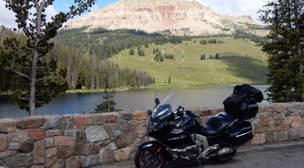
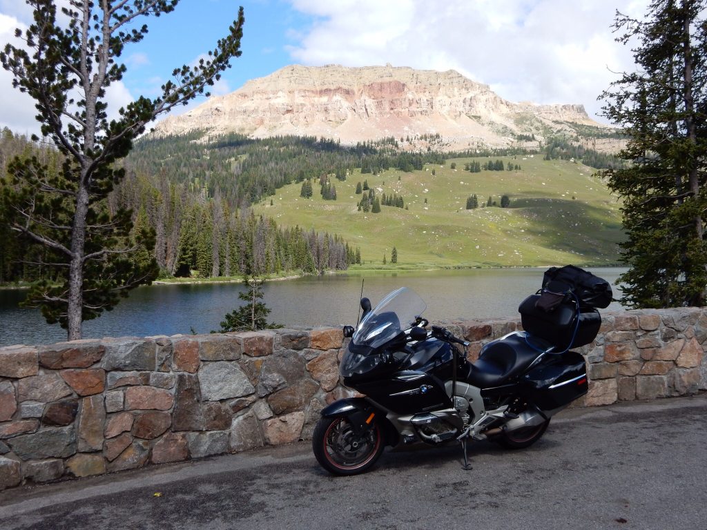
The air got quite a bit colder during the trip up Beartooth. I already had my flannel on over my t-shirt, so I added some heat to the grips and seat. I stopped for my customary photo of my Bike at Beartooth Lake (I always stop for a photo here). The scene changed a bit this year. Sometime since my last visit, the parking area got paved and the edge towards the lake now has a nice stone wall. Someday I’ll post all of my Beartooth Lake photos together with dates.
I had a spirited ride up the rest of the west side of the pass, stopping at the top for more photos. There was a minivan full of family members wandering around in shorts and t-shirts, wondering why it was so cold. I took my photos, noting that the broken clouds weren’t ideal but the lack of haze made for good overall visibility.


There were still plenty of bikes on the pass, many of them obviously on their way home from the Sturgis Rally. They clogged up the end of the pass parking area to pose for photos in front of the sign. I could have been irritated, but I’ve done the same thing more than once before. One shouldn’t condemn others for repeating your own sins.
I stopped at the big parking area halfway down the east side of the pass. I made the short hike out to the end of the ridge, which offers unobstructed views along the entire valley, with US212 snaking along the edge of the mountain down to the valley floor. There are a group of chipmunks that call the end of the viewpoint home, and they are the fattest chipmunks I’ve ever seen. This isn’t that unusual given that so many of the visitors come equipped with bags of peanuts.
I passed another biker on a RoadGlide on the way down the mountain. He was traveling very slow. I figured he’d had a bad experience on one of the corners and was just getting down the mountain with his sensibilities intact. I passed him on one of the switchbacks where I had a clear view down the road and had a nice quick ride down the mountain and into Red Lodge.


While idling through downtown Red Lodge, I noticed the facade for the Blue Ribbon Bar, which I’m sure would make Banker Bob happy. Someday I’ll get the old Sunrun trip reports migrated over here and I’ll include the full story of the Blue Ribbon Bar. For now, this photo will have to suffice.
I parked on Main Street and walked into the Red Lodge Cafe for lunch. They were a little slow, but I wasn’t in a big hurry. The food was good.
Back on the Nightowl, I turned left on MT78 out the north end of Red Lodge and weaved my way up to I90. If you intend to head west on I90 after running east through Beartooth, consider MT78 a superior route to US212. It winds around more but doesn’t slow you down much. It gets the Ghost seal of approval.
Once on the interstate, the goal was to make time. Ideally, I would make Missoula before the early evening turned the countryside into a Bambi festival. That would put me in a good position to take a detour through Lolo Pass on my way to Spokane to pick up Karen the next day. I set the cruise at about 87mph (speed limit is 80) and enjoyed the scenery. I had to slow down a bit for the passes at Livingston, Bozeman, and Butte, but still kept up a good pace through the corners, enjoying the handling capabilities of the Nightowl.
I stopped briefly for gas in Bozeman and continued the blast west. I was making very good time and it looked like I would make Missoula easily. The late afternoon sun was a bit lower in the sky and reminding my that I really should have cleaned the haze off of my helmet’s faceshield.
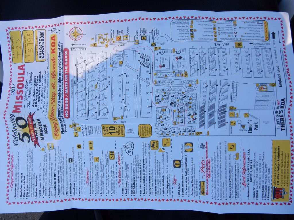
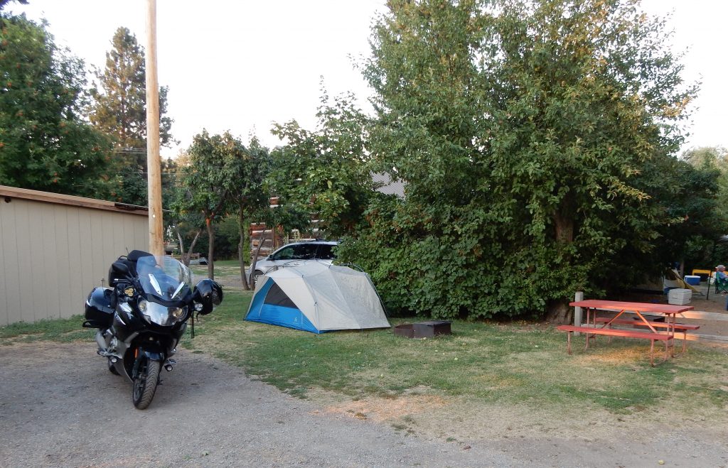
I pulled into Missoula and found my way to the only campground in Missoula proper: the KOA. They had tent sites available but they were still $30/night (and that was without AC power on the site). The campsite was accompanied with a cheat sheet of a campground map, a list of features, a bathroom code, a wifi password, and other rules and guidelines. It was way too complicated. The camp layout was complicated enough that a guy in a canary-yellow golf cart was tasked with leading me to my campsite. We chatted for a moment after I parked at my site and I learned that all the smoke in the sky was from a file long the Lolo Pass road.
Crap.
I checked the Montana DOT site and found that the Lolo Pass route was indeed closed. The latest status reported that they hoped to have pilot car access the next day, but that the pilot car route would be between 8-14 miles. That didn’t sound like much fun, so I started thinking about alternative diversions to fill what would otherwise be a rather short ride from Missoula to Spokane for tomorrow.
I set up camp and, as expected, the tent was pretty wet through and through after being packed up wet after the rain that morning in Cody. The tent would sit in the waning sun for another hour or so, so it should dry out a little before I have to sleep in it.
I made my way back up the main drag to visit an IHOP (International House of Pancakes) for dinner. Along the way, I rode over the overpass that crossed the Montana Rail Link yard. Looking west, I had a good view of the setting sun behind the smoke from the Lolo fire. I was compelled to take a photo or two.


The IHOP was nearly deserted and was manned by a two waiters and a single cook. They cooperated in getting me a seat near an outlet so I could recharge some gadgets. Just after I ordered, my waiter warned me that a bus was arriving and I may want to move to another table (still near another outlet) so I’m not in the middle of the bus people. I accepted.
I was working on trip reports when 30+ middle-aged women filed into the IHOP and started filling the seats in the far side of the restaurant. Within minutes, my healthy wifi connection slowed down to a crawl. Bummer. Meanwhile, the waiters were scrambling to try and keep up, one of them bolting to help in the kitchen after the bus-folk had their drink orders filled.
I managed to finish and post a trip report in time to hit the hot tub before it closed at 10:30pm. The only problem was that the hot tub was really a lukewarm tub. I joined two couples and chatted for a bit until the attendant announced that it was 10:30 and time to depart. When you sit in lukewarm water for 20 minutes and step out into 58º night air, you get chilled pretty quickly. I made my way directly to the closest shower to stand under hot water for a while.
Back at the tent, I was still a bit chilled. Instead of sleeping under the sleeping bag (on the Thermarest pad), I had to zip up the sleeping bag and get inside to stay warm. Sometime in the middle of the night, my head was still cold, so I dug out the knit cap that Jeanne made for me years ago. It kept my head warm for the rest of the night.
The Plan for Tomorrow
With Lolo closed, I will head north of I90 and follow the Montana Rail Link main line along MT200 through the Clark Fork river valley.