
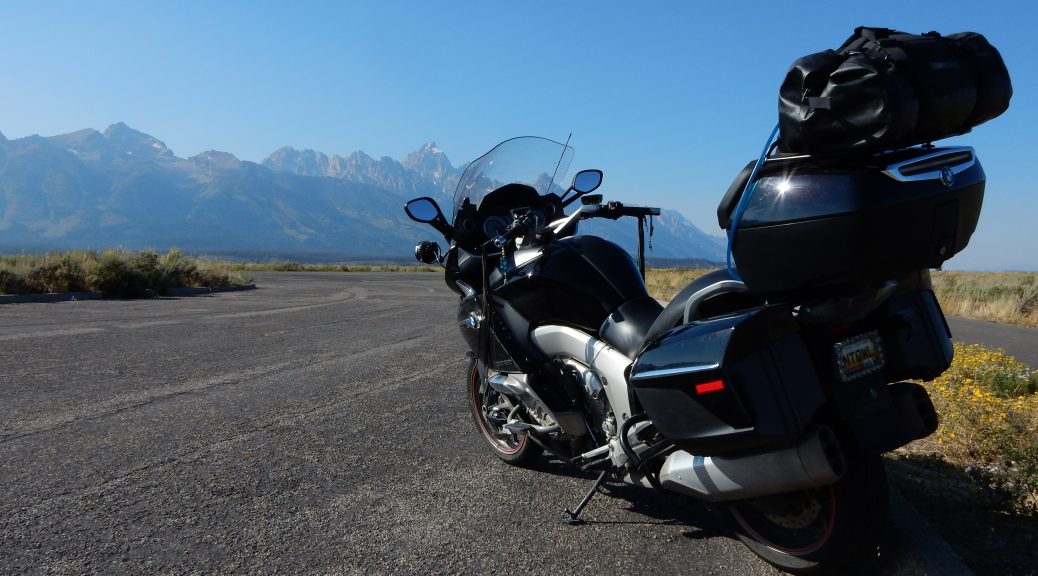
Another two-week journey out west for the annual Par-Tay is in the books. Here’s the pertinent route and statistical information from the trip.
It took me a while to pull all this data together. This shouldn’t be too surprising given that I only spent a grand total of 15 hours at home after the parking the Nightowl before flying off to Europe for a week to work at my company’s software lab in Linz, Austria.
After a week of overseas labor, the travel day returning from Austria was a veritable marathon that lasted 34 hours, involved eight (8) different modes of transportation, and included on-the-ground time in four (4) different countries. It was a good thing that a long Labor Day weekend followed this madness to give me time to rest.
The Road Tales
Here are all the posts from this years trip out to the Par-Tay:
- Tearing Myself Away to Ride
- Ride West, Ride Hard, Ride Far
- A Military Funeral and a Mountain Pass
- Missoula via Chief Joseph and Beartooth
- Wasting Time in Montana (on purpose)
- Two-up Enjoyment in the Cascades
- Par-Tay Arrival and Ferry Drama (almost)
- Airport Shuttle and Eclipse Pursuit
- Eclipse Day!
- Spirited Riding Through the Mountains
- AGATT Challenge Day
- Nightowl 12k Service On-the-Road
- Service Challenges and Good BBQ
- 2017 Par-Tay Summary
Route Map
Here’s the route I took for this trip. It is probably best to use the view larger map button to open the map in a new window so you can inspect it in detail.
Statistics
Here are the pertinent (and often useless) statistics for this journey
Distance
- Total distance: 5,290mi (8,513km)
- Longest day (mileage): 767mi (1,234km) – Madison, WI to Rapid City, SD
- Shortest day (mileage): 43mi (69km) – Eclipse day at Garden Valley, ID
- Average distance per day: 378mi (626km)
- Average distance per travel day: 470mi (608km)
- Miles riding solo: 4,201mi (6,760km)
- Miles riding 2-up: 1,037mi (1,669km)
- States visited: 12 – Michigan, Indiana, Illinois, Wisconsin, Minnesota, South Dakota, Wyoming, Montana, Idaho, Washington, Nebraska, Iowa.
Time
- Total trip days: 14
- Travel days: 12
- Longest day (time): 13:19 – 767mi (1,234km) – Madison, WI to Rapid City, SD
- Shortest day (time): 7:09 – 187mi (301km) – Marblemount, WA to Shelton, WA
Altitude
- Highest altitude: 10,893ft (3,320m) – Bear Tooth Pass on US212 in Wyoming
- Lowest altitude: 10ft (3m) – Bridge crossing portion of Puget Sound in Washington
Fuel
- Average fuel efficiency: 38.6mpg (6.09L/100km)
- Best fuel efficiency: 42.77mpg (5.5L/100km) from Pendleton, OR to Horseshoe Bend, ID
- Worst fuel efficiency: 31.59mpg (7.44L/100km) from Luverne, MN to Vivian, SD
- Average fuel efficiency riding solo: 37.86mpg (6.21L/100km)
- Average fuel efficiency riding 2-up: 41.97mpg (5.6L/100km)
- Total fuel cost: $382.40
- Total fuel used: 136 gallons (515L)
- Average fuel cost: $2.818/gallon ($0.75/L)
- Highest fuel cost: $3.299/gallon ($0.87/L) – Pendleton, OR (day before solar eclipse)
- Lowest fuel cost: $2.379/gallon ($0.63/L) – Des Moines, IA
- Longest distance between fill-ups: 297mi (478km) – Arco, ID to Kinnear, WY
- Most gas pumped during a fill-up: 7.71 gallons (29.18L) – Kinnear, WY – Note that the documented tank capacity is 7 gallons (26.5L), and I know that I overfilled a bit.
Service
- Total service cost: $68.46
- 6k-mile service: $47.07 (performed in Council Bluffs, IA)
- 12k-mile service: $19.31 (performed in Council Bluffs, IA)
- Replace key fob battery: $2.08 (performed in Davenport, IA)
- Things now broken on Nightowl: Left fairing pocket door no longer latches shut; have to tape it. Should get it repaired under warranty. I also need to clean and re-install the K&N air filter as a belated part of the 12k-mile service.
Lodging
- Days sleeping in a tent: 6
- Days getting a hotel room: 7
- Days staying at home or in friends’ homes: 2
Music
- Songs played from music stored on iPhone: 661
- Songs played from SiriusXM radio: I didn’t count.