
Having returned home, momentarily, after my trip out to California, I now had to pack right up and continue east to the next party. In spite of the name, this party does not involve gratuitous exposure of the upper female naughty bits (so much the pity).
The Plan for the Weekend
The typical strategy for our annual MAMMARY run (Mid-Atlantic, Myersville, Maryland, Annual Run… Yup) is pretty simple:
- Head out after work on Thursday and stay the night about halfway there.
- Finish the remaining journey east with a nice easy ride that gets us there in time to welcome the other arrivals.
- Group ride to lunch on Saturday (crab cakes!) and then hang out during the afternoon.
- Ride home on Sunday and/or Monday, depending on weather and how much time we want to take.
A Day at Home
Karen and I both had to work on Thursday. Having been away for the last (almost) two weeks, I spent most of the day wading through 500+ emails and catching up on the handful of mini-dramas that transpired while I was away. At least one was still waiting for me to handle in my one-day flyby before disappearing for another four days.
The Thursday Ride
With work keeping me busy, I didn’t have time to start repacking the Bike for two-up riding and camping until late in the afternoon. I started just early enough that I was showered, packed, and putting on the Leathers when Karen arrived home from work.
A consultation with a few weather apps made it fairly clear that we would have to don our rain gear later that evening but not for the first leg of the trip. We were suited up and able to hit the road just after 6pm.
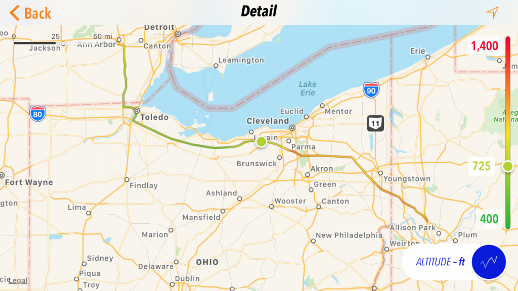
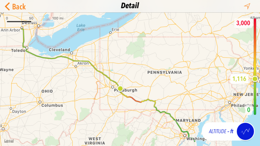
The route is, well, boring. It’s all Slab, including a long stretch of the Ohio Turnpike before continuing on the… Pennsylvania Turnpike. Lucky for me, I finally picked up an EZPass and would be able to ride through those obnoxious toll booths without having to stop to dig for money.
The trip down US23 was quick and uneventful, with a trailing wind pushing us along. We took the northern route to the toll road down I75 instead of riding though surface streets in Maumee. Rolling up to the toll booth, we would usually have to stop for a ticket and Karen would stow it in her fanny pack. Not today! As we approached the toll booth, the reader found our EZPass, the gate opened, and we cruised off without even having to come to a complete stop.
That is so much easier.
The rain started to fall just about the time the Nightowl was needing gas (I hadn’t filled it up since getting home Wednesday night). It was before 9pm at the service plaza, so all the food venues were open. (Usually, we stop to eat late and the only thing open is the burger joint.) We ate at Panera Bread and pulled on our rain gear before continuing east.
It was well into the evening when we crossed the state line and switched Turnpikes. We did a rolling stop at the exit booth for Ohio and made quick time of the two miles (1.2km) to the entrance toll for the Pennsylvania Turnpike, where we noticed that Pennsylvania does things a little different. There are still toll booths, but drivers with an EZPass can run through an express lane that bypasses the booths without even slowing down. I like this process even better.
I really started to notice the extra distance I can see with the Clearwater Kristas (that I added before this trip) when we reached Pennsylvania. The turnpike commission is very thorough with their application of reflectors on the edges of the road and the embedded in the lane markers. With the Kristas on, I could see far down the road, even on my low-beam setting, which is about 30% brightness.
About 30 miles (48km) later, we took the Cranberry exit and found our hotel for the night at about 11:30pm.
The Friday Ride
The route for Friday is a little better than the evening before. Yes, we’re still on the slab, but at least it’s full of curves and crosses the Appalachian Mountains via a tunnel.
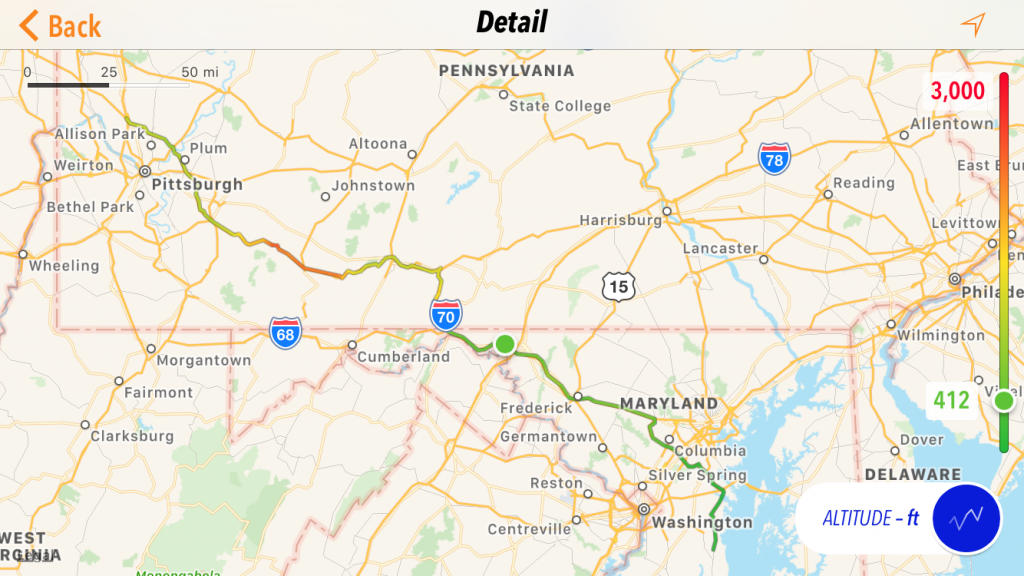
After a relaxing morning, we topped off the Nightowl’s tank and hit the road about 10am. There was a little rain but not nearly enough to warrant an wardrobe change into rain gear. We probably got wetter from the road spray than the actual rain falling from the sky.
For the first time in forever, we elected to not stop in Breezewood, PA. We weren’t that hungry yet and the Nightowl was nowhere near empty on the gas tank. It was quite nice to not have to slog through long lines of tourists at the lunch lines and bathrooms.
That stretch just south of Breezewood hasn’t changed a bit; it’s still a speed trap. On either side of this stretch, all the highways have a speed limit of 70mph, which means everybody has been doing 80mph all day. Between Breezewood and the I68 interchange to the south, the limit drops to 55mph.
In spite of this setback, I like this stretch. You start climbing up the east side of a ridge, and suddenly you swing through a couple of 50mph corners and you’re up high overlooking the west side of the same ridge. Enjoying the westward view, you make a long gentle descent down the ridge. If you don’t touch the brakes every now and then, you’ll eventually find yourself going much, much faster than 55mph, which is exactly what the officers at the bottom of the hill are hoping you’ll do.
So, when you travel this road, set your cruise at 65mph and enjoy the views. Rushing through there is just asking for a forced donation to the county treasury.
One of the things that Steve Mitchell gifted me with before he passed is a good route to the Chesapeake Bay shores east of Washington D.C. without having to travel the dreaded I495 Beltway. On most days, the Beltway is a serious thorn in the side of any traveler. On this, a Friday afternoon leading into a holiday weekend, it turns into a clusterfuck of biblical proportions.
To avoid such frustration, I pass along this (once you see it) simple solution:
- I70 east from Frederick, MA towards Baltimore.
- Exit at MD32 east and take it around the south side of the outer Baltimore suburbs.
- Merge onto I97 south and take it towards Annapolis.
- When I97 ends, take the ramp towards US301 east, but…
- Instead of actually merging onto US301, stay right and take MD665.
- Take the second exit to MD2 and turn south to wherever you need to go.
For us, this route is a little longer in distance but saves much in the way of time and sanity. A little way past the end of this route, we finally stopped for gas, having traversed 284 miles (457km) in one tank (not too damn bad at all). We reached our destination a few miles thereafter.
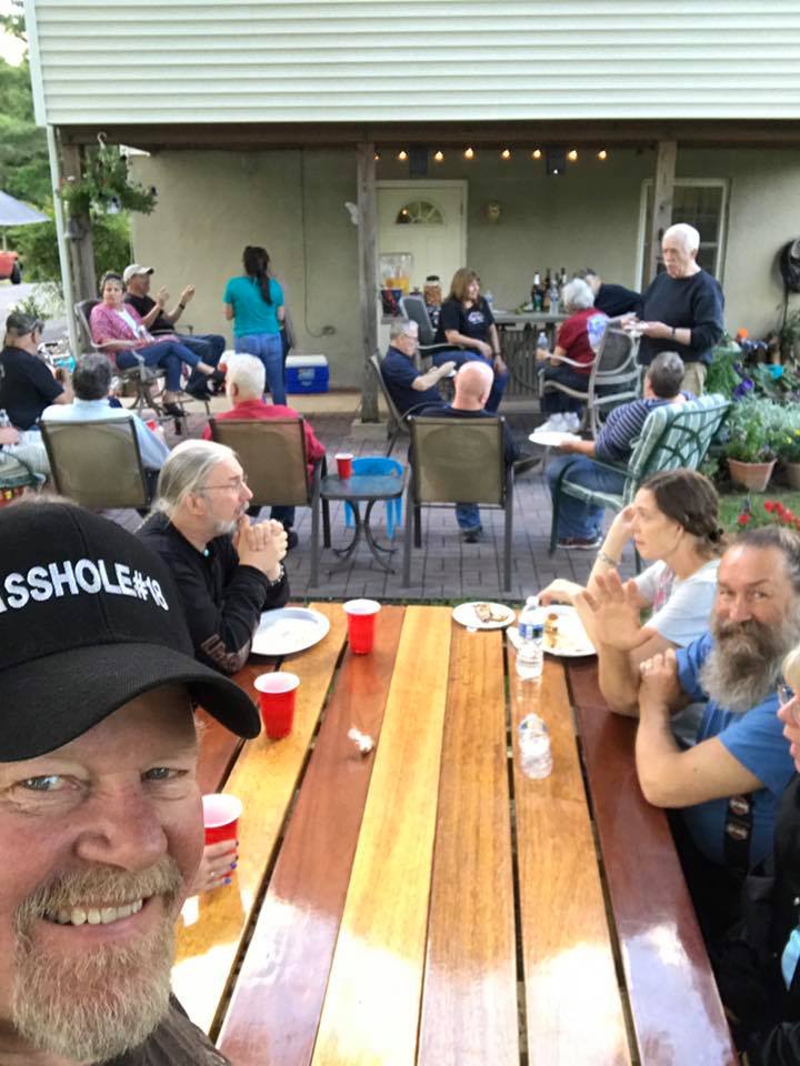
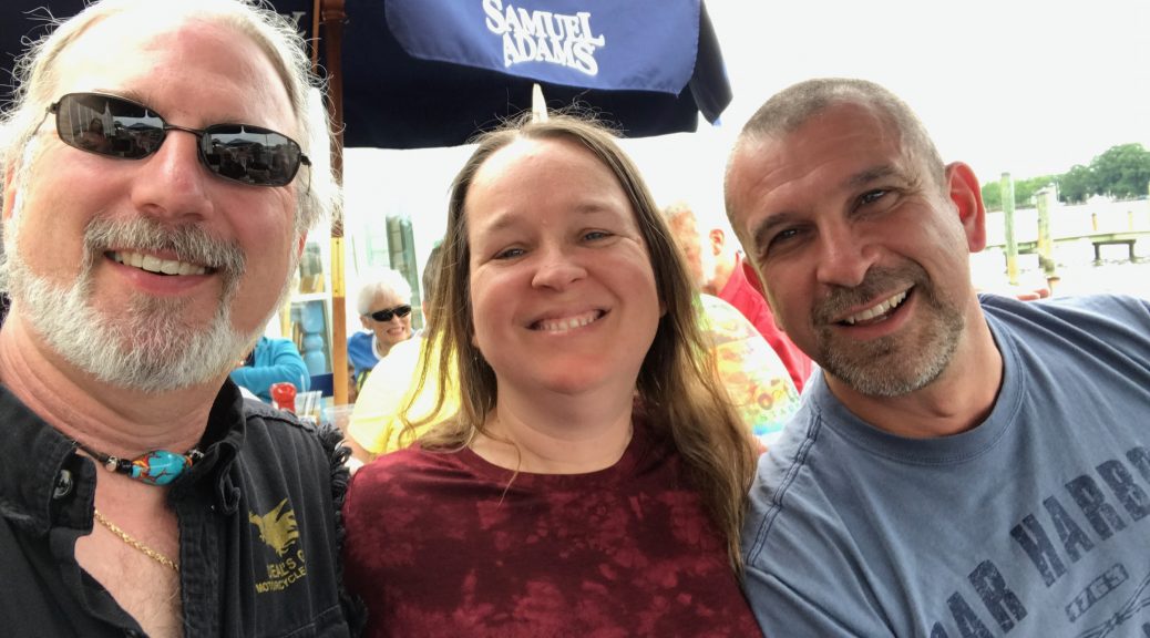
We were off the bike, greeting our friends, and sipping cold adult beverages by 4:30pm.
Saturday
In a tradition that goes back several years, we ride down the Chesapeake Bay shores to Stoney’s on Broomes Island for lunch. They have righteous crab cakes, so you don’t have to twist my arm much to get me to make the ride.
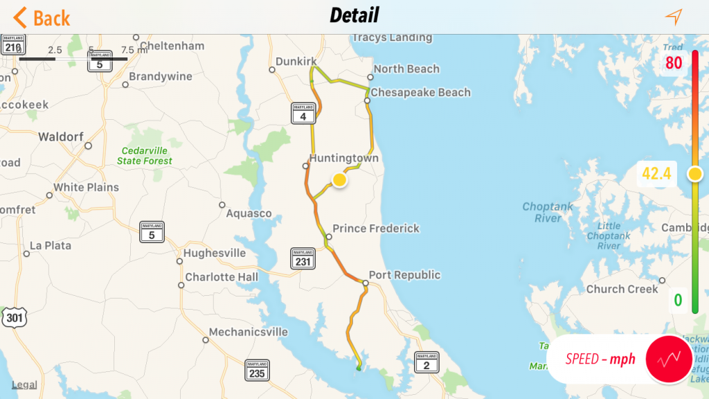
Due to a new cook back in the main kitchen (as opposed to the veteran cook in the bar kitchen), our service was absolutely horrible. Over the course of our three-hour lunch, the food arrived in dribs and drabs, the last meals arriving long after the lucky first meals had been long devoured. The waitress apologized over and over. The manager visited and promised that firings would follow. Ultimately, everybody in our party got 15% off of their meals. It’s a good thing we like each other’s company so much, otherwise the wait would have been much more tedious.


The way back to our hostess’ home was well known, so our group slowly broke up as people made their way back to the party or back to their hotel room to indulge the post-lunch food coma. I led the last group of five bikes back to the party.


It seemed like far too little time had passed before the Ripinator was busy at the grill, nicely charring the blessed animal flesh for our further consumption.
If you go hungry at a MAMMARY party, it’s your own damn fault.
The Sunday Ride
In spite of the threat of rain along the route home, Karen really wanted to have an off day to sleep in and goof off before returning to work. (She really wanted a day for me to mow the hayfield that was growing unattended in our back yard.)
The tent came down, the bike got packed, and we were saying our last goodbyes just before 10am. Since it was still morning of a Sunday with the end of the holiday weekend still a day off, I knew it would be slightly less crazy than usual on the I495 Beltway around Washington D.C.
We made it up I270 and past Hagerstown, MD with the distant skies to the west threatening to douse us at any moment. As we turned north on I70 after the I68 interchange, the heavens opened and we sought the refuge of a rest area to add the rain gear.
The rain would come and go for the next 90 minutes as we ventured through the Breezewood bottleneck and continued west on the Pennsylvania Turnpike. The rain let up shortly after the tunnel and it was time to fuel up the Nightowl. We took the opportunity to get some lunch at the same time, which was fortunate since another cell of heavy rain passed through while we were munching our service plaza pizza.
The rain looked like it would leave us alone for a while, but I could see nice bright colors on the radar south of Cleveland, so we left the rain gear on. We exited Pennsylvania with only a few additional light showers, still making good time on our blast home.
We did have one sudden scare when a truck about 100 yards (100m) in front of us suddenly slammed the brakes and started swerving. This was immediately followed by a parade of debris being flung out from under his trailer. With traffic to the left of us blocking a quick escape, I slowed down and did an impromptu slalom through the debris field. A piece of tire, a piece of fender, a piece of bumper, a piece of deer, a piece of… wait. Deer?
Sure enough, we eventually passed the carcass of the deer that had been hit by the truck. I thought for sure that the truck had a blowout of a steer tire and the subsequent shredding of the tire was taking pieces of truck bodywork with it. Nay, nay, nay. The suicidal deer was the cause of the carnage. We avoided the truck pieces and the deer guts, continuing west towards the looming clouds.
The clouds fulfilled their threat of rain about 20 miles (32km) southwest of Cleveland, and I mean it was fulfilled with a vengeance. The rain came hard, significantly obscuring visibility and sending many a vehicle (car and motorcycle alike) scrambling for the underpasses. Knowing from the radar that the system was crossing the road south-to-north (and it wasn’t a small system), we continued on.
Even after the rain let up slightly, the visibility didn’t improve since the roads were completely saturated. Hell, the road spray from a kid’s tricycle would have been pretty bad, much less that of an eighteen-wheeler.
About a half-hour out of Toledo, we stopped for gas and the rain stopped dropping water on us. Exiting the Ohio Turnpike, we went home the way we had come: up I75 to the north side of Toledo, west of I475, and then north on US23 to Ann Arbor.
By the time we coasted into the garage, we’d been traveling for just over nine-and-a-half hours and covered 545 miles (877km). We laid out wet rain gear (and boots and gloves) out in the garage to dry.
Sleeping in tomorrow morning is going to feel really good.