<--Previous Up Next-->
HellsCanyonBrownlee
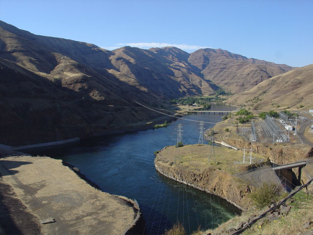
A view of Hells Canyon on the Snake River a the Idaho/Oregon border. To the lower left is the base of the Brownlee Dam, whose generators dictate the presense of the wire towers and power station to the right. In the distance you see the bridge that takes Idaho route 71 across the Snake River where the road becomes Oregon route 86. The canyon is well named; it was about 105 degrees and I was still wearing full leathers. The roads were narrow and tight as they decended into the canyon so you couldn't go more that about 25 miles-per-hour. That low a speed doesn't create much of a breeze. All of these conditions combined to make me a bit uncomfortable. Ok, I'll admit it; I was seriously hurting.