
Why take the direct Slab route from Sheridan, Wyoming to Great Falls, Montana when you can scale several mountain ranges, tangle with a thunderstorm, and dodge deer? All it takes is a few hundred extra miles. Who’s in?
Pre-ride
Welcome to Ghost’s Old Fart Health Complaint blog where our hero complains about his many infirmities.
That distant headache I complained about in yesterday’s report? Well, this morning it was up close and personal.
I had some sinus congestion, so it could just be a sinus headache. However, the heat and exertion from yesterday’s long ride are exactly the kind of things that can trigger a migraine. So, do I try to work it for a while or start popping drugs? If I do the drugs, which one? The Sudafed or the Imitrex?
Such daunting questions for so early in the morning.
I really didn’t want to add yet another health bother to further fuck up this trip, so I did my best to clear my sinuses and laid back down to rest another 30 minutes or so. Even with clear sinuses the headache wasn’t getting any better, so I self-diagnosed (translation: a slightly educated wild-assed guess) a migraine, popped an Imitrex, and laid back down for a little while longer.
At 8am I got up and went downstairs to check out breakfast before it closed at nine. My guts had survived the test of last night’s Raman noodle experiment (remember, I was fighting an intestinal blockage the day before yesterday). and things were moving through me again. Time to try something a little more aggressive.
The pickings were pretty slim at breakfast. The waffle maker was running so I made myself a waffle with syrup and took it back to my room. I ate half of it and decided that was enough for now. I cooked myself in the shower to further steam-clean my sinuses (just in case my migraine diagnosis was full of shit), got dressed, and loaded the Bike. Departure time this morning was 9:44am. (Fins sighs in frustration.)
I gassed up on my way out of town just to be sure I could get through the remote areas to the west before I ran out of gas. I pointed the Nightowl west on the slab, I90 west.
The ride to Ranchester
Rolling up I90 north of Sheridan was it’s usual enjoyable experience. The landscape here is fairly hilly and the highway dodges it was around and over these hills as it tries to follow one river/creek valley and then another. The foliage is mostly grass with some scrub brush. Down in those many valleys the gray-brown grasses get much greener and stands of trees take advantage of the nearby water.
There should have been distant views of the Bighorn mountain range to the west, but the ever present smoke prevented that from happening. I was hoping that the smoke here was coming from the grass fires in the plains to the northeast and that it would clear on the other side of the range.
The traffic level is low; after all, it’s church time on a Sunday morning. The light vehicle volume means I can set the cruise at the desired cruising speed, kick a foot up on a highway peg, and enjoy the ride.
It was just warm enough that I skipped an extra layer under the jacket. Even though I was headed for higher elevation, it’s been warm here and I figured that the jacket with closed vents should be enough to stave off hypothermia up in the mountains. Otherwise I’d be pulling any extra layer off on the west side of the range, where I know it’s basically high plains desert.
I was only going about 12 miles up the range to the US14 exit, so it wasn’t long before settling in time was done and the ride was due to begin in earnest. I exited the slab and took US14 west through Ranchester, Wyoming.
The Plan
Ok, it was really only about half a plan. Really, just a relatively organized concept.
There’s a highway across the core of Montana: state highway 200. I’d travelled pieces of it during the Sunrun multi-day group rides that now feel like they happened in another lifetime. The most scenic portion of the road was the ~170 mile stretch starting at Great Falls and moving west to Missoula, and I wanted to ride it. That meant I needed to get to Great Falls.
If I was a boring Poser, I’d have just stayed on I90 west, turned north on I15 at Butte. That route would take me to Great Falls by the most common, fast, boring route.
Screw that plan, and the horse it rode in on.
If I wind my way through the Bighorn mountains to Cody, Wyoming, then I could do the ultimate biker two-for: The Chief Joseph Scenic Byway and Beartooth Pass. I’ve done them both probably a dozen or more times, but they’re gorgeous, technical, and legendary. Exiting Beartooth to the north would place me in Red Lodge, not a bad place for lunch. From there I can take a often-forgotten highway, MT78, north to I90 and then…
That’s where half a plan comes in. There were a dozen ways to get from that point on I90 to Great Falls. I was thinking I could ride north on US191 from Big Timber, turn west on US12, and north again on US89. That would cover a lot of scenic two-lanes east of the main body of the Rocky Mountains, but still hilly (especially the US89 stretch). The problem was that the US89 stretch was also remote and I didn’t want to ride it after dark for it was sure to turn into an episode of Wild Kingdom after sunset. Could I get there in time?
Well, that depends…
One of the advantages of riding alone is that you don’t have to worry about screwing up several rider’s plans when you pooch-screw a route plan. You just, kind of, make it up as you go along.
For now, the plan ended at Red Lodge. I’d figure out the rest after that.
The Ride to Cody
Riding though Ranchester, I noticed an old Burlington Northern caboose decorating a public park, still in it’s old Cascade Green and yellow paint. The number on the side was 10710, which felt familiar. I wondered if I had an HO scale version of that very caboose in my model railroad inventory. I was tempted to stop for a photo, but I continued on.
Author’s note: I checked my inventory and I don’t have this car: 10710. I do have a Burlington Northern caboose numbered 11710; close, but not quite.
West of Ranchester, the road starts to climb into the Bighorn range. Usually, this would have been obvious from a distance (hell, all the way back on I90), but not today with all the damn smoke in the air.
As I mentioned, it was Sunday morning, so I only had a handful of vehicles to pass before I had a clear path up the mountain. The motorcycle gods had granted me a free pass to enjoy a spirited ride. Within the first two climbing sweepers, I felt really good about how the bike was handling and, conversely, how I was handling the bike. Between the extra mountain practice during the western trip earlier this year and my recent adoption of the trail breaking cornering technique, throwing around a comparable motorcycling behemoth like the Nightowl was increasingly fun.
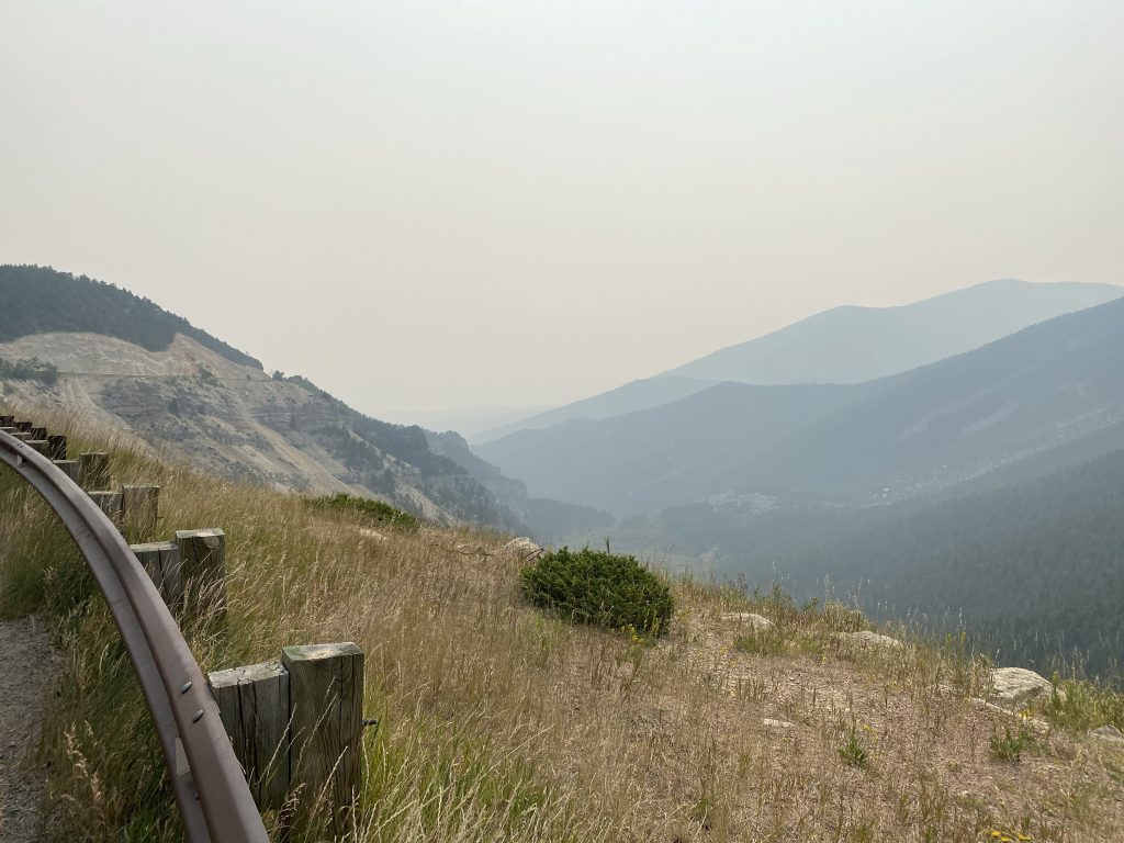
Well up the mountain, I noticed that the blue sky above me was becoming clearer as I rose above the smoke in the valley. I paused for a moment to capture the difference in a couple of photos.
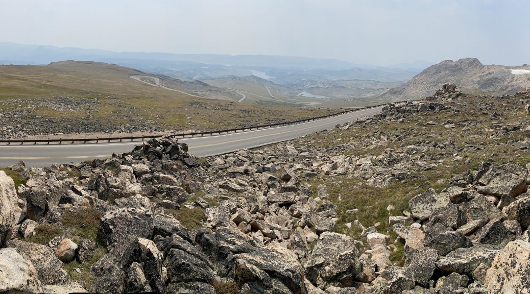
Up on top of the Bighorn range, US14 stays high and follows an alpine valley; it’s my favorite part of this route to Cody. It’s not that there’s some spectacular canyon or snow-capped mountain peaks to ohh and ahh over. It’s not like the road imitates The Dragon. It’s just a long stretch of sweeping curves along a rolling valley floor between the higher peaks to either side. You’re at or above the tree line here, so the views are wide open. As a bonus, the high elevation invariably makes the ride a cool one. US14 is also the least popular of the three main routes from I90 to Yellowstone Park, so there’s less traffic. There’s even a “Go-read-what-you’re-getting-in-to” sign at the base of the pass that encourages your weekend warrior in his 40ft RV to use another route. All this translates into another kicked back, but far from boring, ride through fantastic scenery.
Still don’t get why I like it so much, go ride it, and tell me what you think afterwards.
After diverting onto US14A, the northern of two parallel roads to Cody, and dropping down through the 10% grade descent past several runaway truck ramps (none of them looked recently used), the Nightowl and I were back down on the high desert plain. From here to Cody, the scenery isn’t very exciting. At least you have a few small towns to ride through with their quaint notion of the entire downtown district on a single stretch of the main drag through town. If you take the other route US14, you’re out of the mountains by Greybull, and from there to Cody is featureless, town-less, curve-less; it’s civil-engineered Valium.
About the only really interesting thing that happened was that I did a high-speed flyby of a big gravel truck running the other direction. The slipstream off the front of his truck was so turbulent, the sudden buffeting was strong enough to cancel the cruise control on the Nightowl. That’s only the second time that has happened. (The other time was earlier this year on my way west to California.)
I pulled into Cody fully expecting to stop for gas and a restroom break. Pausing for a moment after parking and consulting the Nightowl’s trip computer and the iPhone’s navigation app, I found that should have enough gas to get all the way to Red Lodge. Yes, the Nightowl currently reported that I’d only have 22 miles more than the distance to Red Lodge, but I knew that the Chief Joseph and Beartooth would be all up-and-down, which would yield better mileage than what I had up until this point (especially the desert blast from the Bighorns to Cody). In short, I had good reason to believe that the distance to empty estimate from the Nightowl would be more than enough.
The Chief Joseph Scenic Byway
I had just pulled out of the gas station parking lot when my phone rang. It was my friend Chuck. He wanted to check up on my because he knew I was on the road and I wasn’t doing my usual posting of trip reports; he wanted to make sure I was OK. (Aren’t friends cool?)
I provided a condensed version of the last two days and ensured him that I’m fine, just a bit behind on reporting. We chatted a bit about his new bike, a K1600B, and our upcoming meet at the Par-Tay that weekend. I thought to ask Chuck about the question from yesterday: why do deer seem to really like the grass that grows right next to the damn highway. Chuck explained that the salt used during winter snow removal tends to get picked up in small amounts by the foliage that grows next to the highways, providing the deer with their salt needs, which makes them naturally attracted to it.
You learn something new every day.
We’d spoken for much of the ride from Cody north to WY296 and I was nearing the turn onto the Chief Joseph Scenic Byway, so we ended the call.
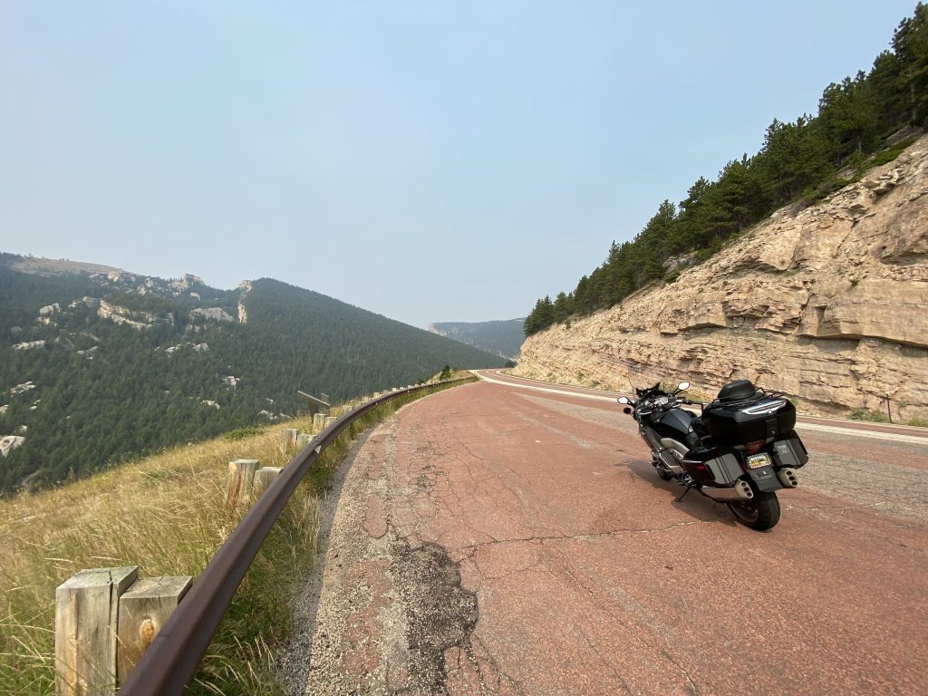
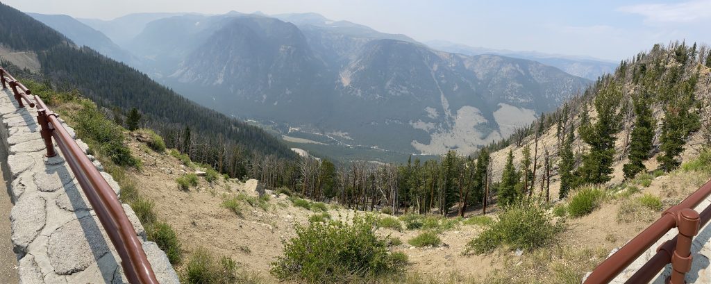
The Chief Joseph is a wonderful stretch of 37 miles of roadway. The eastern third is a switchback-filled climb past roiling rock formations and forested mountainsides to a pass with a beautiful overlook. The western two thirds start with a descent down to cross a canyon via a bridge (there’s an overlook there too) and then a long sweeping ride up a hilly forested valley until you finally reach US212.
Unfortunately, this time it was covered in smoke.
I still enjoyed the ride up to the overlook, leaning the Nightowl over as far as possible to rail around the hairpins. I fully expected for the Pegs to touch down at some point, but they didn’t. So I guess that’s a lie: I could have leaned further, but damn, I was practically horizontal already. <shrug>
At the top, I found the western slope of the pass and the distant valley covered in smoke. Very unfortunate. Instead of the 40 photos I usually take from this vantage point, I took a single panorama and climbed back on the Nightowl.
From the overlook all the way to US212, I needed to pass four vehicles. That’s it. Consequently, I had plenty of fun enjoying the ride. The smoke did get thick in a few low spots, and I did have to engage heavy amounts of braking to avoid a close encounter of the bovine kind (it is open range after all). Still, plenty of fun was had by me and (presumably) the Nightowl.
As I approached the end of WY296 at US212, I checked the distance to empty again and noted that I was in better shape now than when I checked back in Cody.
I love it when gas consumption obey’s the rules of physics.
Beartooth Pass
I’d usually write a complete novel about Beartooth Pass, all by itself, but with the smoke and construction today, I’m going to be a bit terse (famous last words).
First there was a construction zone where there was only one lane open and you had to follow a pilot car. They’re putting in a new bridge to remove a hairpin; it looks like a shorter version of the flying curved bridges featured on the Blue Ridge Parkway. It will be interesting when it’s done.
The time waiting for our turn to roll was helped along by the guy waiting in front of my. He’s a fellow biker and exited his car to come back and shoot the shit for a while. Apparently he’s screwed up both his shoulders and can’t risk injuring them further. Bummer. He had a few questions about the Nightowl, but then the line started to move and he had to hightail it back to his car to keep up.
Out of the pilot car construction madness, I found myself behind a line of about 10 vehicles. I passed three or four to get some free space (out from behind a dude hauling a huge fifth wheel, probably second guessing his decision to take this route). As I passed the Top of the World gas station, I checked the Nightowl’s distance to empty to re-verify that I’m still doing fine on gas to Red Lodge.
As I neared the Beartooth summit, I found myself behind too many bunched up cars to get around and enjoy the switchbacks. This is a bummer but not fatal.
At the summit, I maneuvered around the fleet of cars and bikes gathered at the entry to the parking lot for the Beartooth overlook. For some reason, none of them wanted any part of the rough gravel road to the overlook parking area. All they wanted was a vanity photo next to the Beartooth Pass elevation sign. posers. Oh, and get off my lawn.
Chicken shit bikes at the top.
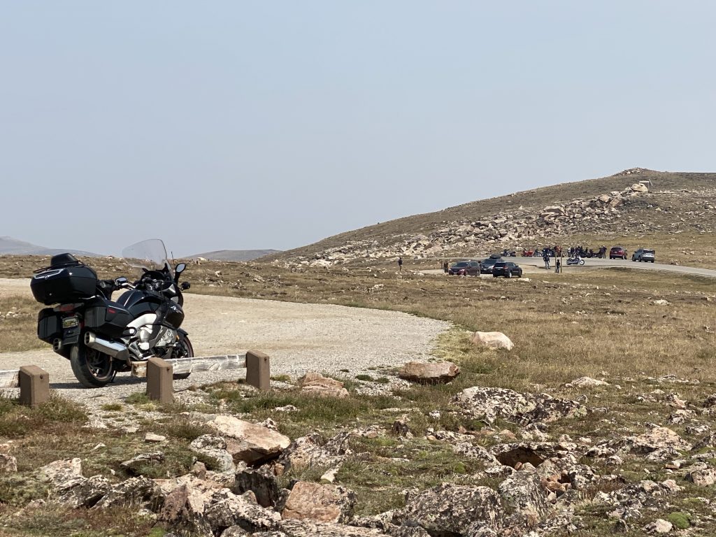
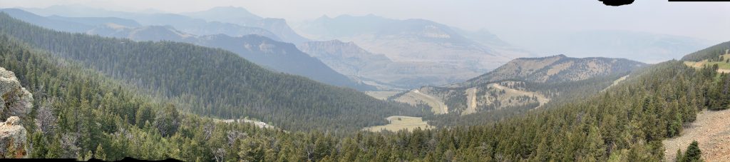
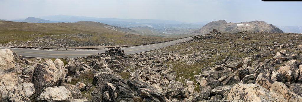
The view from the overlook was, as expected, anti-climactic. Too much smoke made the view worse than the haziest of humid summer days. I took a single panoramic photo and walked back to the Nightowl.
Riding the high-altitude part of Beartooth, I did have fun in switchbacks until I got stuck behind a couple of cars. I’d eventually get impatient and pass them anyway, but all of this extends my arrival in Great Falls later today. (Ghost taps his foot impatiently.)
Even with all the smoke making for poor photos, I still stopped at the north slope overlook and took a single panoramic photo.
In the overlook parking lot, I eavesdropped as another biker looked at Florida group of bikes while loudly assessing their condition. His opinion was that they were much too clean for them to have been ridden all the way from Florida. There must be a trailer involved.
Leaving the overlook, I had a nice rice down the mountain and into town. I occasionally checked the Nightowl’s distance to empty during the long downhill run, not because I thought I’d run out, but because it was fun to ride several miles and see the distance to empty gauge increase in value as you ride.
I rode through Red Lodge, looking for gas and a quick and dirty lunch. I filled up on the north side of downtown and found a Subway sub shop near my next turn on MT78. I even managed to find shade when parking for lunch.
With lunch consumed, I consulted Waze for a route to Great Falls, knowing ahead of time that I’d probably ignore most of it. Sure enough, Waze picks a boring route back to I90; it’s actually longer than MT78, but perhaps a minute or two faster. The later portions of Waze’s route skips the US89 stretch I want to ride. I’m going to defy the Waze Bitch again; she’ll be so disappointed.
Walking back to the bike after lunch, I decided to check out the chicken strips on the outside edges of the Nightowl’s tires. More tire wear near the edges of the tire’s usable tread means your leaning the bike further. The strips on the Nightowl’s tires aren’t completely gone, but they’re pretty narrow for such a large bike. Ok, yes, but I may need to step up my game.
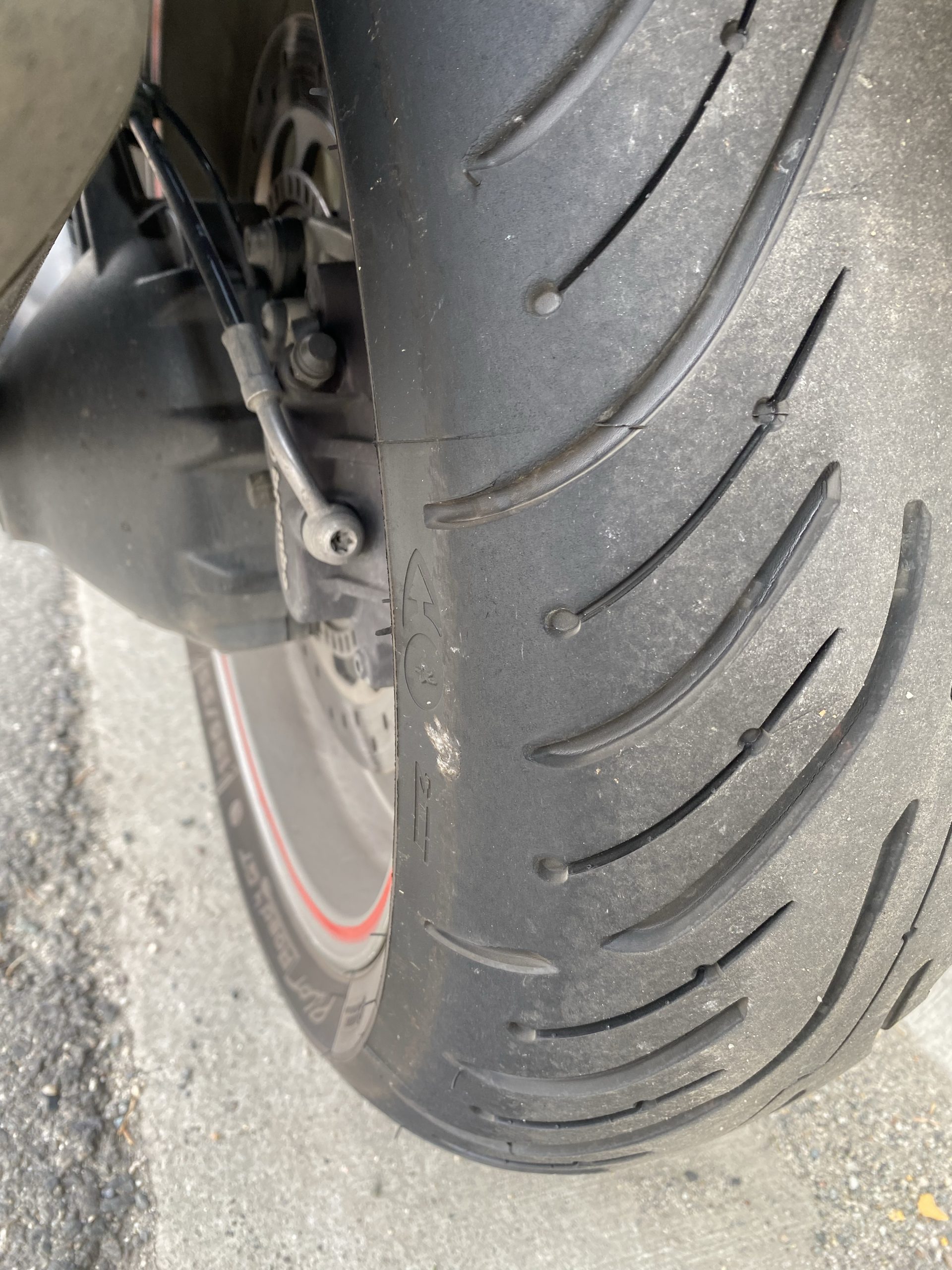
The chicken strips on the Nightowl’s rear tire after carving up the Chief Joseph Scenic Byway and Beartooth Pass. Not bad, but I could do better. 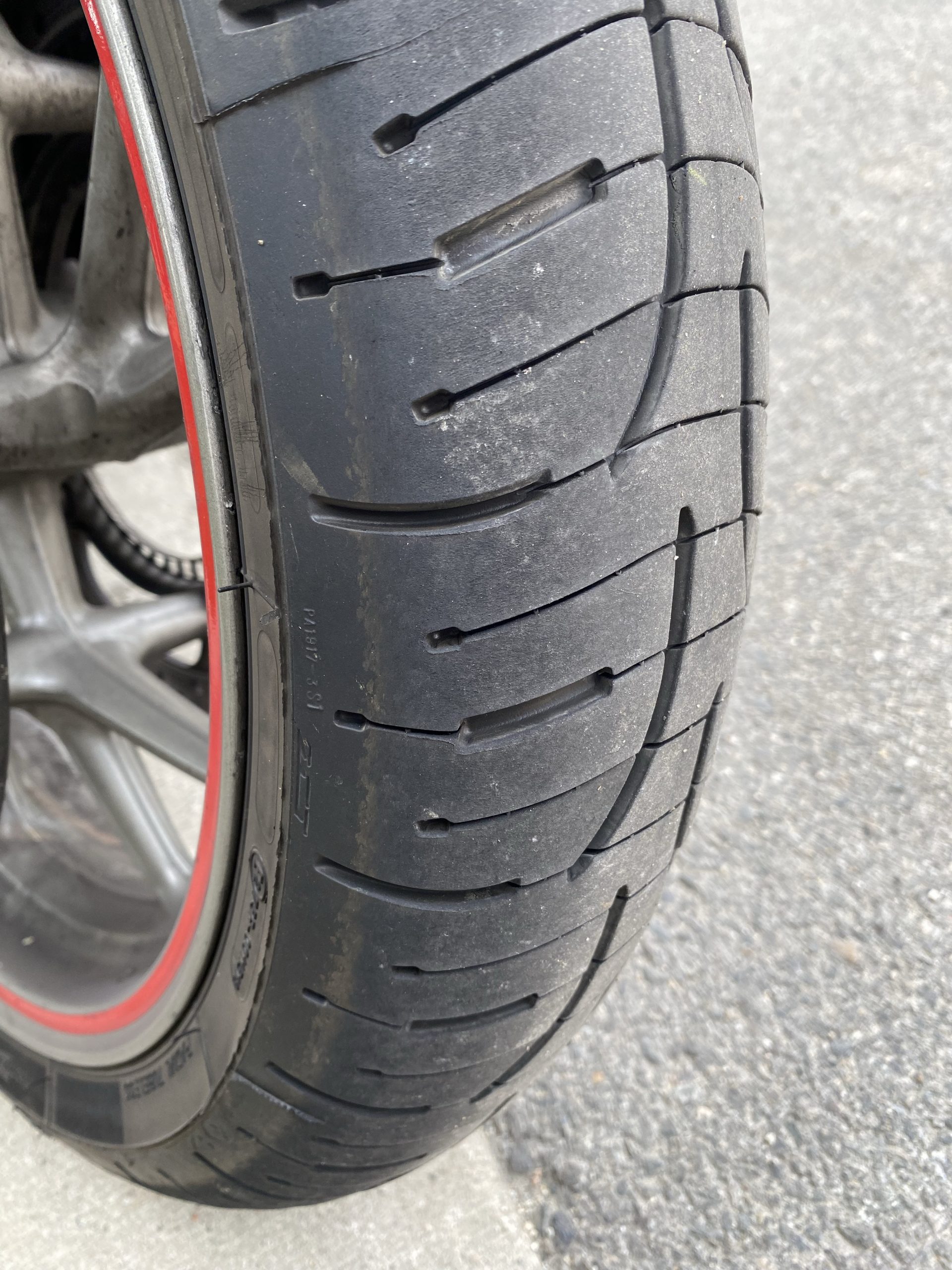
The chicken strips on the Nightowl’s front tire after carving up the Chief Joseph Scenic Byway and Beartooth Pass. Not bad, but I could do better.
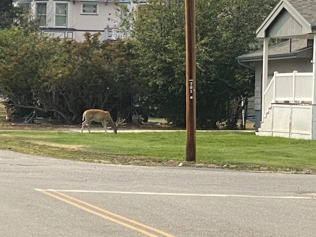
As I was putting on my helmet, I noticed that the deer yard ornament in a nearby homeowner’s yard started moving. What the fuck? Here was a wild buck casually eating this guy’s front lawn like it was a woodland meadow. Never mind that he was in the middle of a town.
Welcome to Red Lodge… I guess.
Smoke or thunderstorm?
I really like MT78 from Red Lodge up to I90 at Columbus. It’s a nice, sparsely traveled road with lots of hills and sweeping curves so you can keep up your pace.
The ever-present smoke had been dimming the sunlight all day, but now it was making the sky really dark. The smoke can’t be this thick, can it? As I’m thinking about this, I notice how badly the grove of trees to my right are being blow around by the wind. On a hunch, I cue up Siri on my iPhone and utter the command, “Show Radar” to prompt it to open the MyRadar app so I can see the live weather radar for my location.
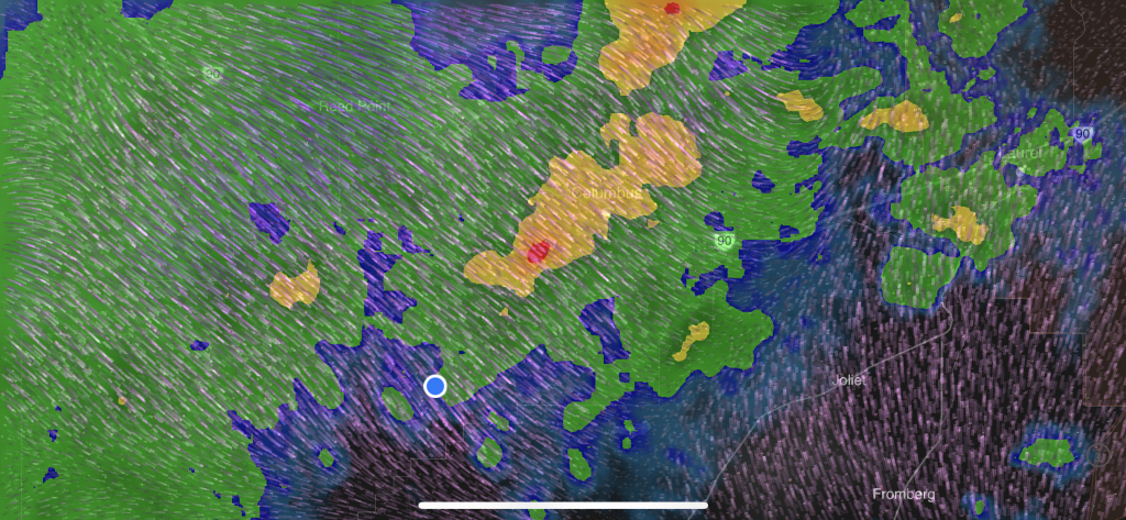
<groan> Looks like I’m in for an ass-kicking. I ride deeper into gathering gloom and gusting winds until I find a general store at an intersection, stopping to don my raingear.
While I’m going my wardrobe change, a proper real-life cowboy drives up in his 1970s Ford pickup and walks over. He flashes me his best, “Oh, you poor bastard” look and notes that he just drove out of a nasty rainstorm. I thank him for the forecast and he goes inside. On his way out, he wishes me well, having picked up his 12-pack of Miller Lite.
With my raingear engages, I climb aboard the Nightowl, carefully, so as to not tear the crotch in the rain pants, and ride into storm. Based on the radar image the where the storm is moving, the time spent wrestling into the raingear served me well, giving the worst of the storm more time to wander further east, away from my path and into the path that Waze originally proposed for this leg of the journey. Someday Waze really needs to become weather-aware.
As it turns out, the storm was more wind than rain, but that rain was bloody hard rain when it fell. There were a few tree limbs down but none of them fell far onto the road. As I neared Columbus, I could see a tantalizingly lighter sky to the west. It prompted me to push a little harder to turn onto I90 so I could double back west out of this crap.
Waze had me weave through the neighborhoods of Columbus to reach I90, just to save 30 seconds of travel time. Yeesh.
One on I90, I was out of the storm within five minutes. It took another 10 minutes of riding before the temperature got back up where it was before the storm. Of course, I’m still in my rain suit, which doesn’t exactly ventilate well, so the increase in ambient temperature has it’s disadvantages too. I resign myself to wait until my exit at Big Timber to remove the raingear… unless it gets even hotter,… but it didn’t.
I remove the rain suit, and took the moment to book a room in Great Falls since I was looking to be in good shape time-wise. Now committed to get there, I started north on US191 in a race to get past US89 before deer witching hour after sunset.
Back roads to Great Falls
Once on US191 north out of Big Timber, I basically had the road to myself. The smoke level and occasional cloud made sunset feel closer than it really was. The landscape here was much more wide open with much less forested areas, so sight lines were wide open to the shoulders to verify that deer weren’t an issue (how could they be? — there was no cover for them).
About halfway through the leg to Harlowtown, I noticed that some of the relaxed vibe for this road was the lack of air turbulence; it was as if I was barely moving at all. At the next farmhouse, I noticed their flag sticking straight out in the same direction I was traveling.
A tailwind.
I do a quick check of the live fuel consumption, doing 80 MPH on level ground: 50 MPG.
<grin>
At Harlowtown, Waze wants me to continue north because it yields a slightly shorter route. I say screw that. I’ll take the scenic route west on US12 and north on US89 through mountains, thank you very much. I turn west on US12.
By all appearances, Harlowtown rolls up the streets pretty early on Sunday evenings. Even at only around 6pm, I saw no people outside and no businesses open. The gas station I saw had the pumps turned on but the tiny convenience store attached to it was closed and dark. With that most excellent tailwind I enjoyed for the last 40 miles, I no longer needed to get gas here anyway. Now I could reach White Sulphur Springs on what I had in the tank.
Of course, now I was almost due west, directly towards the setting sun. Luckily, the sun wasn’t low enough in the sky to create too much glare yet, even with my windshield covered in filth from the earlier rain.
Every few miles, a sign named the mountain range that was visible in the distance. Perhaps they were visible on normal days, but not when there was so much smoke in the air. Sometimes, you could pick out the profile of the distant range though the haze; sometimes not. One sign pointed to the Crazy Mountains. Seeing on their profile, they didn’t look crazy. I wondered if they’d look crazier on a clear day.
In the middle of the hilly grasslands east of the Bair Resevoir, there was signage for an upcoming construction zone, followed by a warning about a one-lane road. Then, at the bottom of a hill, nowhere near any other signs or orange barrels or indication of road construction, was a stop light next to a sign that read Follow pilot car.
I shut off the Nightowl, set it down on the kickstand, put my feet up on the highway pegs, and leaned back on my tent bag. I resigned myself to wait while watching the road at the horizon for any indication of the approaching pilot car. Looking at the scene around me, it seemed completely ridiculous for a motorcycle and tractor trailer (behind me) to be stopped at a makeshift stoplight in the middle of the rolling grasslands. I imagined some local prankster at the crest of one of the nearby hills, watching through binoculars, nudging his girlfriend and saying, “Look Suzy, we caught a biker and a trucker.”
I was still imagining how to punish such a prankster when I caught him when I saw the approaching headlights of the pilot car. It’s only been about 10 minutes, so that’s not entirely bad. The pilot car pulled aside, allowed the four vehicles it was leading to pass and immediately started back the other way. I saw the driver point a remote at the stoplight, which changed to green. I fired up the Nightowl and the truck and I renewed our westbound course.
Following the pilot car, we proceeded to pass signs that all bikers hate to see:
- Fresh oil
- Loose gravel
- Abrupt pavement edge
The fresh pavement was literally laid down earlier today, so it turned our tires black and the edge at the center line was still loose. The pilot car was only moving at 35-40 MPH, so there wasn’t much risk from the oil and gravel, so I settled in for a nice boring precession past the Bair reservoir. Its water level looked low.
The US12/US89 intersection is about three miles east of the town of White Sulphur Springs. I was hoping there was gas at the intersection so I wouldn’t have to ride to town and then double back to turn north on US89. Alas, there was no gas at US89 intersection. I found a station in White Sulphur Springs and refueled the Nightowl. I also took the opportunity to perform a badly needed windshield cleaning and a long overdue helmet visor cleaning.
Turning north on US89, I did a mental measure of the sun’s height in the sky and guessed at little under two hours until sunset. It wasn’t quite as smokey here, so perhaps the deer witching hour wouldn’t start quite as early as yesterday. I didn’t even get two miles down US89 when I had to slow for a doe and two fawns on the shoulder. I honked to spook the fawns into committing to a course; they both retreated into the roadside brush in a mad dash, with one fawn cutting off the other, causing it to careen wildly over on it’s side. Total wipeout. Hilarious. Guess who’s the dominant sibling?
Much like US191 and US12, I’ve got US89 to myself. I’m making really good time and keeping ahead of the setting sun. Still, I’m on active lookout for Bambi; they’re obviously out already.
As the miles rolled, I was reminded of the last time I rode this road. It was in the opposite direction: north to south. The year was 1997 and I was on the last day of a eight-day journey from Michigan out to Helena, MT to participate in the first Run to the Sun group ride with a smattering of other members of the rec.motorcycles.harley newsnet group and the Harley Email Digest. These low mountains along US89 were the first mountains that the Cruiser had seen; that bike would see many more. I’d nearly run out of gas on that day. In a random stroke of luck, I happened across a one-pump gas station at a bar/restaurant in the tiny berg of Monarch. The pump served up some absurdly low octane fuel, but beggars can’t be choosers. I filled up and made my destination that day. It’s hard to think of that ride as happening 24 years ago.
For the last few miles, my body had started to send me nast-grams that I would be needing a restroom sometime soon. I was hoping to find a rest stop or a national forest campground, but nothing was popping up. As the problem became more acute, I uttered my millionth curse against Crohn’s disease and chuckled at the irony. The day before yesterday, I couldn’t go to the bathroom; today I may not be able to prevent it. I begin to look for places to hide behind a tree. Unfortunately, it appears that I’m getting near a village or something as there’s more homes. I can’t hide behind a tree if it’s in someone’s front yard. There’s the village sign…
Monarch.
I wonder…
A mile further down the highway I spot the same bar/restaurant that saved the Cruiser and I 24 years ago. As I pull into the parking lot, I spot a portolet on a small trailer next to a garage. Is that the restroom for the bar? Surely not. Someone is unloading the back of a trailer at the bar/restaurant. I park in front of the same single gas pump and note the open sign on the bar window.
Salvation.
I dismount carefully, and walk to the bar door.
Locked.
Damnation.
I walk over to the guy unloading a trailer and ask about a restroom. He says that he’s closed today. I’m about to explain the desperation of my situation when I remember…
“Can I use the portolet on the little trailer?”
The man’s eyes light up a bit, “Oh! Yeah, you can use that.”
Disaster averted.
I now ponder the synchronicity of the same remote establishment coming to my rescue for two entirely different reasons, during two rides 24 years removed from each other, on two totally different bikes, arriving from opposite directions. I can’t make this stuff up.
The remaining ride up US89 to US87 was uneventful. The miles rolled, the deer remained hidden in the underbrush, and my body refrained from torturing me further.
I turn west on US87 and now I’m riding directly into the setting sun, glaring horribly, even off my clean windshield. I lowered the windshield so I was looking over it, accepting that my head was no longer in the calm riding bubble.
Author note: On all my previous bikes, I adjusted the windshield to be just below my normal eye level. On the Nightowl, my desired windshield level is fine for me, but is too low to send the wind stream over Karen’s head; she was getting her head buffeted around quite a bit. The combination of a larger windshield and a slightly higher adjustment level solved that problem, but now I look through the top of the windshield rather than over it.
The landscape east of Great Falls is wide open grain fields. I noted that the field on the north side of the road had been recently threshed. A few miles later, I saw a three-combine threshing team working a field to the south. This is a common sight on my westward tours in August. Not every farm can afford their own combine; they’re insanely expensive. Threshing teams vend their services to farmers for a fee. During the August threshing period, which differs from year to year, its common to see the teams working the fields or driving on their huge rigs on the highway to get to their next customer.
Dusk was falling rapidly, but not due to the sun setting. There was a bank of clouds (or maybe smoke) at the horizon that was hiding the sun before it had a chance to set. I took some satisfaction that I wasn’t still back on US89 right now.
I rode into Great Falls and easily found the hotel.
Post ride
I checked in and got a few suggestions for dinner establishments that would still be open after 9pm. One suggestion was a Mexican restaurant about a mile away.
I arrived and noted that I was one of three vehicles in the parking lot. I hoped that they were still open.
There were, but just barely. They didn’t close for another 40 minutes, but they were already behaving like they couldn’t wait for closing time to come. I asked for a table.
A pleasantly conversational waitress told me to pick any clean table I wanted, then she glanced around and saw that there were no clean tables that were empty. She offered to wipe one down. She had bright teal green hair that matched her bright teal green shorts.
I sat down at the booth and sat my helmet, jacket, and gloves on the seat instead of the still-damp table.
She asked for a drink order. I glanced behind the bar. The bartender furiously cleaning classes looked barely old enough to drink, much less serve. To stall, I asked the waitress if the hair color accessorized the shorts or vice versa. She answered like I was her best friend and asked her religious beliefs. It was amusing. I eventually ordered a golden margarita, dismayed that I needed to explain that gold indicates that they should use a dark tequila.
While perusing the menu, I realize that I’m not in my usual Mexican food hunting grounds. Further south in the western states, nearly any non-chain Mexican restaurant will serve good food. I was nearly to the Canadian border.
What was I thinking?
I’m tired. I don’t care. I need solid food. I want a drink. It doesn’t have to be five-star.
The margarita arrives. I think there’s some tequila in it. I don’t care. It’s wet.
I order Krab Enchiladas. They arrive quickly. They taste OK. The side of rice is covered in cheese that tastes like the cheese in Macaroni and Cheese mixes. In the last 48 hours, I’ve consumed half a waffle, one bowl of Raman noodles, two bottles of Gatorade and lots of water. This meal OK but far from great. It’s sustenance, so I don’t care.
While I’m paying my bill, I notice that the zipper pull on one of my jacket pockets is broken, making it hard for the zipper lock to disengage when I pull it open and closed. I’ve already replaced all the zipper pulls on this jacket… except for the two inside pockets. I’ll hit a hardware store in the morning and buy some split key rings to fix this. No worries.
Back in the hotel room, I start catching up on three days of trip report writing. I get two days done. I’ll finish the third tomorrow. I’d pulled the memory card from the Nightowl’s dash cam, so I review the captured video for interesting segments. I resolve to build a couple of highlight videos for the last two days. It’s already 3am, so I’ll refrain from copying the videos to the iPad tonight. It can wait.
Sleep ensues.
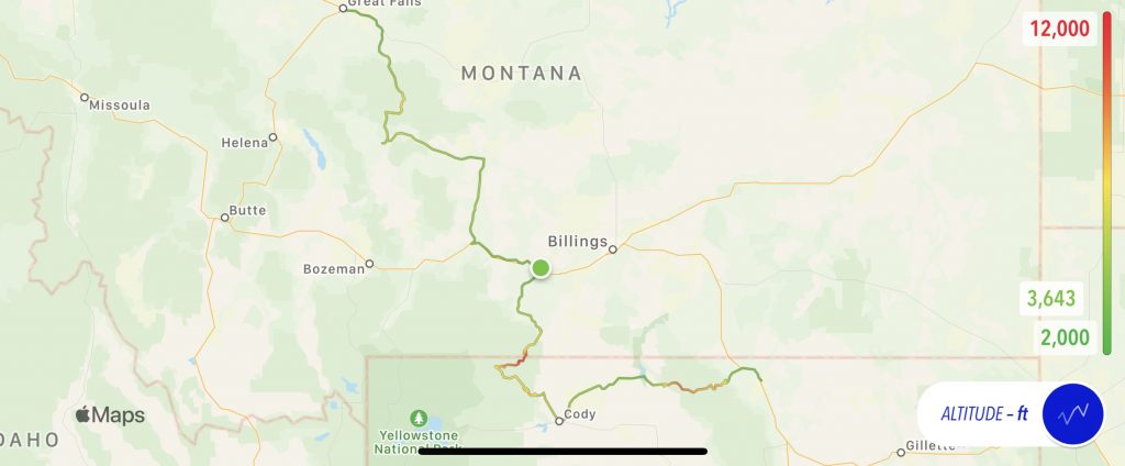
Map
Not too much heat to make the iPhone shut down today, so here’s today’s scenic route in all it’s winding glory. The altitude is overplayed on the route traveled. Note how I could have taken the slab the entire way… but I’m a glutton for punishment.
Tomorrow
Add highlight videos to days two and three. Take MT200 all the way to Missoula. If early enough, take Lola Pass west through Idaho.